Kütahya Province
Local name: Kütahya ili
Located in Turkey Coordinates: 39°15′00″ N 29°30′00″ E
- Population
- 580,701
- 580.7K
- Elevation
- 1,158 m
- above sea level
- Local time
- UTC+03:00
- Europe/Istanbul · UTC+03:00
- Places inside
- 119
- listed under Kütahya Province
About Kütahya Province
Kütahya Province is a region. Location: Turkey. Population: 580,701.
Kütahya Province (Turkish: Kütahya ili) is a province in the Aegean region of Turkey. Its area is 11,634 km2, and its population is 580,701 (2022). In 1990, Kütahya had a population of 578,000. The neighboring provinces are Bursa to the northwest, Bilecik to the northeast, Eskişehir to the east, Afyon to the southeast, Usak to the south, Manisa to the southwest and Balıkesir to the west. The capital city of the province is Kütahya.
Read more on Wikipedia Text: Wikipedia contributors · CC BY-SA 4.0 · shortened
At a glance
- Area
- 11,977 km²
Source: Wikidata
In comparison
- 4 sights and natural places within 10 km Değirmen Deresi, Kayaboğazı Deresi
- Listed here: River: 67, Municipality: 16, District: 13, Mountain: 9
Places in Kütahya Province
119 places-
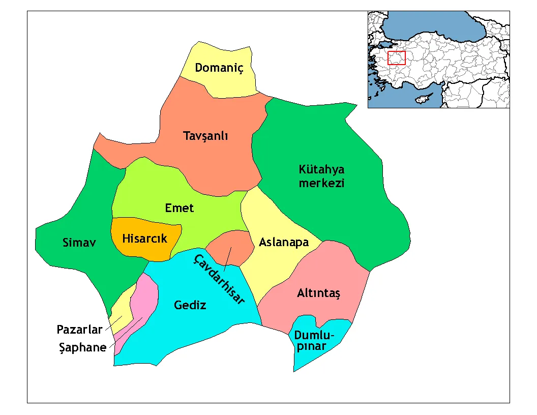
Tavşanlı İlçesi District101.5K
-
Simav İlçesi District66K
-
Gediz İlçesi District50.9K
-
Emet İlçesi District22.2K
-
Altıntaş İlçesi District17.8K
-
Domaniç İlçesi District15.9K
-
Hisarcık İlçesi District14K
-
Aslanapa İlçesi District10.5K
-
Çavdarhisar İlçesi District7.7K
-
Şaphane İlçesi District7.4K
-
Pazarlar İlçesi District5.6K
-
Dumlupınar İlçesi District3K
-
Akdere River
-
Akseki Deresi River
-
Akyar Deresi River
-
Alanavlusu Deresi River
-
Altıntaş Bucağı Municipality
-
Asarlık Deresi River
-
Aslanapa Bucağı Municipality
-
Avşar Deresi River
-
Bağlaryanı Deresi River
-
Baş Deresi River
-
Bedir Deresi River
-
Bulhari Deresi River
-
Büyük Dere River
-
Çan Deresi River
-
Çandıraz Deresi River
-
Çarmuk Deresi River
-
Çavdarhisar Bucağı Municipality
-
Çayıroluk Deresi River
-
Ceviz Deresi River
-
Çiftlik Deresi River
-
Çiftliközü Deresi River
-
Çobanlar Deresi River
-
Comburt Suyu River
-
Çömlekçi Deresi River
-
Dağardı Bucağı Municipality
-
Değirmen Deresi River
-
Değirmen Deresi River
-
Değirmenözü Deresi River
-
Deringöz Deresi River
-
Diken Cayı River
-
Doglusah Goleti Lake
-
Doğuluşah Deresi River
-
Dola Deresi River
-
Domaniç Bucağı Municipality
-
Dumlupınar Bucağı Municipality
-
Eğrigöz Dağı Mountain
-
Emet Bucağı Municipality
-
Enne Barajı Lake
-
Enüştü Village
-
Gazelyakup Deresi River
-
Gediz Bucağı Municipality
-
Gediz Çayı River
-
Göçmen Village
-
Güldür Deresi River
-
Güllüoğlu Çeşmesi Natural site
-
Hamam Deresi River
-
Hamamsuyu River
-
Hisarcık Bucağı Municipality
Largest cities and towns
Nature and heritage in Kütahya Province
-
Ziyaret Tepe Mountain, Simav İlçesi
-
Kozkavak Dağı Mountain, Altıntaş İlçesi
-
Gümüş Dağı Mountain, Kutahya
-
Elmalı Dağ Mountain, Altıntaş İlçesi
-
Çal Tepesi Mountain, Altıntaş İlçesi
-
Şaphane Dağı Mountain, Şaphane İlçesi
Other regions in Turkey
-
Bursa Province Region, Turkey103 km N
-
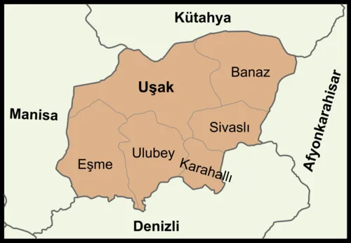 Uşak Province Region, Turkey84 km S
-
Bilecik Province Region, Turkey101 km NE
-
Banaz İlçesi District, Uşak Province60 km S
-
İnegöl District, Bursa Province85 km N
-
Usak District, Uşak Province65 km S
Sources & licences
Data last updated: · 2 independent sources