Ordu
Local name: Ordu ili
Located in Turkey Coordinates: 40°54′31″ N 37°41′04″ E
- Population
- 763,190
- 763.2K
- Elevation
- 0 m
- above sea level
- Local time
- UTC+03:00
- Europe/Istanbul · UTC+03:00
- Places inside
- 91
- listed under Ordu
About Ordu
Ordu is a region. Location: Turkey. Population: 763,190.
Ordu Province (Turkish: Ordu ili) is a province and metropolitan municipality of Turkey, located on the Black Sea coast. Its area is 5,914 km2, and its population is 763,190 (2022). Its adjacent provinces are Samsun to the northwest, Tokat to the southwest, Sivas to the south, and Giresun to the east. Its license-plate code is 52. The capital of the province is the city of Ordu.
Read more on Wikipedia Text: Wikipedia contributors · CC BY-SA 4.0 · shortened
At a glance
- Area
- 5,952 km²
Source: Wikidata
In comparison
- 2 sights and natural places within 10 km Çal Tepesi, Kavranbeli Deresi
- Listed here: River: 37, Municipality: 20, District: 19, Village: 7
Places in Ordu
91 places-
Altınordu District186.1K
-
Ünye İlçesi District118.2K
-
Fatsa İlçesi District106K
-
Gölköy İlçesi District32.8K
-
Korgan İlçesi District32.4K
-
Kumru İlçesi District32.3K
-
Perşembe İlçesi District32.1K
-
Aybastı İlçesi District24.2K
-
Akkuş District21.3K
-
Ulubey İlçesi District20.9K
-
Mesudiye İlçesi District17K
-
İkizce İlçesi District16.7K
-
Gürgentepe İlçesi District16.2K
-
Çaybaşı İlçesi District15.2K
-
Çatalpınar İlçesi District14.7K
-
Kabataş İlçesi District12.3K
-
Gülyalı İlçesi District9.1K
-
Kabadüz İlçesi District8.3K
-
Çamaş İlçesi District7.8K
-
Akçay Village932
-
Akkuş Bucağı Municipality
-
Alaçayır Deresi River
-
Ambartepe Village
-
Armutkolu Çayı River
-
Aybastı Bucağı Municipality
-
Aybastı Çayı River
-
Bolaman Bucağı Municipality
-
Bolaman Çayı River
-
Çaka Deresi River
-
Çalış Deresi River
-
Çaltı Village
-
Çamalan Deresi River
-
Çamaş Bucağı Municipality
-
Canik Dağları Mountain
-
Çatalpınar Bucağı Municipality
-
Çaybaşı Bucağı Municipality
-
Ceviz Deresi River
-
Ceyhanlı Village
-
Curi Deresi River
-
Döngeri Village
-
Dumnaçökek Village
-
Elekçi Irmağı River
-
Eriklik Deresi River
-
Fatsa Bucağı Municipality
-
Fatsa Körfezi Natural site
-
Gaçalı Dere River
-
Giresun Dağları Mountain
-
Gölköy Bucağı Municipality
-
Gülyalı Bucağı Municipality
-
Gürgentepe Bucağı Municipality
-
İğdir Ormanları Natural site
-
Ilıca Irmağı River
-
Kabadüz Bucağı Municipality
-
Kabataş Bucağı Municipality
-
Kara Dere River
-
Karakoyun Çayı River
-
Karakuş Çayı River
-
Kargı Village
-
Kavaklar Deresi River
-
Kavranbeli Deresi River
Largest cities and towns
-
Ordu City, Altınordu229.2K
-
Kumru City, Kumru İlçesi32.2K
-
Çatalpınar City, Çatalpınar İlçesi15K
-
Fatsa City, Fatsa İlçesi82.2K
-
Ünye City, Ünye İlçesi77.6K
-
Kabataş City, Kabataş İlçesi9.1K
-
Mesudiye City, Mesudiye İlçesi6.6K
-
Gürgentepe City, Gürgentepe İlçesi18.8K
Nature and heritage in Ordu
-
Teveklik Tepesi Mountain, Altınordu
-
Gürgen Tepesi Mountain, Gürgentepe İlçesi
-
Göndeliç Tepesi Mountain, Mesudiye İlçesi
-
Evliya Tepesi Mountain, Gürgentepe İlçesi
-
Evliya Tepesi Mountain, Ulubey İlçesi
-
Eğrikırık Dağı Mountain, Korgan İlçesi
Other regions in Turkey
-
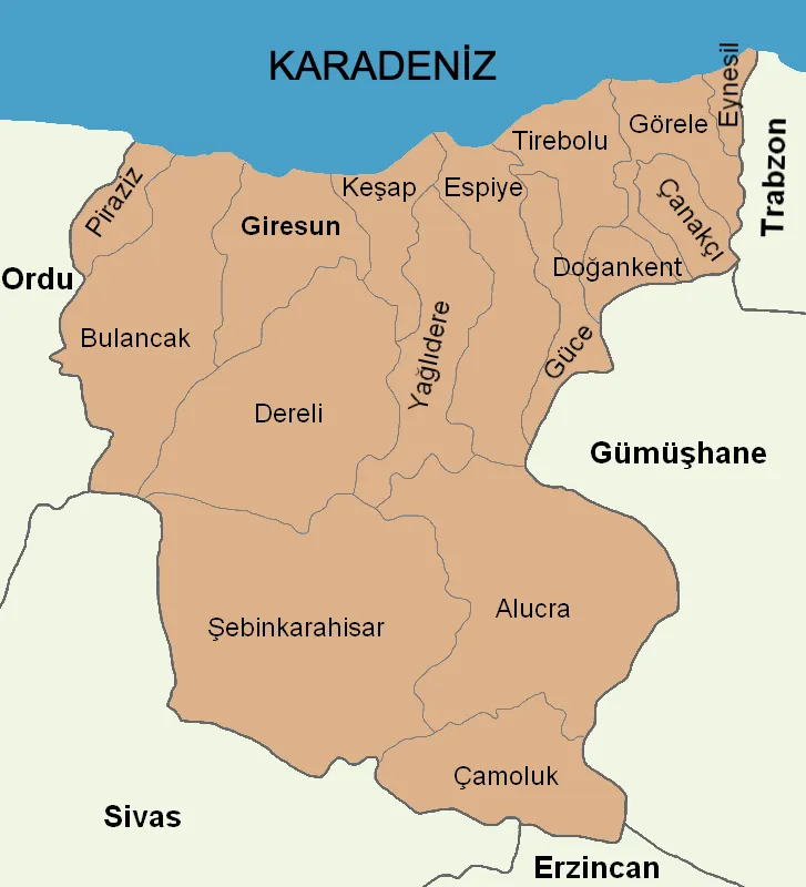 Giresun Province Region, Turkey83 km SE
-
Piraziz İlçesi District, Giresun Province37 km E
-
Bulancak İlçesi District, Giresun Province46 km E
Sources & licences
Data last updated: · 2 independent sources