Çavuştepe
Located in Gürpınar İlçesi, Van Province Coordinates: 38°21′47″ N 43°27′24″ E
- Local time
- UTC+03:00
- Europe/Istanbul · UTC+03:00
- Elevation
- 1,855 m
- above sea level
About Çavuştepe
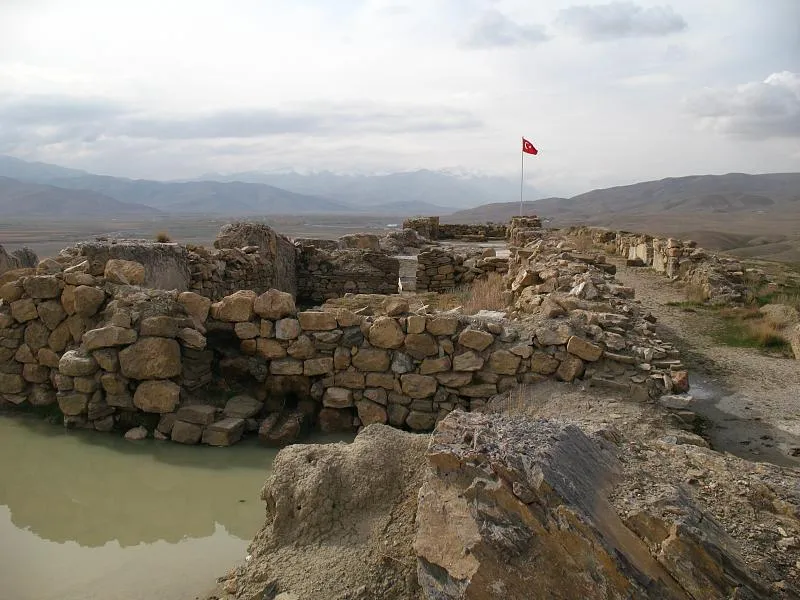
Çavuştepe is a historic site. Location: Gürpınar İlçesi, Van Province.
Sardurihinilli, also known as Haykaberd (Armenian: Հայկաբերդ, lit. 'Fortress of Hayk') or Çavuştepe Kalesi, is an ancient Urartian fortified site located on a ridge on the northeastern edge of the village of Çavuştepe in the Gürpınar district of Van Province in eastern Turkey. It is located approximately 25 kilometers southeast of Van along the road leading to the city of Hakkâri, in a valley once known as Hayots Dzor in historic Armenia. It was founded by the Urartian king Sarduri II (r.
Read more on Wikipedia Text: Wikipedia contributors · CC BY-SA 4.0 · shortened
In comparison
- 13 sights and natural places within 10 km Abdo Pınarı, Bol Dağı
Nearby attractions & nature
Everything nearby-
Abdo Pınarı Natural site, Van Province1.1 km NW
-
Bol Dağı Mountain, Gürpınar İlçesi2.8 km E
-
Camıztaşı Tepesi Mountain, Edremit4.8 km N
-
Kelepun Deresi River, Van Province4.5 km SW
-
Ganisipi Pınarı Natural site, Van Province6.1 km W
-
Akpınar Natural site, Van Province6.7 km N
-
Elyesünnet Dağı Mountain, Gürpınar İlçesi11 km E
-
Güzelsu Çayı River, Van Province6.4 km SW
Nearest towns and villages
-
Çavuştepe Village, Gürpınar İlçesi1.5 km SW
-
Taşkonak Village, Edremit2.3 km NE
-
Çakınlı Village, Gürpınar İlçesi3.6 km S
-
Değirmendüzü Village, Gürpınar İlçesi6.8 km SW
Sources & licences
Data last updated: · 2 independent sources