Bishopdale
Located in England, United Kingdom Coordinates: 54°15′00″ N 2°01′00″ W
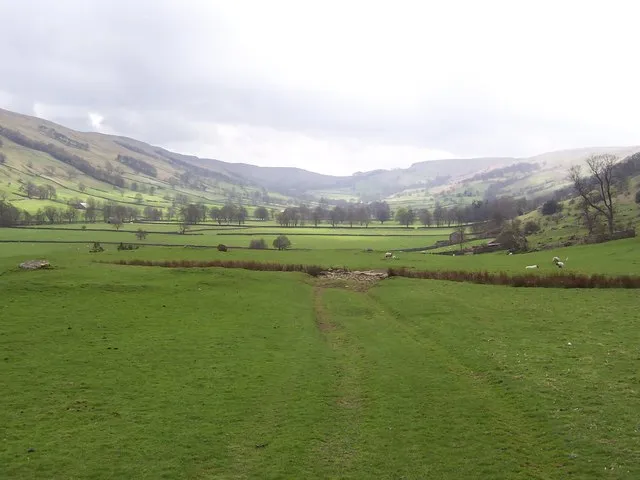
- Elevation
- 480 m
- above sea level
- Local time
- UTC+00:00
- Europe/London · UTC+00:00
About Bishopdale
Bishopdale is a natural site. Location: England, United Kingdom.
Bishopdale is a dale in the Yorkshire Dales National Park in North Yorkshire, England. The dale is a side dale on the south side of Wensleydale, and extends for some 6 miles (10 km) south west from Aysgarth. Bishopdale is also the name of a civil parish, which includes only the sparsely populated upper reaches of the dale, from the head of the dale as far downstream as Howesyke and Howgill Gill.
Read more on Wikipedia Text: Wikipedia contributors · CC BY-SA 4.0 · shortened
In comparison
- 23 sights and natural places within 10 km Naughtberry Hill, Harland Hill
Nearest towns and villages
-
Burton-cum-Walden Village, Richmondshire District1 km SE
-
Newbiggin Village, Richmondshire District1 km NE
-
Thoralby Village, Richmondshire District2.7 km NW
-
Newbiggin Village, Newbiggin2.1 km NE
-
Bishopdale Village, Richmondshire District3.8 km SW
-
Cross Lanes Village, Newbiggin2.6 km NE
Nearby attractions & nature
Everything nearby-
Naughtberry Hill Mountain, Bishopdale2.4 km SW
-
Harland Hill Mountain, Burton-cum-Walden3.8 km E
-
Brown Haw Mountain, Burton-cum-Walden3.9 km S
-
Penhill Beacon Mountain, Carlton Town5.7 km E
-
yorkshire dales Natural site, Bainbridge4.7 km NW
-
Height of Hazely Mountain, Burton-cum-Walden5.2 km NE
-
Buckden Pike Mountain, Buckden5.8 km SW
-
Addlebrough Mountain, Thornton Rust5.9 km NW
More nature in United Kingdom
-
 Great Whernside Mountain, Kettlewell with Starbotton10 km S
-
Little Whernside Mountain, Carlton Highdale6.5 km SE
-
Great Haw Mountain, Colsterdale9.5 km SE
-
Tor Mere Top Mountain, Carlton Highdale7.6 km S
-
Yockenthwaite Moor Mountain, Buckden8.6 km W
-
Dead Man's Hill Mountain, Stonebeck Up8.8 km SE
Sources & licences
Data last updated: · 2 independent sources