Flitwick
Located in Central Bedfordshire, England Coordinates: 52°00′05″ N 0°30′15″ W
- Elevation
- 89 m
- above sea level
- Local time
- UTC+00:00
- Europe/London · UTC+00:00
- Places inside
- 3
- listed under Flitwick
About Flitwick
Flitwick is a municipality. Location: Central Bedfordshire, England. Elevation: 89 m.
In comparison
- Nearest larger town: Flitwick, 1 km E
- 69 sights and natural places within 10 km Flitwick (Mount Hill), Flitwick Church
- Listed here: Attraction: 1, Historic site: 1, Town: 1
Places in Flitwick
3 places-
Flitwick Town13K
-
Flitwick Church Attraction
-
Flitwick (Mount Hill) Historic site
Nearby attractions & nature
Everything nearby-
Flitwick Moor Natural site, England1.8 km E
-
Steppingley Church Attraction, Steppingley1.8 km NW
-
St. Mary Magdalene church Attraction, Westoning1.9 km S
-
Westoning Baptist Church Attraction, Westoning2.1 km S
-
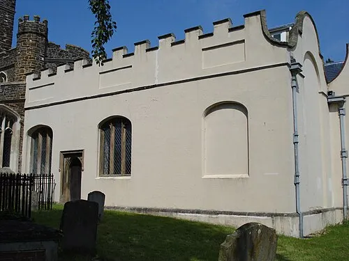 de Grey Mausoleum Landmark, Flitton and Greenfield3.4 km E
-
Dillingham Park Landmark, Ampthill3.3 km N
-
Flitton church Attraction, Flitton and Greenfield3.3 km E
-
St. James the Apostle church Attraction, Pulloxhill3.5 km E
Sources & licences
Data last updated: