Hotham
Located in East Yorkshire, England Coordinates: 53°47′57″ N 0°39′57″ W
- Elevation
- 8 m
- above sea level
- Local time
- UTC+00:00
- Europe/London · UTC+00:00
- Places inside
- 1
- listed under Hotham
About Hotham
Hotham is a municipality. Location: East Yorkshire, England. Elevation: 8 m.
In comparison
- Nearest larger town: Hotham, 2 km E
- 5 sights and natural places within 10 km High Hunsley Wold, Church Hill
Airports nearest to Hotham
- Humberside Airport (HUY) Grimsby, Lincolnshire 32 km
- Leeds Bradford Airport (LBA) Leeds, West Yorkshire 66 km
- Teesside International Airport (MME) Darlington, Durham 93 km
Straight-line distance; airports with scheduled flights only. Source: OurAirports (public domain).
Places in Hotham
1 place-
Hotham Village233
Nearby attractions & nature
Everything nearby-
High Hunsley Wold Mountain, Rowley6.4 km E
-
Church Hill Mountain, Holme upon Spalding Moor7.2 km NW
-
Great Wold Mountain, South Cave7.4 km E
-
Weighton Wold Mountain, Market Weighton7.8 km NE
-
Whitton Island Island, Blacktoft10 km S
-
River Ouse River, England11 km S
-
River Trent River, England11 km S
-
Boothferry Park Landmark, Kingston upon Hull19 km E
Other cities and towns in East Yorkshire
-
Welton Municipality, East Yorkshire12 km SE
-
Newport Municipality, East Yorkshire4.4 km SW
-
South Cave Municipality, East Yorkshire5.4 km SE
-
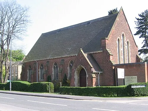 Brough Town, Elloughton-cum-Brough10 km SE
-
Newbald Municipality, East Yorkshire5.1 km NE
-
Gilberdyke Municipality, East Yorkshire6.8 km SW
Sources & licences
Data last updated: