Aztec West
Located in Gloucestershire, England Coordinates: 51°32′35″ N 2°34′05″ W
- Elevation
- 80 m
- above sea level
- Local time
- UTC+00:00
- Europe/London · UTC+00:00
About Aztec West
Aztec West is a natural site. Location: Gloucestershire, England.
In comparison
- 18 sights and natural places within 10 km Memorial Stadium, Purdown BT Tower
Nearest towns and villages
-
Almondsbury Village, Almondsbury1.3 km N
-
Stoke Gifford Town, Stoke Gifford3.5 km SE
-
Almondsbury Municipality, South Gloucestershire1.5 km W
-
Patchway Municipality, South Gloucestershire1.3 km SW
-
Patchway Neighbourhood, Patchway1.1 km SW
-
Bradley Stoke Municipality, South Gloucestershire1.7 km SE
Nearby attractions & nature
Everything nearby-
Abbey Hill Mountain, Thornbury7.2 km NE
-
Kings Weston Hill Mountain, Bristol7.5 km SW
-
Aust Hill Mountain, Aust7.7 km NW
-
Aust Cliff Mountain, Aust8 km NW
-
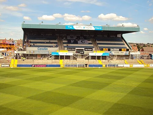 Memorial Stadium Landmark, Bristol6.4 km S
-
Durdham Down Mountain, Bristol8.9 km SW
-
Hopewell Hill Mountain, South Gloucestershire9.1 km SE
-
Milbury Heath Mountain, Thornbury9.4 km NE
Sources & licences
Data last updated: