Totley
Located in Sheffield, England Coordinates: 53°18′51″ N 1°32′27″ W
- Elevation
- 197 m
- above sea level
- Local time
- UTC+00:00
- Europe/London · UTC+00:00
About Totley
Totley is a village. Location: Sheffield, England. Elevation: 197 m.
Totley is a suburb on the extreme southwest of the city of Sheffield, in South Yorkshire, England. Lying within the historic county boundaries of Derbyshire, Totley was amalgamated into the city of Sheffield in 1933, and is today part of the Dore and Totley electoral ward in the city, though it remains close to the contemporary county boundary of Derbyshire. Totley had a population of 7,963 in 2011.
Read more on Wikipedia Text: Wikipedia contributors · CC BY-SA 4.0 · shortened
In comparison
- Nearest larger town: Holmesfield, 3 km SE
- 22 sights and natural places within 10 km Holmesfield Castle Hill, Highfield Hill
Nearby attractions & nature
Everything nearby-
Holmesfield Castle Hill Historic site, Holmesfield2.5 km SE
-
High Neb Mountain, Sheffield9.7 km NW
-
Backmoor Mountain, Sheffield6.3 km NE
-
 Don Valley Stadium Landmark, Sheffield12 km NE
-
Redmires Lake, England7.6 km NW
-
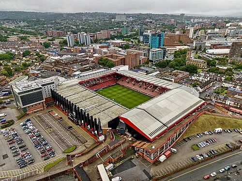 Bramall Lane Landmark, Sheffield7.8 km NE
Sources & licences
Data last updated: · 2 independent sources