Shepton Mallet
Located in Mendip District, Somerset Coordinates: 51°11′24″ N 2°33′00″ W
- Elevation
- 143 m
- above sea level
- Local time
- UTC+00:00
- Europe/London · UTC+00:00
- Places inside
- 8
- listed under Shepton Mallet
About Shepton Mallet
Shepton Mallet is a village. Location: Mendip District, Somerset. Elevation: 143 m.
In comparison
- Nearest larger town: Shepton Mallet, 0 km E
- 15 sights and natural places within 10 km Long Hill, Worminster Sleight
- Listed here: Neighbourhood: 5, Village: 2, Town: 1
Places in Shepton Mallet
8 places-
Shepton Mallet Town10.4K
-
Bowlish Neighbourhood
-
Cannard's Grave Village
-
Charlton Neighbourhood
-
Darshill Neighbourhood
-
Downside Village
-
Field Neighbourhood
-
West Shepton Neighbourhood
Nearby attractions & nature
Everything nearby-
Long Hill Mountain, Ashwick3.2 km N
-
Worminster Sleight Mountain, St. Cuthbert Out3.9 km W
-
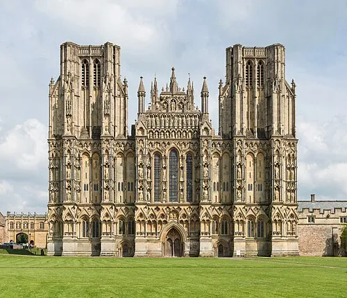 Wells Cathedral Attraction, Wells6.9 km W
-
Cranmore Hill Mountain, Cranmore5.6 km E
-
Small Down Knoll Mountain, Evercreech5.7 km SE
-
Launcherly Hill Mountain, North Wootton6.2 km W
Sources & licences
Data last updated: