Cheadle
Located in Stockport, England Coordinates: 53°24′00″ N 2°13′00″ W
- Population
- 5,698
- 5.7K
- Elevation
- 41 m
- above sea level
- Local time
- UTC+00:00
- Europe/London · UTC+00:00
About Cheadle
Cheadle is a village. Location: Stockport, England. Population: 5,698. Elevation: 41 m.
Cheadle () is a suburban village in the Metropolitan Borough of Stockport, in Greater Manchester, England. Within the boundaries of the historic county of Cheshire, it borders Cheadle Hulme, Gatley, Heald Green and Cheadle Heath in Stockport, and East Didsbury in Manchester. In 2011, it had a population of 14,698.
Read more on Wikipedia Text: Wikipedia contributors · CC BY-SA 4.0 · shortened
At a glance
- Area
- 3.3 km²
Source: Wikidata
In comparison
- No. 8 of 10 places in Stockport by population
- Nearest larger town: Gatley, 1 km SW
- 30 sights and natural places within 10 km Edgeley Park, Peel Moat
Nearby attractions & nature
Everything nearby-
Peel Moat Landmark, Stockport3.7 km NE
-
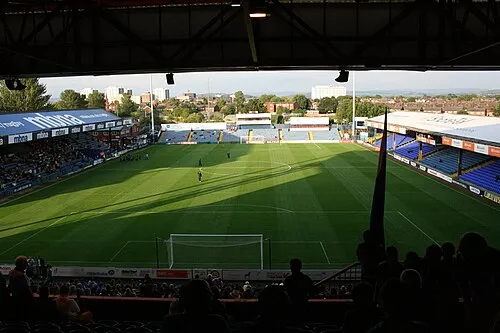 Edgeley Park Landmark, Offerton Park3.3 km E
-
Stockport Castle Historic site, Stockport4.2 km E
-
River Goyt River, England4.8 km NE
-
Norbury Church Attraction, Stockport7.2 km E
-
Avro Heritage Museum Museum, Stockport7.4 km SE
Sources & licences
Data last updated: · 2 independent sources