Platt Bridge
Located in Wigan, England Coordinates: 53°31′13″ N 2°35′55″ W
- Elevation
- 29 m
- above sea level
- Local time
- UTC+00:00
- Europe/London · UTC+00:00
About Platt Bridge
Platt Bridge is a village. Location: Wigan, England. Elevation: 29 m.
Platt Bridge is a settlement in the Metropolitan Borough of Wigan, Greater Manchester, England, 2 miles (3.2 km) south of Wigan town centre along the spine of the A573 road. Historically part of the Hindley Urban District, in Lancashire, the area is now a residential suburb of Wigan. The first mention of Platt Bridge in documents occurs in 1599. The name comes from "plat" or "platte" meaning a foot-bridge. Platt Bridge borders Abram, Bamfurlong, Hindley and Ince-in-Makerfield.
Read more on Wikipedia Text: Wikipedia contributors · CC BY-SA 4.0 · shortened
In comparison
- Nearest larger town: Abram, 1 km S
- 13 sights and natural places within 10 km Wigan Athletic FC, Firs Park
Nearby attractions & nature
Everything nearby-
Wigan Athletic FC Landmark, Wigan4.6 km NW
-
Firs Park Natural site, Wigan4.7 km SE
-
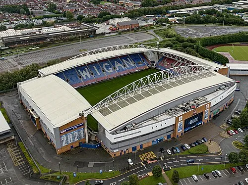 DW Stadium Landmark, Shevington4.8 km NW
-
Westleigh Brook River, Wigan5.4 km SE
-
Pennington Hall Park Natural site, Wigan6.1 km SE
-
Newton Le Willows Castle Hill Historic site, St. Helens6.7 km S
Sources & licences
Data last updated: · 2 independent sources