- Elevation
- 656 m
- above sea level
- Local time
- UTC+00:00
- Europe/London · UTC+00:00
- Airports
- GLA Glasgow Airport31 km
- PIK Glasgow Prestwick Airport66 km
About Beinn Tharsuinn
Beinn Tharsuinn is a mountain. Location: Argyll and Bute, Scotland. Elevation: 656 m. The nearest airport is Glasgow Airport (31 km). Nearby sights include Beinn Chaorach and Balcnock.
Photos of Beinn Tharsuinn
-
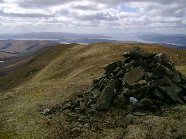
Beinn a' Mhanaich Mark Nightingale · CC BY-SA 2.0 -
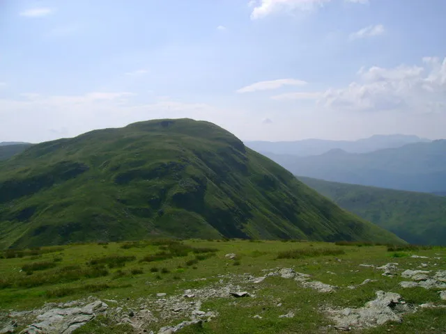
Doune Hill Mark Nightingale · CC BY-SA 2.0


Climate of Beinn Tharsuinn
This month · November
A wet month
Day 5° · Night 0° · Rain 204 mm
- Hottest month
- July (day 14°)
- Coldest month
- February (night -2°)
- Wettest month
- January (229 mm)
- Driest month
- June (95 mm)
Bars: average monthly low and high temperature. Below: precipitation. Monthly averages for 1970–2000 at about 18 km resolution, adjusted for elevation. Highlighted months are mild and relatively dry. Source: WorldClim 2.1 (CC BY 4.0).
Show values as a table
| Month | Jan | Feb | Mar | Apr | May | Jun | Jul | Aug | Sep | Oct | Nov | Dec |
|---|---|---|---|---|---|---|---|---|---|---|---|---|
| Average high (°C) | 3° | 3° | 4° | 7° | 10° | 12° | 14° | 14° | 11° | 8° | 5° | 3° |
| Average low (°C) | -2° | -2° | -1° | 0° | 3° | 5° | 7° | 7° | 6° | 3° | 0° | -1° |
| Precipitation (mm) | 229 | 149 | 164 | 100 | 100 | 95 | 110 | 132 | 180 | 207 | 204 | 208 |
How to get to Beinn Tharsuinn
The nearest airport is Glasgow Airport (GLA), 31 km to the southeast as the crow flies. The nearest large city is Glasgow, 39 km to the southeast.
Airports
- Glasgow Airport (GLA) Glasgow 31 kmsoutheast
- Glasgow Prestwick Airport (PIK) Prestwick, South Ayrshire 66 kmsouth
- Edinburgh Airport (EDI) Ingliston, Edinburgh 87 kmeast
Nearby large cities
- Glasgow Population: 626.4K 39 kmsoutheast
- Edinburgh Population: 515K 98 kmeast
- Dundee Population: 148.2K 118 kmeast
- Belfast Population: 348K 182 kmsouthwest
- Aberdeen Population: 198.6K 201 kmnortheast
Straight-line distances; road distances are longer. Airport data: OurAirports.
Day trips from Beinn Tharsuinn
Within 100 km: 160 historic and cultural sites, 3,671 natural sites, 1,260 lakes, rivers and coasts.
0–25 km376 places
- Inchlonaig Island 9 kmE
- Inchcailloch Island 12 kmE
- Aber Isle Island 13 kmE
- Bucinch Island 10 kmE
25–60 km1,784 places
- Great Cumbrae Island Island 37 kmS
- Hunterston Sands Beach 41 kmS
- Cala Island 54 kmW
- Torsa Island Island 57 kmW
60–100 km2,931 places
- Isle of Arran Island 63 kmSW
- Colonsay Island 91 kmW
- Ayr Beach Beach 70 kmS
- Troon Beach Beach 61 kmS
Straight-line distances.
Nearest towns and villages
-
Garelochhead Village, Argyll and Bute5.1 km W
-
Luss Village, Argyll and Bute7 km E
-
Helensburgh Town, Argyll and Bute9 km S
-
Rhu Village, Argyll and Bute7.9 km S
-
Faslane Port Village, Argyll and Bute5.1 km W
-
Rosneath Village, Argyll and Bute9.2 km S
Nearby attractions & nature
Everything nearby-
Beinn Chaorach Mountain, Argyll and Bute0.9 km NW
-
Balcnock Mountain, Argyll and Bute1.2 km E
-
Creag an Leinibh Mountain, Argyll and Bute2.1 km E
-
Beinn a' Mhanaich Mountain, Argyll and Bute3.7 km NW
-
Beinn Eich Mountain, Argyll and Bute3.3 km N
-
Beinn Ruisg Mountain, Argyll and Bute3.4 km E
-
Doune Hill Mountain, Argyll and Bute5.5 km N
-
Glen Fruin Natural site, Argyll and Bute4.2 km S
Sources & licences
Data last updated: