Cruach Scarba SE Top
Located in Argyll and Bute, Scotland Coordinates: 56°10′18″ N 5°42′59″ W
- Elevation
- 422 m
- above sea level
- Local time
- UTC+00:00
- Europe/London · UTC+00:00
- Airports
- ILY Islay Airport64 km
- TRE Tiree Airport80 km
About Cruach Scarba SE Top
Cruach Scarba SE Top is a mountain. Location: Argyll and Bute, Scotland. Elevation: 422 m. The nearest airport is Islay Airport (64 km). Nearby sights include Cruach Scarba and Cruach Coire Buidhe.
Photos of Cruach Scarba SE Top
-
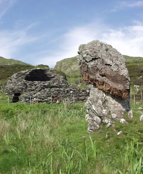
Eileach an Naoimh Christopher Bruce · CC BY-SA 2.0

Climate of Cruach Scarba SE Top
This month · November
A wet month
Day 8° · Night 4° · Rain 211 mm
- Hottest month
- August (day 15°)
- Coldest month
- February (night 2°)
- Wettest month
- January (229 mm)
- Driest month
- May (82 mm)
Bars: average monthly low and high temperature. Below: precipitation. Monthly averages for 1970–2000 at about 18 km resolution, adjusted for elevation. Highlighted months are mild and relatively dry. Source: WorldClim 2.1 (CC BY 4.0).
Show values as a table
| Month | Jan | Feb | Mar | Apr | May | Jun | Jul | Aug | Sep | Oct | Nov | Dec |
|---|---|---|---|---|---|---|---|---|---|---|---|---|
| Average high (°C) | 6° | 5° | 6° | 8° | 11° | 13° | 15° | 15° | 13° | 10° | 8° | 6° |
| Average low (°C) | 2° | 2° | 2° | 3° | 6° | 8° | 10° | 10° | 8° | 6° | 4° | 2° |
| Precipitation (mm) | 229 | 139 | 171 | 102 | 82 | 91 | 113 | 137 | 186 | 203 | 211 | 209 |
How to get to Cruach Scarba SE Top
The nearest airport is Islay Airport (ILY), 64 km to the southwest as the crow flies. The nearest large city is Glasgow, 97 km to the east.
Airports
- Islay Airport (ILY) Isle of Islay, Argyll and Bute 64 kmsouthwest
- Tiree Airport (TRE) Balemartine, Argyll and Bute 80 kmnorthwest
- Campbeltown Airport (CAL) Campbeltown 82 kmsouth
Nearby large cities
- Glasgow Population: 626.4K 97 kmeast
- Edinburgh Population: 515K 159 kmeast
- Dundee Population: 148.2K 173 kmeast
- Belfast Population: 348K 176 kmsouth
- Aberdeen Population: 198.6K 247 kmnortheast
Straight-line distances; road distances are longer. Airport data: OurAirports.
Day trips from Cruach Scarba SE Top
Within 100 km: 80 historic and cultural sites, 2,892 natural sites, 1,241 lakes, rivers and coasts.
0–25 km510 places
- Scarba Island 1 kmN
- Cala Island 19 kmS
- Torsa Island Island 11 kmNE
- Shuna Island 9 kmNE
25–60 km1,607 places
- Colonsay Island 33 kmW
- Kiloran Beach Beach 30 kmW
- Oronsay Island 56 kmN
- Oronsay Island 38 kmSW
60–100 km2,096 places
- Isle of Arran Island 70 kmSE
- Great Cumbrae Island Island 67 kmSE
- Eigg Island 86 kmN
- Troon Beach Beach 96 kmSE
Straight-line distances.
Nearest towns and villages
-
 Kinuachdrachd Village, Argyll and Bute5.4 km S
-
Blackmill Bay Village, Argyll and Bute5.9 km NE
-
Toberonochy Village, Argyll and Bute7.3 km NE
-
Aird Village, Argyll and Bute7.9 km E
-
Bardrishaig Village, Argyll and Bute9.7 km NE
-
Cullipool Village, Argyll and Bute10 km NE
Nearby attractions & nature
Everything nearby-
Cruach Scarba Mountain, Argyll and Bute0.7 km NW
-
Cruach Coire Buidhe Mountain, Argyll and Bute1 km SW
-
Scarba Island, Argyll and Bute1.3 km N
-
Maol Buidhe Mountain, Argyll and Bute2.2 km E
-
Kilmory Lodge Hill Mountain, Argyll and Bute2.5 km NE
-
An Cruachan Mountain, Argyll and Bute3.2 km S
-
Eilean Mòr Island, Argyll and Bute2.6 km SW
-
Eilean Beag Island, Argyll and Bute3.1 km S
Sources & licences
Data last updated: