McCrierick's Cairn
Located in Dumfries and Galloway, Scotland Coordinates: 55°21′59″ N 4°06′10″ W
- Elevation
- 556 m
- above sea level
- Local time
- UTC+00:00
- Europe/London · UTC+00:00
- Airports
- PIK Glasgow Prestwick Airport34 km
- GLA Glasgow Airport60 km
About McCrierick's Cairn
McCrierick's Cairn is a mountain. Location: Dumfries and Galloway, Scotland. Elevation: 556 m. The nearest airport is Glasgow Prestwick Airport (34 km). Nearby sights include Hare Hill and The Knipe.
Photos of McCrierick's Cairn
-
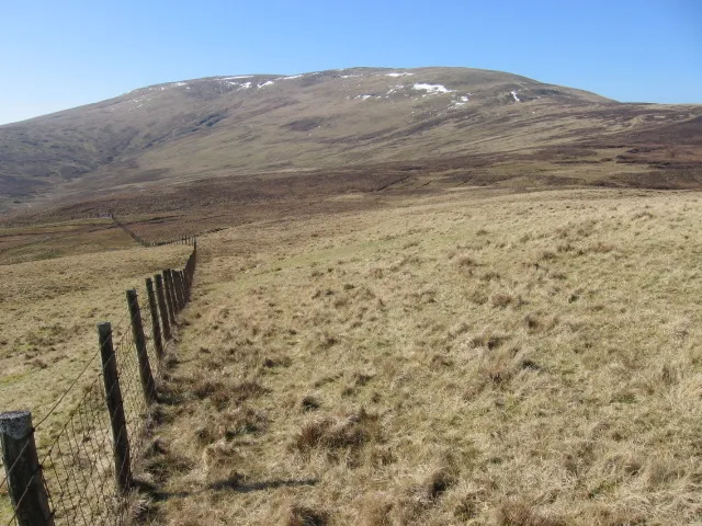
Blackcraig Hill Chris Wimbush · CC BY-SA 2.0

Climate of McCrierick's Cairn
This month · November
A wet month
Day 6° · Night 1° · Rain 193 mm
- Hottest month
- July (day 15°)
- Coldest month
- January (night -2°)
- Wettest month
- January (200 mm)
- Driest month
- June (88 mm)
Bars: average monthly low and high temperature. Below: precipitation. Monthly averages for 1970–2000 at about 18 km resolution, adjusted for elevation. Highlighted months are mild and relatively dry. Source: WorldClim 2.1 (CC BY 4.0).
Show values as a table
| Month | Jan | Feb | Mar | Apr | May | Jun | Jul | Aug | Sep | Oct | Nov | Dec |
|---|---|---|---|---|---|---|---|---|---|---|---|---|
| Average high (°C) | 3° | 3° | 5° | 8° | 11° | 14° | 15° | 15° | 12° | 9° | 6° | 4° |
| Average low (°C) | -2° | -2° | -1° | 0° | 3° | 6° | 8° | 8° | 6° | 3° | 1° | -1° |
| Precipitation (mm) | 200 | 136 | 152 | 91 | 95 | 88 | 93 | 120 | 163 | 192 | 193 | 195 |
How to get to McCrierick's Cairn
The nearest airport is Glasgow Prestwick Airport (PIK), 34 km to the northwest as the crow flies. The nearest large city is Glasgow, 56 km to the north.
Airports
- Glasgow Prestwick Airport (PIK) Prestwick, South Ayrshire 34 kmnorthwest
- Glasgow Airport (GLA) Glasgow 60 kmnorth
- Edinburgh Airport (EDI) Ingliston, Edinburgh 80 kmnortheast
Nearby large cities
- Glasgow Population: 626.4K 56 kmnorth
- Edinburgh Population: 515K 87 kmnortheast
- Dundee Population: 148.2K 142 kmnortheast
- Belfast Population: 348K 145 kmsouthwest
- Newcastle upon Tyne Population: 300.1K 165 kmeast
Straight-line distances; road distances are longer. Airport data: OurAirports.
Day trips from McCrierick's Cairn
Within 100 km: 312 historic and cultural sites, 2,778 natural sites, 782 lakes, rivers and coasts.
0–25 km331 places
- Kids Isle Island 19 kmSW
- McDowalls Isle Island 24 kmSW
- Lint Holm Island 19 kmS
- New Island Island 21 kmNE
25–60 km1,338 places
- Ayr Beach Beach 36 kmW
- Troon Beach Beach 40 kmNW
- Horse Isle Island 56 kmNW
- Green Island Island 37 kmS
60–100 km2,203 places
- Isle of Arran Island 77 kmW
- Great Cumbrae Island Island 68 kmNW
- Powillimount Beach Beach 63 kmSE
- Hunterston Sands Beach 64 kmNW
Straight-line distances.
Nearest towns and villages
-
 New Cumnock Village, East Ayrshire6.1 km NW
-
 Kirkconnel Village, Dumfries and Galloway6.9 km E
-
 Sanquhar Village, Dumfries and Galloway11 km E
-
Afton Bridgend Neighbourhood, East Ayrshire5.8 km NW
-
Mansfield Village, East Ayrshire6.4 km NW
-
Kelloholm Neighbourhood, Dumfries and Galloway7.1 km E
Nearby attractions & nature
Everything nearby-
Hare Hill Mountain, East Ayrshire1.4 km W
-
The Knipe Mountain, East Ayrshire1.9 km W
-
Dun Rig Head Mountain, East Ayrshire2 km S
-
Laglass Hill Mountain, East Ayrshire2.4 km SW
-
Blackcraig Hill Mountain, East Ayrshire4.2 km SW
-
Well Hill Mountain, Dumfries and Galloway3.6 km SE
-
Magheuchan Rig Mountain, Dumfries and Galloway3.6 km S
-
Mid Hill Mountain, Dumfries and Galloway3.8 km SE
Sources & licences
Data last updated: