- Local time
- UTC+00:00
- Europe/London · UTC+00:00
- Airports
- INV Inverness Airport103 km
- TRE Tiree Airport106 km
About Eilean Mhairtein
Eilean Mhairtein is an island. Location: Scotland, United Kingdom. The nearest airport is Inverness Airport (103 km). Nearby sights include Beinn Sgritheall and Eilean a' Chuilinn.
Climate of Eilean Mhairtein
This month · November
A wet month
Day 7° · Night 2° · Rain 296 mm
- Hottest month
- July (day 16°)
- Coldest month
- February (night 0°)
- Wettest month
- January (301 mm)
- Driest month
- May (116 mm)
Bars: average monthly low and high temperature. Below: precipitation. Monthly averages for 1970–2000 at about 18 km resolution, adjusted for elevation. Highlighted months are mild and relatively dry. Source: WorldClim 2.1 (CC BY 4.0).
Show values as a table
| Month | Jan | Feb | Mar | Apr | May | Jun | Jul | Aug | Sep | Oct | Nov | Dec |
|---|---|---|---|---|---|---|---|---|---|---|---|---|
| Average high (°C) | 5° | 5° | 7° | 9° | 13° | 14° | 16° | 16° | 13° | 10° | 7° | 5° |
| Average low (°C) | 1° | 0° | 1° | 2° | 5° | 7° | 9° | 9° | 7° | 5° | 2° | 1° |
| Precipitation (mm) | 301 | 195 | 246 | 135 | 116 | 126 | 144 | 167 | 248 | 277 | 296 | 295 |
How to get to Eilean Mhairtein
The nearest airport is Inverness Airport (INV), 103 km to the northeast as the crow flies. The nearest large city is Glasgow, 164 km to the southeast.
Airports
- Inverness Airport (INV) Inverness, Highland 103 kmnortheast
- Tiree Airport (TRE) Balemartine, Argyll and Bute 106 kmsouthwest
- Barra Airport (BRR) Eoligarry 113 kmwest
Nearby large cities
- Glasgow Population: 626.4K 164 kmsoutheast
- Dundee Population: 148.2K 176 kmsoutheast
- Edinburgh Population: 515K 198 kmsoutheast
- Aberdeen Population: 198.6K 212 kmeast
- Belfast Population: 348K 284 kmsouth
Straight-line distances; road distances are longer. Airport data: OurAirports.
Day trips from Eilean Mhairtein
Within 100 km: 38 historic and cultural sites, 4,010 natural sites, 1,125 lakes, rivers and coasts.
0–25 km546 places
- Sandaig Islands Island 7 kmNW
- Eilean Ràrsaidh Island 2 kmSW
- Pabay Island 22 kmNW
- Ornsay Island 12 kmW
25–60 km1,773 places
- Isle of Skye Island 44 kmNW
- Island of Raasay Island 39 kmNW
- Eigg Island 44 kmSW
- Scalpay Island 29 kmNW
60–100 km2,854 places
- Hebrides Island 76 kmW
- The Coral Beaches Beach 75 kmNW
- Clett Island 76 kmNW
- Eriska Island 68 kmS
Straight-line distances.
Nearest towns and villages
-
Arnisdale Village, Highland1.9 km E
-
Corran Village, Highland3.6 km SE
-
Eilanreach Village, Highland7.2 km N
-
Glenelg Village, Highland8.4 km N
-
Inverie Village, Highland13 km SW
-
Inverguseran Village, Highland8.7 km SW
Nearby attractions & nature
Everything nearby-
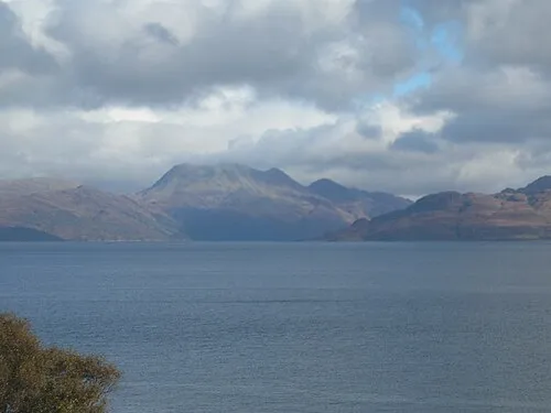 Beinn Sgritheall Mountain, Highland1.8 km NE
-
Eilean a' Chuilinn Island, Highland1 km W
-
Eilean Tioram Island, Scotland1.2 km SE
-
Loch Hourn Natural site, Highland0.8 km SW
-
Creag an Fhithich Mountain, Highland1.3 km NE
-
Eilean Ràrsaidh Island, Highland1.6 km SW
-
Creag an Taghainn Mountain, Highland2 km NW
-
Beinn Sgritheall East Top Mountain, Highland2.2 km NE
Sources & licences
Data last updated: