- Elevation
- 619 m
- above sea level
- Local time
- UTC+00:00
- Europe/London · UTC+00:00
- Airports
- TRE Tiree Airport78 km
- BRR Barra Airport114 km
About Beinn an Albannaich
Beinn an Albannaich is a mountain. Location: Highland, Scotland. Elevation: 619 m. The nearest airport is Tiree Airport (78 km). Nearby sights include Beinn Resipol and Creag an Eighich.
Photos of Beinn an Albannaich
-
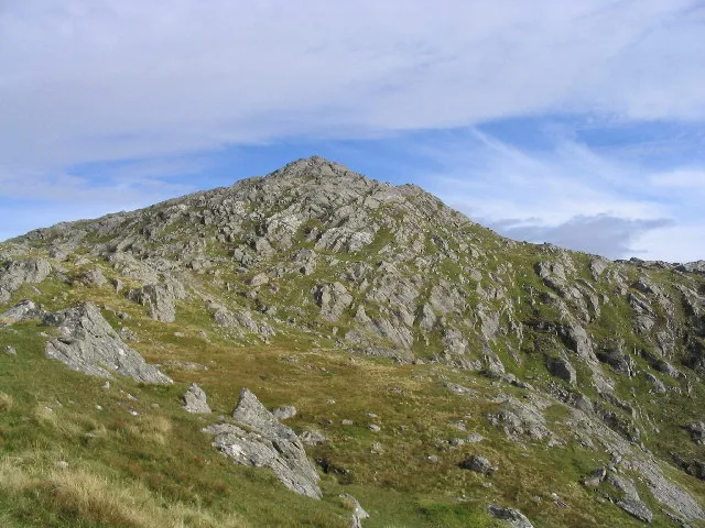
Beinn Resipol Andrew Dann · CC BY-SA 2.0

Climate of Beinn an Albannaich
This month · November
A wet month
Day 5° · Night 1° · Rain 267 mm
- Hottest month
- July (day 14°)
- Coldest month
- February (night -1°)
- Wettest month
- January (278 mm)
- Driest month
- May (105 mm)
Bars: average monthly low and high temperature. Below: precipitation. Monthly averages for 1970–2000 at about 18 km resolution, adjusted for elevation. Highlighted months are mild and relatively dry. Source: WorldClim 2.1 (CC BY 4.0).
Show values as a table
| Month | Jan | Feb | Mar | Apr | May | Jun | Jul | Aug | Sep | Oct | Nov | Dec |
|---|---|---|---|---|---|---|---|---|---|---|---|---|
| Average high (°C) | 3° | 3° | 5° | 7° | 11° | 12° | 14° | 14° | 12° | 8° | 5° | 3° |
| Average low (°C) | -1° | -1° | 0° | 1° | 4° | 6° | 8° | 8° | 6° | 4° | 1° | -1° |
| Precipitation (mm) | 278 | 176 | 223 | 125 | 105 | 113 | 135 | 160 | 228 | 250 | 267 | 266 |
How to get to Beinn an Albannaich
The nearest airport is Tiree Airport (TRE), 78 km to the west as the crow flies. For international flights: Glasgow Airport (GLA) (121 km). The nearest large city is Glasgow, 129 km to the southeast.
Airports
- Tiree Airport (TRE) Balemartine, Argyll and Bute 78 kmwest
- Barra Airport (BRR) Eoligarry 114 kmwest
- Glasgow Airport (GLA) Glasgow 121 kmsoutheast
Nearby large cities
- Glasgow Population: 626.4K 129 kmsoutheast
- Dundee Population: 148.2K 167 kmeast
- Edinburgh Population: 515K 175 kmsoutheast
- Aberdeen Population: 198.6K 222 kmeast
- Belfast Population: 348K 237 kmsouth
Straight-line distances; road distances are longer. Airport data: OurAirports.
Day trips from Beinn an Albannaich
Within 100 km: 32 historic and cultural sites, 4,011 natural sites, 1,325 lakes, rivers and coasts.
0–25 km486 places
- Oronsay Island 18 kmW
- Shuna Island Island 22 kmSE
- Eilean Shona Island 15 kmNW
- Samalaman Island Island 17 kmNW
25–60 km1,799 places
- Eigg Island 37 kmNW
- Eriska Island 26 kmSE
- Ulva Island 44 kmSW
- Treshnish Isles Island 52 kmSW
60–100 km3,083 places
- Hebrides Island 76 kmW
- Isle of Skye Island 74 kmNW
- Island of Raasay Island 78 kmN
- Colonsay Island 81 kmSW
Straight-line distances.
Nearest towns and villages


Nearby attractions & nature
Everything nearby-
Beinn Resipol Mountain, Highland0.7 km NE
-
Creag an Eighich Mountain, Highland1.3 km SE
-
Cnoc Lag nam Brach Mountain, Highland2.8 km N
-
Beinn a' Chaorainn Mountain, Highland2.8 km E
-
Beinn a' Chaorainn South Top Mountain, Highland2.9 km SE
-
Creag nam Feannag Mountain, Highland3.5 km N
-
Torran nam Mial Mountain, Highland3.9 km NE
-
Tom Liath Mountain, Highland3.9 km NW
Sources & licences
Data last updated: