- Elevation
- 810 m
- above sea level
- Local time
- UTC+00:00
- Europe/London · UTC+00:00
- Airports
- TRE Tiree Airport100 km
- INV Inverness Airport109 km
About Beinn an Tuim
Beinn an Tuim is a mountain. Location: Highland, Scotland. Elevation: 810 m. The nearest airport is Tiree Airport (100 km). Nearby sights include Meall an Uillt Chaoil and Stob Coire nan Cearc.
Photos of Beinn an Tuim
-
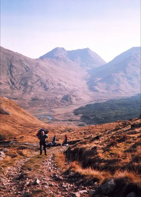
Streap Adam Ward · CC BY-SA 2.0 -
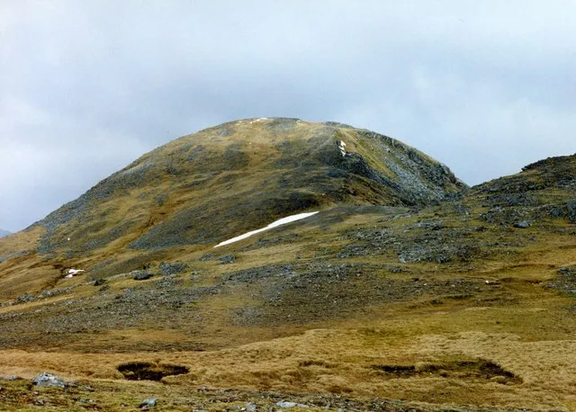
Sgurr Thuilm wfmillar · CC BY-SA 2.0


Climate of Beinn an Tuim
This month · November
A wet month
Day 4° · Night -1° · Rain 290 mm
- Hottest month
- July (day 13°)
- Coldest month
- February (night -3°)
- Wettest month
- January (302 mm)
- Driest month
- May (112 mm)
Bars: average monthly low and high temperature. Below: precipitation. Monthly averages for 1970–2000 at about 18 km resolution, adjusted for elevation. Highlighted months are mild and relatively dry. Source: WorldClim 2.1 (CC BY 4.0).
Show values as a table
| Month | Jan | Feb | Mar | Apr | May | Jun | Jul | Aug | Sep | Oct | Nov | Dec |
|---|---|---|---|---|---|---|---|---|---|---|---|---|
| Average high (°C) | 2° | 2° | 3° | 6° | 10° | 12° | 13° | 13° | 10° | 7° | 4° | 2° |
| Average low (°C) | -3° | -3° | -2° | -1° | 2° | 4° | 6° | 6° | 4° | 2° | -1° | -3° |
| Precipitation (mm) | 302 | 197 | 250 | 132 | 112 | 122 | 142 | 166 | 243 | 270 | 290 | 294 |
How to get to Beinn an Tuim
The nearest airport is Tiree Airport (TRE), 100 km to the southwest as the crow flies. The nearest large city is Glasgow, 135 km to the southeast.
Airports
- Tiree Airport (TRE) Balemartine, Argyll and Bute 100 kmsouthwest
- Inverness Airport (INV) Inverness, Highland 109 kmnortheast
- Barra Airport (BRR) Eoligarry 125 kmwest
Nearby large cities
- Glasgow Population: 626.4K 135 kmsoutheast
- Dundee Population: 148.2K 156 kmeast
- Edinburgh Population: 515K 172 kmsoutheast
- Aberdeen Population: 198.6K 203 kmeast
- Belfast Population: 348K 258 kmsouth
Straight-line distances; road distances are longer. Airport data: OurAirports.
Day trips from Beinn an Tuim
Within 100 km: 36 historic and cultural sites, 4,558 natural sites, 1,327 lakes, rivers and coasts.
0–25 km487 places
- Eilean nan Gobhar Island 24 kmW
- An t-Eilean Meadhoin Island 24 kmW
- Eilean Dubh Island 7 kmSW
- Eilean Dubh Island 18 kmW
25–60 km1,981 places
- Eigg Island 47 kmW
- Scalpay Island 56 kmNW
- Oronsay Island 41 kmSW
- Eriska Island 41 kmS
60–100 km3,453 places
- Hebrides Island 86 kmW
- Isle of Skye Island 68 kmNW
- Island of Raasay Island 67 kmNW
- Scarba Island 82 kmS
Straight-line distances.
Nearest towns and villages
-
 Glenfinnan Village, Highland4.2 km SW
-
Gleann Fhionnainn Village, Highland4.1 km SW
-
Kinlocheil Village, Highland7.1 km SE
-
Garvan Village, Highland8.4 km SE
-
 Fassfern Village, Highland10 km SE
-
 Caol Village, Highland20 km E
Nearby attractions & nature
Everything nearby-
Meall an Uillt Chaoil Mountain, Highland0.8 km N
-
Stob Coire nan Cearc Mountain, Highland1.9 km NE
-
Streap Mountain, Highland3.3 km NE
-
Eilean Darach Island, Highland2.5 km SW
-
Sgurr Thuilm Mountain, Highland4.5 km N
-
Stob Lochan Lourie Mountain, Highland3.1 km SE
-
Druim na Saille Mountain, Highland3.2 km SE
-
Torr a' Choit Mountain, Highland3.4 km SW
Sources & licences
Data last updated: