- Elevation
- 217 m
- above sea level
- Local time
- UTC+00:00
- Europe/London · UTC+00:00
- Airports
- BEB Benbecula Airport66 km
- BRR Barra Airport70 km
About Beinn Buidhe na Creige
Beinn Buidhe na Creige is a mountain. Location: Highland, Scotland. Elevation: 217 m. The nearest airport is Benbecula Airport (66 km). Nearby sights include Glen Eynort and Loch Eynort.
Climate of Beinn Buidhe na Creige
This month · November
A wet month
Day 8° · Night 4° · Rain 226 mm
- Hottest month
- July (day 16°)
- Coldest month
- February (night 2°)
- Wettest month
- November (226 mm)
- Driest month
- May (88 mm)
Bars: average monthly low and high temperature. Below: precipitation. Monthly averages for 1970–2000 at about 18 km resolution, adjusted for elevation. Highlighted months are mild and relatively dry. Source: WorldClim 2.1 (CC BY 4.0).
Show values as a table
| Month | Jan | Feb | Mar | Apr | May | Jun | Jul | Aug | Sep | Oct | Nov | Dec |
|---|---|---|---|---|---|---|---|---|---|---|---|---|
| Average high (°C) | 6° | 6° | 7° | 9° | 12° | 14° | 16° | 16° | 14° | 11° | 8° | 7° |
| Average low (°C) | 2° | 2° | 2° | 3° | 6° | 9° | 11° | 11° | 9° | 6° | 4° | 2° |
| Precipitation (mm) | 203 | 133 | 167 | 98 | 88 | 103 | 115 | 132 | 199 | 221 | 226 | 216 |
How to get to Beinn Buidhe na Creige
The nearest airport is Benbecula Airport (BEB), 66 km to the northwest as the crow flies. The nearest large city is Glasgow, 201 km to the southeast.
Airports
- Benbecula Airport (BEB) Balivanich 66 kmnorthwest
- Barra Airport (BRR) Eoligarry 70 kmwest
- Tiree Airport (TRE) Balemartine, Argyll and Bute 88 kmsouth
Nearby large cities
- Glasgow Population: 626.4K 201 kmsoutheast
- Dundee Population: 148.2K 224 kmeast
- Edinburgh Population: 515K 242 kmsoutheast
- Aberdeen Population: 198.6K 258 kmeast
- Belfast Population: 348K 296 kmsouth
Straight-line distances; road distances are longer. Airport data: OurAirports.
Day trips from Beinn Buidhe na Creige
Within 100 km: 36 historic and cultural sites, 2,940 natural sites, 1,425 lakes, rivers and coasts.
0–25 km269 places
- Isle of Skye Island 9 kmNE
- Island of Raasay Island 24 kmNE
- Scalpay Island 23 kmE
- Dùn Mòr Island 23 kmS
25–60 km1,184 places
- Hebrides Island 41 kmSW
- Eigg Island 40 kmS
- The Coral Beaches Beach 33 kmNW
- Clett Island 36 kmNW
60–100 km2,948 places
- Isle of Harris Natural site 78 kmN
- Isle of Barra Beach Beach 76 kmSW
- Scalpay Island 72 kmN
- Oronsay Island 70 kmSE
Straight-line distances.
Nearest towns and villages


Nearby attractions & nature
Everything nearby-
Glen Eynort Natural site, Highland1.3 km NE
-
Loch Eynort Natural site, Highland1.2 km SE
-
Beinn Clachan Gorma Mountain, Highland2.2 km NW
-
Biod Mor Mountain, Highland2.2 km N
-
Beinn a' Bhraghad West Top Mountain, Highland2.3 km E
-
Beinn Bhreac Mountain, Highland2.9 km NW
-
Glen Brittle Forest Natural site, Highland2.8 km E
-
An Cruachan Mountain, Highland3 km SE
More nature in United Kingdom
-
Beinn a' Bhraghad Mountain, Highland4.1 km E
-
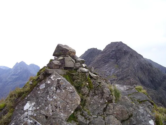 Sgurr a' Mhadaidh Mountain, Highland8 km E
-
Beinn Staic Mountain, Highland3.3 km SE
-
Sgurr nan Gobhar Mountain, Highland6.3 km E
-
Truagh Mheall Mountain, Highland3.8 km SE
-
Cnoc Scarall Mountain, Highland3.9 km NE
Sources & licences
Data last updated: