- Elevation
- 628 m
- above sea level
- Local time
- UTC+00:00
- Europe/London · UTC+00:00
- Airports
- WIC Wick John O'Groats Airport57 km
- INV Inverness Airport65 km
About Beinn Dhorain
Beinn Dhorain is a mountain. Location: Highland, Scotland. Elevation: 628 m. The nearest airport is Wick John O'Groats Airport (57 km). Nearby sights include Ben Uarie and Creag a' Bhodaich.
Photos of Beinn Dhorain
-
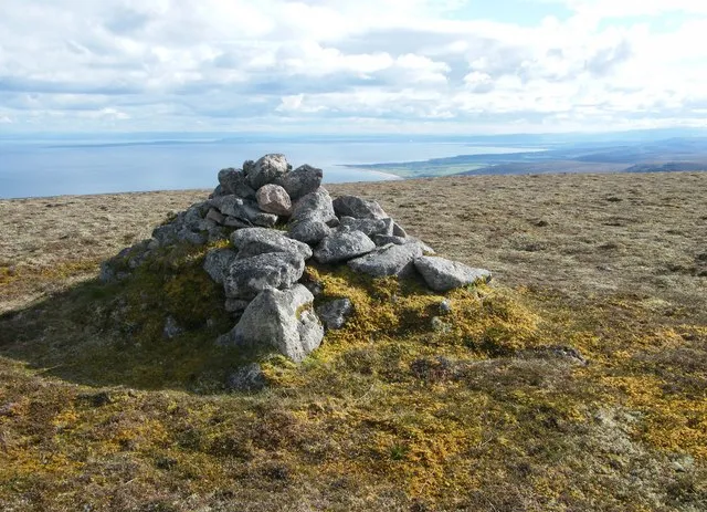
Beinn Mhealaich Alan Stewart · CC BY-SA 2.0 -
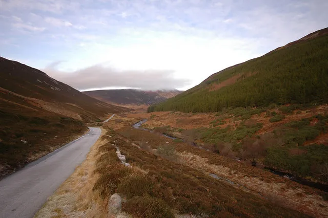
Glen Loth Steven Brown · CC BY-SA 2.0


Climate of Beinn Dhorain
This month · November
A wet month
Day 5° · Night 0° · Rain 116 mm
- Hottest month
- July (day 13°)
- Coldest month
- February (night -3°)
- Wettest month
- November (116 mm)
- Driest month
- May (60 mm)
Bars: average monthly low and high temperature. Below: precipitation. Monthly averages for 1970–2000 at about 18 km resolution, adjusted for elevation. Highlighted months are mild and relatively dry. Source: WorldClim 2.1 (CC BY 4.0).
Show values as a table
| Month | Jan | Feb | Mar | Apr | May | Jun | Jul | Aug | Sep | Oct | Nov | Dec |
|---|---|---|---|---|---|---|---|---|---|---|---|---|
| Average high (°C) | 3° | 3° | 4° | 6° | 9° | 12° | 13° | 13° | 11° | 8° | 5° | 3° |
| Average low (°C) | -2° | -3° | -2° | -1° | 2° | 5° | 7° | 6° | 5° | 2° | 0° | -2° |
| Precipitation (mm) | 108 | 77 | 96 | 62 | 60 | 68 | 72 | 82 | 101 | 111 | 116 | 106 |
How to get to Beinn Dhorain
The nearest airport is Wick John O'Groats Airport (WIC), 57 km to the northeast as the crow flies. The nearest large city is Aberdeen, 150 km to the southeast.
Airports
- Wick John O'Groats Airport (WIC) Wick 57 kmnortheast
- Inverness Airport (INV) Inverness, Highland 65 kmsouth
- Kirkwall Airport (KOI) Kirkwall, Orkney Islands 108 kmnortheast
Nearby large cities
- Aberdeen Population: 198.6K 150 kmsoutheast
- Dundee Population: 148.2K 191 kmsouth
- Edinburgh Population: 515K 244 kmsouth
- Glasgow Population: 626.4K 252 kmsouth
- Newcastle upon Tyne Population: 300.1K 375 kmsouth
Straight-line distances; road distances are longer. Airport data: OurAirports.
Day trips from Beinn Dhorain
Within 100 km: 55 historic and cultural sites, 2,321 natural sites, 624 lakes, rivers and coasts.
0–25 km187 places
- Rubha Mòr Island 25 kmNW
- Eilean nam Faoileag Island 12 kmSW
- Loch an Tubairnaich Lake 9 kmSW
- Loch Scalabsdale Lake 10 kmN
25–60 km728 places
- Lossiemouth East Beach Beach 55 kmSE
- Clett Island 59 kmN
- Eilean nan Ron Island 57 kmNW
- Rabbit Islands Island 57 kmNW
60–100 km2,085 places
- Hoy Island 87 kmN
- Flotta Island 90 kmNE
- Findlays Seat Mountain 72 kmSE
- Hesta Head Natural site 91 kmNE
Straight-line distances.
Nearest towns and villages

Nearby attractions & nature
Everything nearby-
Ben Uarie Mountain, Highland0.8 km N
-
Creag a' Bhodaich Mountain, Highland1.9 km SW
-
Glen Sletdale Natural site, Highland2.4 km SW
-
A' Chrasg Mountain, Highland2.4 km NE
-
The Craggan Mountain, Highland2.7 km W
-
Beinn Mhealaich Mountain, Highland3.6 km E
-
Glen Loth Natural site, Highland4 km S
-
Carn Garbh Mountain, Highland3.8 km SW
Sources & licences
Data last updated: