- Elevation
- 695 m
- above sea level
- Local time
- UTC+00:00
- Europe/London · UTC+00:00
- Airports
- INV Inverness Airport57 km
- SYY Stornoway Airport120 km
About Beinn na Muice
Beinn na Muice is a mountain. Location: Highland, Scotland. Elevation: 695 m. The nearest airport is Inverness Airport (57 km). Nearby sights include Carn an Daimh Bhain and Visge Misgeach.
Photos of Beinn na Muice
-
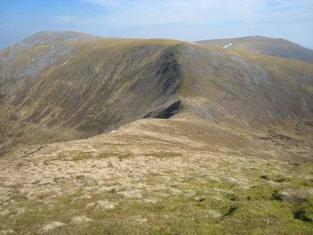
Sgurr na Ruaidhe Stuart Meek · CC BY-SA 2.0 -
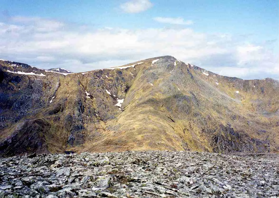
Sgùrr na Lapaich Mick Knapton at English Wikipedia · CC BY-SA 3.0


Climate of Beinn na Muice
This month · November
A wet month
Day 5° · Night -1° · Rain 290 mm
- Hottest month
- July (day 14°)
- Coldest month
- February (night -3°)
- Wettest month
- January (305 mm)
- Driest month
- May (120 mm)
Bars: average monthly low and high temperature. Below: precipitation. Monthly averages for 1970–2000 at about 18 km resolution, adjusted for elevation. Highlighted months are mild and relatively dry. Source: WorldClim 2.1 (CC BY 4.0).
Show values as a table
| Month | Jan | Feb | Mar | Apr | May | Jun | Jul | Aug | Sep | Oct | Nov | Dec |
|---|---|---|---|---|---|---|---|---|---|---|---|---|
| Average high (°C) | 3° | 3° | 4° | 7° | 11° | 13° | 14° | 14° | 12° | 8° | 5° | 3° |
| Average low (°C) | -2° | -3° | -2° | -1° | 2° | 5° | 7° | 7° | 5° | 2° | -1° | -3° |
| Precipitation (mm) | 305 | 207 | 251 | 132 | 120 | 126 | 138 | 162 | 235 | 271 | 290 | 294 |
How to get to Beinn na Muice
The nearest airport is Inverness Airport (INV), 57 km to the east as the crow flies. The nearest large city is Dundee, 161 km to the southeast.
Airports
- Inverness Airport (INV) Inverness, Highland 57 kmeast
- Stornoway Airport (SYY) Stornoway, Western Isles 120 kmnorthwest
- Benbecula Airport (BEB) Balivanich 144 kmwest
Nearby large cities
- Dundee Population: 148.2K 161 kmsoutheast
- Aberdeen Population: 198.6K 176 kmeast
- Glasgow Population: 626.4K 178 kmsouth
- Edinburgh Population: 515K 196 kmsoutheast
- Belfast Population: 348K 320 kmsouth
Straight-line distances; road distances are longer. Airport data: OurAirports.
Day trips from Beinn na Muice
Within 100 km: 40 historic and cultural sites, 4,418 natural sites, 1,013 lakes, rivers and coasts.
0–25 km432 places
- Eilean Aigas Island 25 kmE
- Eilean a' Mhuillidh Island 6 kmE
- Eilean Gaineamhach Island 25 kmNE
- Eilean Dubhain Island 25 kmW
25–60 km1,987 places
- Moy Island Island 30 kmNE
- Eilean Sùbhainn Island 44 kmNW
- Sandaig Islands Island 52 kmSW
- Eilean Ruairidh Mòr Island 46 kmNW
60–100 km3,052 places
- Isle of Skye Island 78 kmW
- Island of Raasay Island 66 kmW
- Eigg Island 93 kmSW
- Scalpay Island 63 kmW
Straight-line distances.
Nearest towns and villages


Nearby attractions & nature
Everything nearby-
Carn an Daimh Bhain Mountain, Highland0.8 km NE
-
Visge Misgeach River, Highland0.1 km SE
-
Sgurr na Muice Mountain, Highland1.8 km N
-
Meall Innis an Loichel Mountain, Highland1.9 km SW
-
Eilean Graimich Island, Highland1.6 km SE
-
Creag a' Chaobh Mountain, Highland2.2 km W
-
An Sithean Mountain, Highland2.8 km E
-
Carn Eiteige Mountain, Highland3.1 km N
Sources & licences
Data last updated: