- Elevation
- 580 m
- above sea level
- Local time
- UTC+00:00
- Europe/London · UTC+00:00
- Airports
- INV Inverness Airport77 km
- SYY Stornoway Airport78 km
About Beinn nam Ban
Beinn nam Ban is a mountain. Location: Highland, Scotland. Elevation: 580 m. The nearest airport is Inverness Airport (77 km). Nearby sights include Carnan Ban and Creag na Ceapaich.
Photos of Beinn nam Ban
-
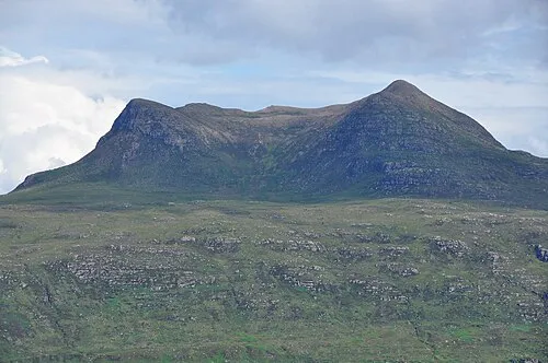
Beinn Ghobhlach Nilfanion · CC BY-SA 3.0 -
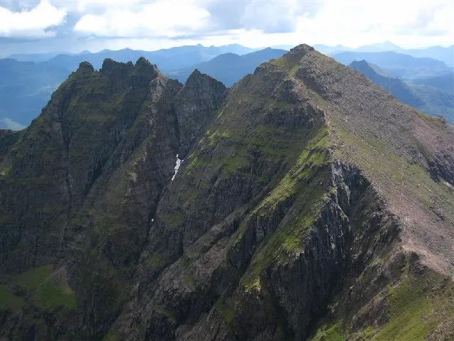
An Teallach David Crocker · CC BY-SA 2.0


Climate of Beinn nam Ban
This month · November
A wet month
Day 6° · Night 0° · Rain 244 mm
- Hottest month
- July (day 14°)
- Coldest month
- December (night -2°)
- Wettest month
- November (244 mm)
- Driest month
- May (96 mm)
Bars: average monthly low and high temperature. Below: precipitation. Monthly averages for 1970–2000 at about 18 km resolution, adjusted for elevation. Highlighted months are mild and relatively dry. Source: WorldClim 2.1 (CC BY 4.0).
Show values as a table
| Month | Jan | Feb | Mar | Apr | May | Jun | Jul | Aug | Sep | Oct | Nov | Dec |
|---|---|---|---|---|---|---|---|---|---|---|---|---|
| Average high (°C) | 4° | 4° | 5° | 8° | 10° | 12° | 14° | 14° | 12° | 9° | 6° | 4° |
| Average low (°C) | -1° | -2° | -1° | 1° | 3° | 5° | 7° | 7° | 5° | 3° | 0° | -2° |
| Precipitation (mm) | 230 | 159 | 192 | 111 | 96 | 110 | 121 | 141 | 200 | 228 | 244 | 231 |
How to get to Beinn nam Ban
The nearest airport is Inverness Airport (INV), 77 km to the southeast as the crow flies. The nearest large city is Aberdeen, 202 km to the east.
Airports
- Inverness Airport (INV) Inverness, Highland 77 kmsoutheast
- Stornoway Airport (SYY) Stornoway, Western Isles 78 kmnorthwest
- Benbecula Airport (BEB) Balivanich 137 kmwest
Nearby large cities
- Aberdeen Population: 198.6K 202 kmeast
- Dundee Population: 148.2K 205 kmsoutheast
- Glasgow Population: 626.4K 230 kmsouth
- Edinburgh Population: 515K 245 kmsoutheast
- Belfast Population: 348K 367 kmsouth
Straight-line distances; road distances are longer. Airport data: OurAirports.
Day trips from Beinn nam Ban
Within 100 km: 43 historic and cultural sites, 3,672 natural sites, 996 lakes, rivers and coasts.
0–25 km468 places
- Eilean a' Char Island 23 kmNW
- Tanera More Island 21 kmNW
- Summer Isles Island 21 kmNW
- Priest Island Island 22 kmNW
25–60 km1,513 places
- Eilean Dubh Island 49 kmN
- Moy Island Island 52 kmSE
- Eilean Sùbhainn Island 25 kmSW
- Soyea Island Island 32 kmN
60–100 km2,730 places
- Isle of Skye Island 89 kmSW
- Isle of Harris Natural site 96 kmW
- Island of Raasay Island 75 kmSW
- The Coral Beaches Beach 95 kmSW
Straight-line distances.
Nearest towns and villages
-
Ullapool Village, Highland4 km NE
-
Aultnaharrie Village, Highland1.9 km N
-
 Dundonnell Village, Highland3.4 km SW
-
Blarnalearoch Neighbourhood, Highland3.8 km E
-
Loggie Village, Highland4.1 km E
-
Braes of Ullapool Neighbourhood, Highland4.2 km NE
Nearby attractions & nature
Everything nearby-
Carnan Ban Mountain, Highland2.1 km SE
-
Creag na Ceapaich Mountain, Highland2.3 km SW
-
Loch Broom Natural site, Highland3.3 km E
-
Creag Corcurach Mountain, Highland3.7 km SE
-
Beinn Ghobhlach Mountain, Highland6.4 km NW
-
Dundonnell River River, Highland2.5 km SW
-
Cnoc an Droighinn Mountain, Highland4.4 km SE
-
Ullapool River River, Highland3.9 km N
More nature in United Kingdom
-
An Teallach Mountain, Highland7.6 km SW
-
Cnoc a' Bhaid-rallaich Mountain, Highland4.8 km NW
-
An Teallach - Sgurr Fiona Mountain, Highland8.4 km SW
-
Mac is Mathair Mountain, Highland5.1 km SW
-
Meall an Duibhe Mountain, Highland5.5 km SE
-
Cnoc na Garbh Choille Mountain, Highland5.8 km S
Sources & licences
Data last updated: