- Elevation
- 424 m
- above sea level
- Local time
- UTC+00:00
- Europe/London · UTC+00:00
- Airports
- WIC Wick John O'Groats Airport43 km
- INV Inverness Airport76 km
About Braigh na h-Eaglaise
Braigh na h-Eaglaise is a mountain. Location: Highland, Scotland. Elevation: 424 m. The nearest airport is Wick John O'Groats Airport (43 km). Nearby sights include Cnoc Spardain and Cnoc Bad Asgaraidh.
Photos of Braigh na h-Eaglaise
-
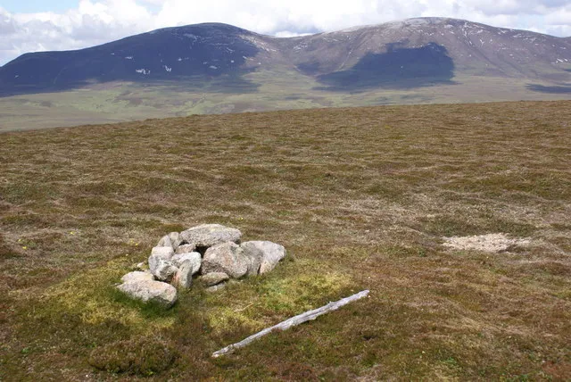
Scaraben Peter Standing · CC BY-SA 2.0 -
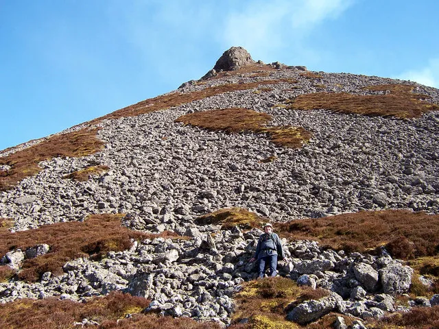
Maiden Pap bill copland · CC BY-SA 2.0


Climate of Braigh na h-Eaglaise
This month · November
A wet month
Day 6° · Night 1° · Rain 120 mm
- Hottest month
- August (day 15°)
- Coldest month
- February (night -1°)
- Wettest month
- November (120 mm)
- Driest month
- May (62 mm)
Bars: average monthly low and high temperature. Below: precipitation. Monthly averages for 1970–2000 at about 18 km resolution, adjusted for elevation. Highlighted months are mild and relatively dry. Source: WorldClim 2.1 (CC BY 4.0).
Show values as a table
| Month | Jan | Feb | Mar | Apr | May | Jun | Jul | Aug | Sep | Oct | Nov | Dec |
|---|---|---|---|---|---|---|---|---|---|---|---|---|
| Average high (°C) | 4° | 4° | 5° | 7° | 10° | 13° | 15° | 15° | 12° | 10° | 6° | 4° |
| Average low (°C) | -1° | -1° | 0° | 1° | 3° | 6° | 8° | 8° | 6° | 4° | 1° | -1° |
| Precipitation (mm) | 110 | 81 | 98 | 67 | 62 | 67 | 72 | 83 | 103 | 114 | 120 | 110 |
How to get to Braigh na h-Eaglaise
The nearest airport is Wick John O'Groats Airport (WIC), 43 km to the northeast as the crow flies. The nearest large city is Aberdeen, 146 km to the southeast.
Airports
- Wick John O'Groats Airport (WIC) Wick 43 kmnortheast
- Inverness Airport (INV) Inverness, Highland 76 kmsouth
- Kirkwall Airport (KOI) Kirkwall, Orkney Islands 96 kmnortheast
Nearby large cities
- Aberdeen Population: 198.6K 146 kmsoutheast
- Dundee Population: 148.2K 194 kmsouth
- Edinburgh Population: 515K 249 kmsouth
- Glasgow Population: 626.4K 261 kmsouth
- Newcastle upon Tyne Population: 300.1K 377 kmsouth
Straight-line distances; road distances are longer. Airport data: OurAirports.
Day trips from Braigh na h-Eaglaise
Within 100 km: 61 historic and cultural sites, 2,002 natural sites, 565 lakes, rivers and coasts.
0–25 km123 places
- Loch an Tubairnaich Lake 23 kmSW
- Lochan Thulachan Lake 19 kmN
- Loch Stemster Lake 24 kmNE
- Loch Scalabsdale Lake 11 kmW
25–60 km602 places
- Lossiemouth East Beach Beach 54 kmS
- Clett Island 50 kmN
- Neave Island Island 58 kmNW
- Glass Islands Island 52 kmNW
60–100 km1,903 places
- Hoy Island 77 kmN
- Flotta Island 78 kmN
- Findlays Seat Mountain 72 kmS
- Hesta Head Natural site 78 kmNE
Straight-line distances.
Nearest towns and villages


Nearby attractions & nature
Everything nearby-
Cnoc Spardain Mountain, Highland1.8 km NE
-
Cnoc Bad Asgaraidh Mountain, Highland2 km E
-
Cnoc Allt na Beithe Mountain, Highland2.5 km W
-
Cnoc Coir a' Phuill Mountain, Highland2.6 km SW
-
Turnal Rock Mountain, Highland3 km E
-
Scaraben Mountain, Highland4.8 km N
-
Creag Thoraraidh Mountain, Highland4.1 km SW
-
Cnoc na Croiche Mountain, Highland4.3 km E
More nature in United Kingdom
-
Maiden Pap Mountain, Highland7.5 km N
-
Mid Hill Mountain, Highland4.3 km W
-
Sron Gharbh Mountain, Highland4.6 km N
-
Sal-vaich Mountain, Highland4.9 km NW
-
Ord of Caithness Mountain, Highland5 km S
-
East Scaraben Mountain, Highland5.4 km N
Sources & licences
Data last updated: