- Elevation
- 598 m
- above sea level
- Local time
- UTC+00:00
- Europe/London · UTC+00:00
- Airports
- INV Inverness Airport88 km
- SYY Stornoway Airport117 km
About Carn a' Coire Dhoimhneid
Carn a' Coire Dhoimhneid is a mountain. Location: Highland, Scotland. Elevation: 598 m. The nearest airport is Inverness Airport (88 km). Nearby sights include Carn Sgriobhaich and Carn Bad a' Chreamha.
Photos of Carn a' Coire Dhoimhneid
-
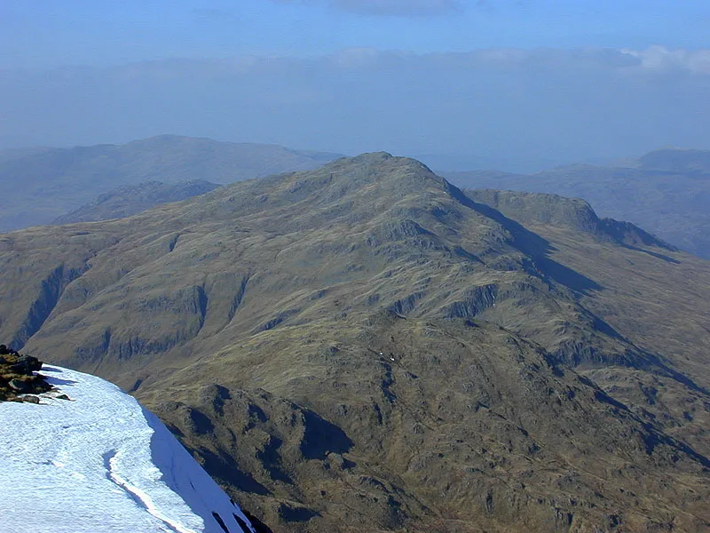
A' Ghlas-bheinn Nigel Brown · CC BY-SA 2.0

Climate of Carn a' Coire Dhoimhneid
This month · November
A wet month
Day 6° · Night 0° · Rain 291 mm
- Hottest month
- July (day 14°)
- Coldest month
- February (night -2°)
- Wettest month
- January (295 mm)
- Driest month
- May (113 mm)
Bars: average monthly low and high temperature. Below: precipitation. Monthly averages for 1970–2000 at about 18 km resolution, adjusted for elevation. Highlighted months are mild and relatively dry. Source: WorldClim 2.1 (CC BY 4.0).
Show values as a table
| Month | Jan | Feb | Mar | Apr | May | Jun | Jul | Aug | Sep | Oct | Nov | Dec |
|---|---|---|---|---|---|---|---|---|---|---|---|---|
| Average high (°C) | 3° | 4° | 5° | 8° | 11° | 13° | 14° | 14° | 12° | 9° | 6° | 4° |
| Average low (°C) | -2° | -2° | -1° | 0° | 3° | 6° | 8° | 7° | 6° | 3° | 0° | -2° |
| Precipitation (mm) | 295 | 194 | 243 | 130 | 113 | 124 | 139 | 161 | 241 | 269 | 291 | 292 |
How to get to Carn a' Coire Dhoimhneid
The nearest airport is Inverness Airport (INV), 88 km to the east as the crow flies. The nearest large city is Glasgow, 173 km to the southeast.
Airports
- Inverness Airport (INV) Inverness, Highland 88 kmeast
- Stornoway Airport (SYY) Stornoway, Western Isles 117 kmnorthwest
- Benbecula Airport (BEB) Balivanich 119 kmwest
Nearby large cities
- Glasgow Population: 626.4K 173 kmsoutheast
- Dundee Population: 148.2K 175 kmsoutheast
- Aberdeen Population: 198.6K 202 kmeast
- Edinburgh Population: 515K 202 kmsoutheast
- Belfast Population: 348K 300 kmsouth
Straight-line distances; road distances are longer. Airport data: OurAirports.
Day trips from Carn a' Coire Dhoimhneid
Within 100 km: 37 historic and cultural sites, 4,136 natural sites, 1,029 lakes, rivers and coasts.
0–25 km529 places
- Sandaig Islands Island 21 kmSW
- Eilean Ràrsaidh Island 20 kmSW
- Eilean Bàn Island 19 kmW
- Eilean Donan Island 6 kmW
25–60 km1,940 places
- Isle of Skye Island 50 kmW
- Island of Raasay Island 40 kmW
- Scalpay Island 34 kmW
- Eilean Tigh Island 43 kmNW
60–100 km2,733 places
- Hebrides Island 91 kmW
- Eigg Island 62 kmSW
- The Coral Beaches Beach 77 kmW
- Scalpay Island 99 kmNW
Straight-line distances.
Nearest towns and villages


Nearby attractions & nature
Everything nearby-
Carn Sgriobhaich Mountain, Highland0.9 km NE
-
Carn Bad a' Chreamha Mountain, Highland1 km W
-
Carn Loch Bhuic Mhoir Mountain, Highland1.5 km W
-
Carn Loch nan Eun Mountain, Highland1.8 km NE
-
Boc Mor Mountain, Highland1.9 km W
-
Beinn a' Mheadhain Far East Top Mountain, Highland2.1 km N
-
Carn Coire na Coille Mountain, Highland2.1 km E
-
Carn Loch an t-Sabhail Mountain, Highland2.7 km E
Sources & licences
Data last updated: