- Elevation
- 550 m
- above sea level
- Local time
- UTC+00:00
- Europe/London · UTC+00:00
- Airports
- INV Inverness Airport67 km
- SYY Stornoway Airport101 km
About Carn Beag
Carn Beag is a mountain. Location: Highland, Scotland. Elevation: 550 m. The nearest airport is Inverness Airport (67 km). Nearby sights include An Liathanach and Beinn na Feusaige.
Photos of Carn Beag
-
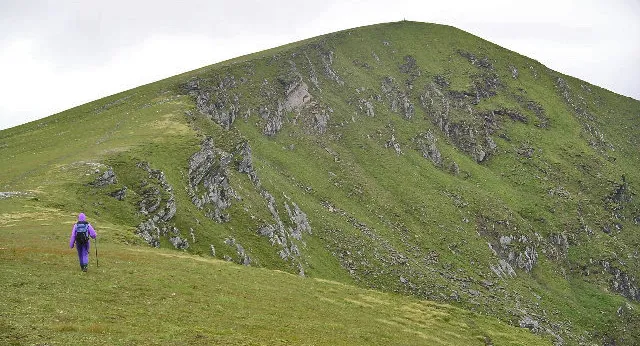
Fionn Bheinn Chris Eilbeck, cropped by Iain99 · CC BY-SA 2.0

Climate of Carn Beag
This month · November
A wet month
Day 6° · Night 0° · Rain 287 mm
- Hottest month
- July (day 15°)
- Coldest month
- December (night -2°)
- Wettest month
- January (290 mm)
- Driest month
- May (115 mm)
Bars: average monthly low and high temperature. Below: precipitation. Monthly averages for 1970–2000 at about 18 km resolution, adjusted for elevation. Highlighted months are mild and relatively dry. Source: WorldClim 2.1 (CC BY 4.0).
Show values as a table
| Month | Jan | Feb | Mar | Apr | May | Jun | Jul | Aug | Sep | Oct | Nov | Dec |
|---|---|---|---|---|---|---|---|---|---|---|---|---|
| Average high (°C) | 4° | 4° | 5° | 8° | 11° | 13° | 15° | 15° | 13° | 9° | 6° | 4° |
| Average low (°C) | -2° | -2° | -1° | 0° | 3° | 6° | 7° | 7° | 5° | 3° | 0° | -2° |
| Precipitation (mm) | 290 | 200 | 243 | 133 | 115 | 126 | 138 | 162 | 234 | 268 | 287 | 285 |
How to get to Carn Beag
The nearest airport is Inverness Airport (INV), 67 km to the east as the crow flies. The nearest large city is Dundee, 179 km to the southeast.
Airports
- Inverness Airport (INV) Inverness, Highland 67 kmeast
- Stornoway Airport (SYY) Stornoway, Western Isles 101 kmnorthwest
- Benbecula Airport (BEB) Balivanich 132 kmwest
Nearby large cities
- Dundee Population: 148.2K 179 kmsoutheast
- Aberdeen Population: 198.6K 190 kmeast
- Glasgow Population: 626.4K 196 kmsouth
- Edinburgh Population: 515K 215 kmsoutheast
- Belfast Population: 348K 332 kmsouth
Straight-line distances; road distances are longer. Airport data: OurAirports.
Day trips from Carn Beag
Within 100 km: 40 historic and cultural sites, 4,218 natural sites, 1,052 lakes, rivers and coasts.
0–25 km435 places
- Eilean Mòr Island 21 kmW
- Sgeirean an Amadain Island 22 kmNW
- Eilean Camas a' Chonnaidh Island 24 kmNW
- Eilean Mhic an Fhùlaraich Island 23 kmNW
25–60 km1,857 places
- Island of Raasay Island 57 kmW
- Scalpay Island 58 kmSW
- Eilean a' Char Island 55 kmN
- Moy Island Island 38 kmE
60–100 km3,018 places
- Isle of Skye Island 71 kmSW
- Eigg Island 94 kmSW
- The Coral Beaches Beach 88 kmW
- Scalpay Island 96 kmW
Straight-line distances.
Nearest towns and villages
-
 Achnasheen Village, Highland5.9 km NE
-
 Kinlochewe Village, Highland10 km NW
-
Craig Village, Highland9.7 km SW
-
Incheril Village, Highland9.8 km NW
-
Scardroy Village, Highland11 km E
-
 Achanalt Village, Highland16 km NE
Nearby attractions & nature
Everything nearby-
An Liathanach Mountain, Highland2 km NE
-
Beinn na Feusaige Mountain, Highland2.2 km SW
-
Loch a’ Chroisg Lake, Highland2 km NE
-
Loch Sgamhain Lake, Highland2.2 km SW
-
An Liathanach East Top Mountain, Highland3.5 km NE
-
Cnoc na Moine Mountain, Highland3.9 km S
-
Meallan Mhic Iamhair Mountain, Highland4.1 km W
-
Loch Gowan Lake, Highland3.8 km E
More nature in United Kingdom
-
Fionn Bheinn Mountain, Highland7.7 km NE
-
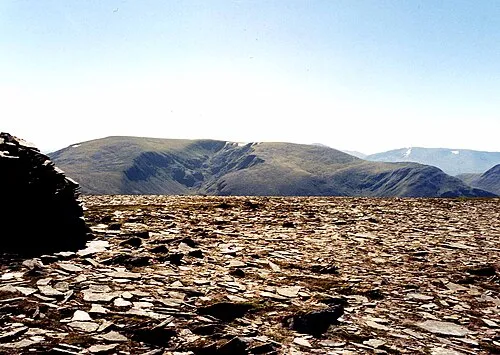 Maoile Lunndaidh Mountain, Highland10 km S
-
Cnoc an t-Sithein Mountain, Highland4.6 km E
-
An Cabar Mountain, Highland4.9 km N
-
Meall a' Chaorainn Mountain, Highland5.6 km NE
-
Moruisg Mountain, Highland5.6 km S
Sources & licences
Data last updated: