- Elevation
- 517 m
- above sea level
- Local time
- UTC+00:00
- Europe/London · UTC+00:00
- Airports
- INV Inverness Airport88 km
- SYY Stornoway Airport98 km
About Cnoc Glas
Cnoc Glas is a mountain. Location: Highland, Scotland. Elevation: 517 m. The nearest airport is Inverness Airport (88 km). Nearby sights include Glas Bheinn and Carn Cadha an Eididh.
Climate of Cnoc Glas
This month · November
A wet month
Day 6° · Night 1° · Rain 268 mm
- Hottest month
- July (day 15°)
- Coldest month
- February (night -1°)
- Wettest month
- November (268 mm)
- Driest month
- May (103 mm)
Bars: average monthly low and high temperature. Below: precipitation. Monthly averages for 1970–2000 at about 18 km resolution, adjusted for elevation. Highlighted months are mild and relatively dry. Source: WorldClim 2.1 (CC BY 4.0).
Show values as a table
| Month | Jan | Feb | Mar | Apr | May | Jun | Jul | Aug | Sep | Oct | Nov | Dec |
|---|---|---|---|---|---|---|---|---|---|---|---|---|
| Average high (°C) | 4° | 4° | 6° | 8° | 11° | 13° | 15° | 15° | 13° | 9° | 6° | 4° |
| Average low (°C) | -1° | -1° | 0° | 1° | 3° | 6° | 8° | 8° | 6° | 4° | 1° | -1° |
| Precipitation (mm) | 259 | 170 | 214 | 117 | 103 | 116 | 128 | 146 | 222 | 250 | 268 | 261 |
How to get to Cnoc Glas
The nearest airport is Inverness Airport (INV), 88 km to the east as the crow flies. The nearest large city is Dundee, 189 km to the southeast.
Airports
- Inverness Airport (INV) Inverness, Highland 88 kmeast
- Stornoway Airport (SYY) Stornoway, Western Isles 98 kmnorthwest
- Benbecula Airport (BEB) Balivanich 112 kmwest
Nearby large cities
- Dundee Population: 148.2K 189 kmsoutheast
- Glasgow Population: 626.4K 193 kmsoutheast
- Aberdeen Population: 198.6K 208 kmeast
- Edinburgh Population: 515K 219 kmsoutheast
- Belfast Population: 348K 319 kmsouth
Straight-line distances; road distances are longer. Airport data: OurAirports.
Nearest towns and villages
-
Lochcarron Village, Highland6.2 km S
-
New Kelso Village, Highland3.8 km SE
-
Strathcarron Village, Highland5.5 km SE
-
Kirkton Neighbourhood, Highland4.8 km S
-
Blackwood Village, Highland6 km E
-
Coulags Village, Highland6.4 km E
Nearby attractions & nature
Everything nearby-
Glas Bheinn Mountain, Highland1.7 km S
-
Carn Cadha an Eididh Mountain, Highland2 km NE
-
Sgurr a' Gharaidh Mountain, Highland2.2 km SW
-
Torr na h-Iolaire Mountain, Highland2.4 km E
-
Meall an Daimh Mountain, Highland2.7 km NE
-
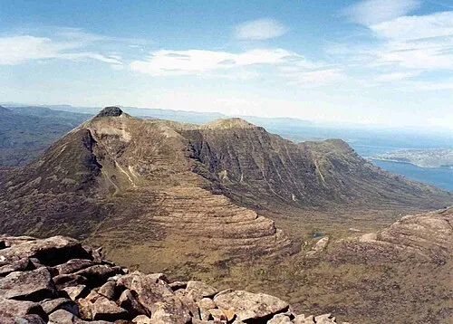 Beinn Damh Mountain, Highland4.5 km N
-
An Ruadh-Stac Mountain, Highland3 km NE
-
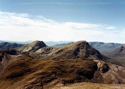 Maol Chean-dearg Mountain, Highland4.7 km NE
More nature in United Kingdom
-
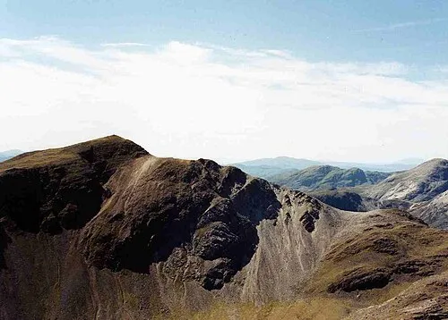 Sgorr Ruadh Mountain, Highland7.5 km NE
-
Meall na Caillich Mountain, Highland3.2 km SW
-
Creag Dabaobh Mountain, Highland3.4 km S
-
Meall na Caillich South Top Mountain, Highland3.9 km SW
-
Meall nan Ceapairean Mountain, Highland4.6 km NE
-
Meall Dubh na Drochaid Mountain, Highland4.7 km N
Sources & licences
Data last updated: