- Elevation
- 302 m
- above sea level
- Local time
- UTC+00:00
- Europe/London · UTC+00:00
- Airports
- TRE Tiree Airport66 km
- ILY Islay Airport101 km
About Creag an Fhithich
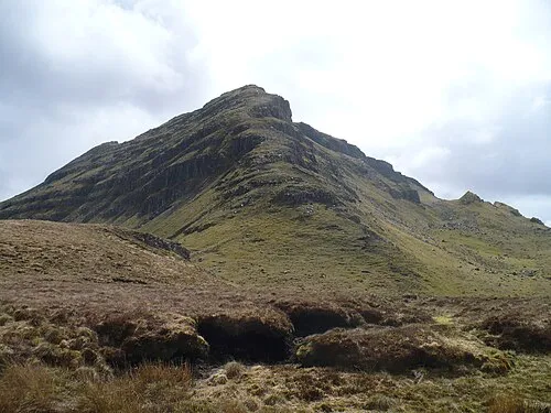
Creag an Fhithich is a mountain. Location: Highland, Scotland. Elevation: 302 m. The nearest airport is Tiree Airport (66 km). Nearby sights include Cnoc Carach and Beinn Bhan.
Climate of Creag an Fhithich
This month · November
A wet month
Day 8° · Night 4° · Rain 256 mm
- Hottest month
- July (day 16°)
- Coldest month
- February (night 2°)
- Wettest month
- January (272 mm)
- Driest month
- May (102 mm)
Bars: average monthly low and high temperature. Below: precipitation. Monthly averages for 1970–2000 at about 18 km resolution, adjusted for elevation. Highlighted months are mild and relatively dry. Source: WorldClim 2.1 (CC BY 4.0).
Show values as a table
| Month | Jan | Feb | Mar | Apr | May | Jun | Jul | Aug | Sep | Oct | Nov | Dec |
|---|---|---|---|---|---|---|---|---|---|---|---|---|
| Average high (°C) | 5° | 6° | 7° | 9° | 13° | 14° | 16° | 16° | 14° | 11° | 8° | 5° |
| Average low (°C) | 2° | 2° | 3° | 4° | 6° | 9° | 11° | 10° | 9° | 6° | 4° | 2° |
| Precipitation (mm) | 272 | 167 | 212 | 123 | 102 | 107 | 132 | 159 | 223 | 242 | 256 | 253 |
How to get to Creag an Fhithich
The nearest airport is Tiree Airport (TRE), 66 km to the west as the crow flies. The nearest large city is Glasgow, 123 km to the southeast.
Airports
- Tiree Airport (TRE) Balemartine, Argyll and Bute 66 kmwest
- Islay Airport (ILY) Isle of Islay, Argyll and Bute 101 kmsouth
- Barra Airport (BRR) Eoligarry 113 kmnorthwest
Nearby large cities
- Glasgow Population: 626.4K 123 kmsoutheast
- Dundee Population: 148.2K 174 kmeast
- Edinburgh Population: 515K 175 kmeast
- Belfast Population: 348K 218 kmsouth
- Aberdeen Population: 198.6K 235 kmeast
Straight-line distances; road distances are longer. Airport data: OurAirports.
Day trips from Creag an Fhithich
Within 100 km: 43 historic and cultural sites, 3,532 natural sites, 1,330 lakes, rivers and coasts.
0–25 km420 places
- Oronsay Island 14 kmNW
- Eriska Island 24 kmE
- Isle of Mull Island 17 kmS
- Lismore Island Island 18 kmSE
25–60 km1,775 places
- Eigg Island 44 kmNW
- Kiloran Beach Beach 56 kmSW
- Scarba Island 42 kmS
- Ulva Island 28 kmW
60–100 km2,710 places
- Hebrides Island 77 kmNW
- Isle of Skye Island 87 kmN
- Island of Raasay Island 93 kmN
- Colonsay Island 60 kmSW
Straight-line distances.
Nearest towns and villages
Nearby attractions & nature
Everything nearby-
Cnoc Carach Mountain, Highland0.8 km NW
-
Beinn Bhan Mountain, Highland1.9 km N
-
Loch Aline Natural site, Highland2.3 km E
-
Creag Bhan Ard Mountain, Highland3.3 km NW
-
River Aline River, Highland3.4 km E
-
Sgurr na Greine Mountain, Highland4.1 km N
-
Tom na Corr Laraich Mountain, Highland4.2 km E
-
Loch Arienas Lake, Highland3.7 km NE
More nature in United Kingdom
-
Sithean na Raplaich Mountain, Highland5.5 km NW
-
Glais Bheinn Mountain, Highland6.5 km SE
-
Gleann Geal Natural site, Highland7 km NE
-
Tom na Dubh Ghlaic Mountain, Highland5 km NE
-
Braigh Dubh Dhoire Mountain, Highland5.1 km E
-
 Beinn Iadain Mountain, Highland9.5 km N
Sources & licences
Data last updated: