- Elevation
- 1,005 m
- above sea level
- Local time
- UTC+00:00
- Europe/London · UTC+00:00
- Airports
- INV Inverness Airport65 km
- SYY Stornoway Airport111 km
About Creag Toll a' Choin
Creag Toll a' Choin is a mountain. Location: Highland, Scotland. Elevation: 1,005 m. The nearest airport is Inverness Airport (65 km). Nearby sights include Maoile Lunndaidh and Carn nam Fiaclan.
Photos of Creag Toll a' Choin
-
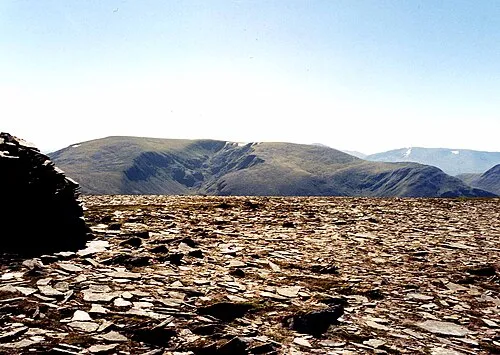
Maoile Lunndaidh Mick Knapton · CC BY-SA 3.0 -
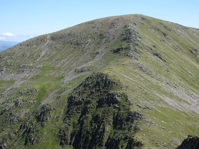
Sgurr a' Chaorachain Hugh Venables · CC BY-SA 2.0 -
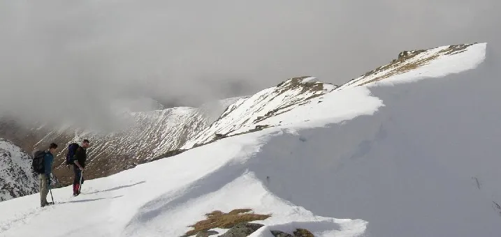
Sgurr Choinnich The original uploader was Grinner at English Wikipedia · Public domain


Climate of Creag Toll a' Choin
This month · November
A wet month
Day 3° · Night -3° · Rain 306 mm
- Hottest month
- July (day 12°)
- Coldest month
- December (night -4°)
- Wettest month
- January (318 mm)
- Driest month
- May (125 mm)
Bars: average monthly low and high temperature. Below: precipitation. Monthly averages for 1970–2000 at about 18 km resolution, adjusted for elevation. Highlighted months are mild and relatively dry. Source: WorldClim 2.1 (CC BY 4.0).
Show values as a table
| Month | Jan | Feb | Mar | Apr | May | Jun | Jul | Aug | Sep | Oct | Nov | Dec |
|---|---|---|---|---|---|---|---|---|---|---|---|---|
| Average high (°C) | 1° | 1° | 2° | 5° | 9° | 11° | 12° | 12° | 10° | 6° | 3° | 1° |
| Average low (°C) | -4° | -4° | -4° | -2° | 0° | 3° | 5° | 5° | 3° | 0° | -3° | -4° |
| Precipitation (mm) | 318 | 215 | 265 | 143 | 125 | 132 | 146 | 170 | 249 | 286 | 306 | 308 |
How to get to Creag Toll a' Choin
The nearest airport is Inverness Airport (INV), 65 km to the east as the crow flies. The nearest large city is Dundee, 171 km to the southeast.
Airports
- Inverness Airport (INV) Inverness, Highland 65 kmeast
- Stornoway Airport (SYY) Stornoway, Western Isles 111 kmnorthwest
- Benbecula Airport (BEB) Balivanich 135 kmwest
Nearby large cities
- Dundee Population: 148.2K 171 kmsoutheast
- Aberdeen Population: 198.6K 185 kmeast
- Glasgow Population: 626.4K 185 kmsouth
- Edinburgh Population: 515K 205 kmsoutheast
- Belfast Population: 348K 323 kmsouth
Straight-line distances; road distances are longer. Airport data: OurAirports.
Day trips from Creag Toll a' Choin
Within 100 km: 37 historic and cultural sites, 4,267 natural sites, 1,007 lakes, rivers and coasts.
0–25 km439 places
- Eilean a' Mhuillidh Island 16 kmSE
- Eilean na Craoibhe Island 23 kmNW
- Sgeir Fhada Island 23 kmW
- Eilean Dubhain Island 15 kmW
25–60 km1,952 places
- Island of Raasay Island 58 kmW
- Scalpay Island 56 kmW
- Moy Island Island 37 kmE
- Eilean Tigh Island 53 kmW
60–100 km2,920 places
- Isle of Skye Island 70 kmW
- Eigg Island 89 kmSW
- The Coral Beaches Beach 91 kmW
- Clett Island 91 kmW
Straight-line distances.
Nearest towns and villages
-
Craig Village, Highland9.3 km W
-
Scardroy Village, Highland10 km NE
-
 Achnasheen Village, Highland13 km N
-
 Kinlochewe Village, Highland20 km NW
-
 Lochcarron Village, Highland24 km W
-
Balnacra Village, Highland15 km W
Nearby attractions & nature
Everything nearby-
Maoile Lunndaidh Mountain, Highland0.7 km NE
-
Carn nam Fiaclan Mountain, Highland0.7 km W
-
Fuar-tholl Mor Mountain, Highland0.8 km NW
-
Creag Dhubh Mhor Mountain, Highland2.1 km N
-
Creag Breac Mountain, Highland2.6 km SE
-
Sgurr a' Chaorachain Mountain, Highland4.4 km W
-
Bidean an Eoin Deirg Mountain, Highland2.9 km SW
-
Meall a' Chreagain Duibh Mountain, Highland3 km SW
More nature in United Kingdom
-
Sgurr Choinnich Mountain, Highland5.5 km W
-
Gleann Fhiodhaig Natural site, Highland4 km NE
-
Creag Dhubh Bheag Mountain, Highland3.3 km NE
-
Maoile Choill-mhias Mountain, Highland3.7 km SE
-
An Sidhean Mountain, Highland4 km E
-
Moruisg East Top Mountain, Highland4.7 km NW
Sources & licences
Data last updated: