- Elevation
- 256 m
- above sea level
- Local time
- UTC+00:00
- Europe/London · UTC+00:00
- Airports
- WIC Wick John O'Groats Airport69 km
- KOI Kirkwall Airport99 km
About Druim Meleag
Druim Meleag is a mountain. Location: Highland, Scotland. Elevation: 256 m. The nearest airport is Wick John O'Groats Airport (69 km). Nearby sights include Meall an Spothaidh and Garbh-chnoc nan Ealachan.
Photos of Druim Meleag
-
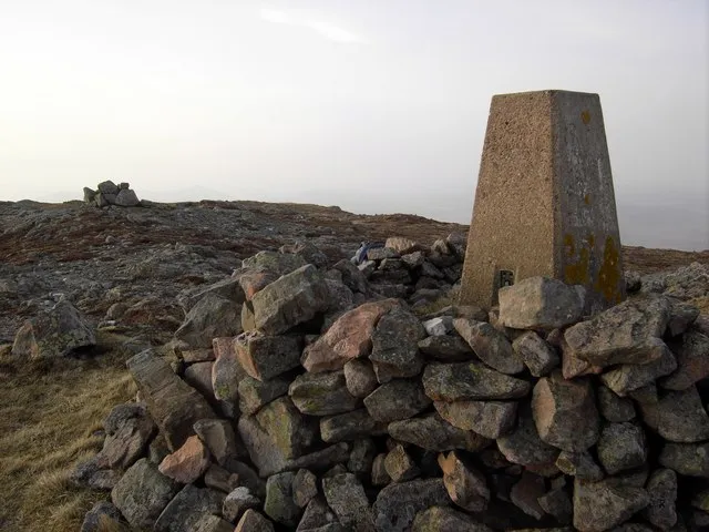
Beinn Stumanadh Colin Kinnear · CC BY-SA 2.0

Climate of Druim Meleag
This month · November
A wet month
Day 7° · Night 2° · Rain 146 mm
- Hottest month
- August (day 15°)
- Coldest month
- February (night 0°)
- Wettest month
- November (146 mm)
- Driest month
- May (70 mm)
Bars: average monthly low and high temperature. Below: precipitation. Monthly averages for 1970–2000 at about 18 km resolution, adjusted for elevation. Highlighted months are mild and relatively dry. Source: WorldClim 2.1 (CC BY 4.0).
Show values as a table
| Month | Jan | Feb | Mar | Apr | May | Jun | Jul | Aug | Sep | Oct | Nov | Dec |
|---|---|---|---|---|---|---|---|---|---|---|---|---|
| Average high (°C) | 5° | 5° | 7° | 9° | 12° | 14° | 15° | 15° | 13° | 11° | 7° | 5° |
| Average low (°C) | 0° | 0° | 1° | 2° | 4° | 7° | 9° | 9° | 7° | 5° | 2° | 0° |
| Precipitation (mm) | 128 | 91 | 114 | 75 | 70 | 79 | 86 | 99 | 125 | 136 | 146 | 131 |
How to get to Druim Meleag
The nearest airport is Wick John O'Groats Airport (WIC), 69 km to the east as the crow flies. The nearest large city is Aberdeen, 192 km to the southeast.
Airports
- Wick John O'Groats Airport (WIC) Wick 69 kmeast
- Kirkwall Airport (KOI) Kirkwall, Orkney Islands 99 kmnortheast
- Inverness Airport (INV) Inverness, Highland 99 kmsouth
Nearby large cities
- Aberdeen Population: 198.6K 192 kmsoutheast
- Dundee Population: 148.2K 231 kmsouth
- Edinburgh Population: 515K 283 kmsouth
- Glasgow Population: 626.4K 285 kmsouth
Straight-line distances; road distances are longer. Airport data: OurAirports.
Day trips from Druim Meleag
Within 100 km: 52 historic and cultural sites, 1,822 natural sites, 561 lakes, rivers and coasts.
0–25 km282 places
- Eilean nan Ron Island 15 kmN
- Rabbit Islands Island 14 kmNW
- Neave Island Island 14 kmN
- Eilean Iosal Island 17 kmN
25–60 km971 places
- Clett Island 48 kmNE
- Eilean Dubh Island 53 kmW
- Whale Islet Island 51 kmW
- Meall Mòr Island 57 kmW
60–100 km1,182 places
- Hoy Island 74 kmNE
- Flotta Island 81 kmNE
- Hesta Head Natural site 88 kmNE
- Lossiemouth East Beach Beach 98 kmSE
Straight-line distances.
Nearest towns and villages
Nearby attractions & nature
Everything nearby-
Meall an Spothaidh Mountain, Highland1.7 km SW
-
Garbh-chnoc nan Ealachan Mountain, Highland2 km N
-
Cnoc Maol Malpelly Mountain, Highland2.2 km E
-
Meall a' Bhreac-leathaid Mountain, Highland2.6 km SW
-
Creag Dhubh Mountain, Highland2.6 km SW
-
Beinn Stumanadh Mountain, Highland3.8 km W
-
Loch nan Ealachan Lake, Highland3.2 km N
-
Cnoc a' Bhothain Mountain, Highland4.1 km NE
More nature in United Kingdom
-
Cnoc Carnachadh Mountain, Highland4.3 km NE
-
Sron Achcheargary Mountain, Highland5.1 km NE
-
Ben Hiel Mountain, Highland8.2 km W
-
Cnoc na Moine Mountain, Highland5.5 km W
-
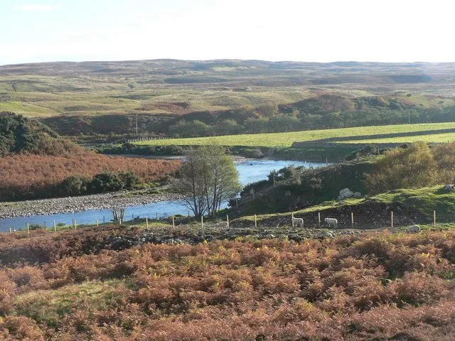 Strath Naver Natural site, Highland8.2 km S
-
Bruach Apigill Mountain, Highland6.3 km N
Sources & licences
Data last updated: