- Elevation
- 264 m
- above sea level
- Local time
- UTC+00:00
- Europe/London · UTC+00:00
- Airports
- INV Inverness Airport58 km
- SYY Stornoway Airport133 km
About Eilean Loch Beinn a' Mheadhoin
Eilean Loch Beinn a' Mheadhoin is a mountain. Location: Highland, Scotland. Elevation: 264 m. The nearest airport is Inverness Airport (58 km). Nearby sights include Meall Beag and Meall Mor.
Photos of Eilean Loch Beinn a' Mheadhoin
-
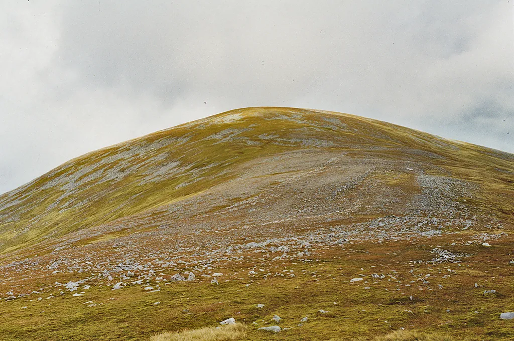
Toll Creagach Nigel Brown · CC BY-SA 2.0

Climate of Eilean Loch Beinn a' Mheadhoin
This month · November
A wet month
Day 8° · Night 2° · Rain 275 mm
- Hottest month
- July (day 17°)
- Coldest month
- February (night 0°)
- Wettest month
- January (295 mm)
- Driest month
- May (109 mm)
Bars: average monthly low and high temperature. Below: precipitation. Monthly averages for 1970–2000 at about 18 km resolution, adjusted for elevation. Highlighted months are mild and relatively dry. Source: WorldClim 2.1 (CC BY 4.0).
Show values as a table
| Month | Jan | Feb | Mar | Apr | May | Jun | Jul | Aug | Sep | Oct | Nov | Dec |
|---|---|---|---|---|---|---|---|---|---|---|---|---|
| Average high (°C) | 5° | 6° | 7° | 10° | 13° | 15° | 17° | 17° | 14° | 11° | 8° | 6° |
| Average low (°C) | 0° | 0° | 1° | 2° | 5° | 8° | 10° | 9° | 7° | 5° | 2° | 0° |
| Precipitation (mm) | 295 | 195 | 237 | 120 | 109 | 116 | 127 | 151 | 222 | 254 | 275 | 284 |
How to get to Eilean Loch Beinn a' Mheadhoin
The nearest airport is Inverness Airport (INV), 58 km to the northeast as the crow flies. The nearest large city is Dundee, 149 km to the southeast.
Airports
- Inverness Airport (INV) Inverness, Highland 58 kmnortheast
- Stornoway Airport (SYY) Stornoway, Western Isles 133 kmnorthwest
- Dundee Airport (DND) Dundee 148 kmsoutheast
Nearby large cities
- Dundee Population: 148.2K 149 kmsoutheast
- Glasgow Population: 626.4K 164 kmsouth
- Aberdeen Population: 198.6K 170 kmeast
- Edinburgh Population: 515K 182 kmsoutheast
- Belfast Population: 348K 308 kmsouth
Straight-line distances; road distances are longer. Airport data: OurAirports.
Day trips from Eilean Loch Beinn a' Mheadhoin
Within 100 km: 48 historic and cultural sites, 4,645 natural sites, 1,067 lakes, rivers and coasts.
0–25 km457 places
- Bàn Eilean Island 24 kmSE
- Eilean na Faoileige Island 23 kmS
- Eilean nan Each Island 14 kmSE
- Eilean nan Greusaich Island 18 kmS
25–60 km1,967 places
- Moy Island Island 36 kmNE
- Eilean Sùbhainn Island 57 kmNW
- Sandaig Islands Island 51 kmW
- Eilean Ruairidh Mòr Island 58 kmNW
60–100 km3,336 places
- Isle of Skye Island 82 kmW
- Island of Raasay Island 71 kmW
- Eigg Island 89 kmSW
- Scalpay Island 66 kmW
Straight-line distances.
Nearest towns and villages

Nearby attractions & nature
Everything nearby-
Meall Beag Mountain, Highland1.1 km NW
-
Meall Mor Mountain, Highland1.7 km NW
-
Meallan na Ceardaich Mountain, Highland1.7 km N
-
Carn Fiaclach Mountain, Highland2.2 km E
-
Beinn nan Sparra Mountain, Highland2.2 km S
-
Loch Beinn a’ Mheadhoin Lake, Highland2.1 km SW
-
Doire Tana East Top Mountain, Highland2.9 km NW
-
Glen Affric Natural site, Highland2.9 km SW
More nature in United Kingdom
-
Toll Creagach Mountain, Highland6.6 km W
-
Feith a' Ghiubhais Mountain, Highland3.5 km NW
-
Carn Loch na Gobhlaig Mountain, Highland3.5 km N
-
Beinn a' Mheadhoin Mountain, Highland4.1 km W
-
Doire Tana Mountain, Highland4.2 km W
-
Meall an Daimh Mountain, Highland4.2 km S
Sources & licences
Data last updated: