- Elevation
- 246 m
- above sea level
- Local time
- UTC+00:00
- Europe/London · UTC+00:00
- Airports
- GLA Glasgow Airport99 km
- TRE Tiree Airport101 km
About Glen Duror
Glen Duror is a natural site. Location: Highland, Scotland. The nearest airport is Glasgow Airport (99 km). Nearby sights include Salachan Glen and Beinn Achara.
Climate of Glen Duror
This month · November
A wet month
Day 8° · Night 3° · Rain 245 mm
- Hottest month
- July (day 17°)
- Coldest month
- February (night 1°)
- Wettest month
- January (262 mm)
- Driest month
- May (101 mm)
Bars: average monthly low and high temperature. Below: precipitation. Monthly averages for 1970–2000 at about 18 km resolution, adjusted for elevation. Highlighted months are mild and relatively dry. Source: WorldClim 2.1 (CC BY 4.0).
Show values as a table
| Month | Jan | Feb | Mar | Apr | May | Jun | Jul | Aug | Sep | Oct | Nov | Dec |
|---|---|---|---|---|---|---|---|---|---|---|---|---|
| Average high (°C) | 6° | 6° | 7° | 10° | 13° | 15° | 17° | 16° | 14° | 11° | 8° | 6° |
| Average low (°C) | 1° | 1° | 2° | 3° | 6° | 8° | 10° | 10° | 8° | 6° | 3° | 1° |
| Precipitation (mm) | 262 | 170 | 203 | 115 | 101 | 107 | 128 | 152 | 210 | 235 | 245 | 251 |
How to get to Glen Duror
The nearest airport is Glasgow Airport (GLA), 99 km to the southeast as the crow flies. The nearest large city is Glasgow, 105 km to the southeast.
Airports
- Glasgow Airport (GLA) Glasgow 99 kmsoutheast
- Tiree Airport (TRE) Balemartine, Argyll and Bute 101 kmwest
- Islay Airport (ILY) Isle of Islay, Argyll and Bute 123 kmsouthwest
Nearby large cities
- Glasgow Population: 626.4K 105 kmsoutheast
- Dundee Population: 148.2K 141 kmeast
- Edinburgh Population: 515K 148 kmsoutheast
- Aberdeen Population: 198.6K 200 kmeast
- Belfast Population: 348K 231 kmsouth
Straight-line distances; road distances are longer. Airport data: OurAirports.
Day trips from Glen Duror
Within 100 km: 60 historic and cultural sites, 4,481 natural sites, 1,376 lakes, rivers and coasts.
0–25 km455 places
- Eriska Island 15 kmSW
- Shuna Island Island 10 kmSW
- Lismore Island Island 25 kmSW
- Eilean Dubh Island 23 kmSW
25–60 km2,224 places
- Scarba Island 58 kmSW
- Oronsay Island 42 kmW
- Torsa Island Island 48 kmSW
- Shuna Island 51 kmSW
60–100 km3,238 places
- Isle of Skye Island 96 kmNW
- Great Cumbrae Island Island 99 kmS
- Island of Raasay Island 97 kmNW
- Colonsay Island 87 kmSW
Straight-line distances.
Nearest towns and villages
Nearby attractions & nature
Everything nearby-
Salachan Glen Natural site, Highland2.1 km SW
-
Beinn Achara Mountain, Highland2.6 km W
-
Ardsheal Hill Mountain, Highland3.3 km NW
-
Sgorr Dhonuill West Top Mountain, Highland2.8 km NE
-
Fraochaidh Mountain, Argyll and Bute3 km SE
-
Beinn Keil Mountain, Highland3.5 km W
-
A' Mhaoile Mountain, Highland3.6 km S
-
Stob Coire Chaluim Mountain, Highland3.6 km SE
More nature in United Kingdom
-
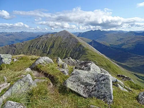 Beinn a' Bheithir - Sgorr Dhearg Mountain, Highland5.3 km NE
-
Beinn Sgluich Mountain, Highland4.8 km SW
-
Back Hill Mountain, Highland4.3 km NW
-
Fraochaidh NE Top Mountain, Highland4.6 km E
-
Creag Ghorm Mountain, Highland4.8 km NE
-
Beinn a’ Bheithir Mountain, Highland4.8 km NE
Sources & licences
Data last updated: · 2 independent sources