- Elevation
- 170 m
- above sea level
- Local time
- UTC+00:00
- Europe/London · UTC+00:00
- Airports
- INV Inverness Airport67 km
- SYY Stornoway Airport88 km
About Inverlael
Inverlael is a village. Location: Highland, Scotland. Elevation: 170 m.
Inverlael is a hamlet on the southern tip of Loch Broom in Ross-shire in the Highland council area in Scotland. It is located on the A835 main road 6 miles from Ullapool and 50 miles from Inverness. It is also atop the River Lael from where it gets its name. There are also many walking and hiking routes in the area surrounding the hamlet.
Source: Wikipedia · CC BY-SA 4.0
Photos of Inverlael
-
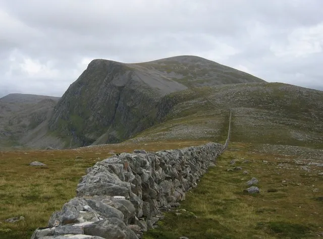
Beinn Dearg Stuart Meek · CC BY-SA 2.0 -
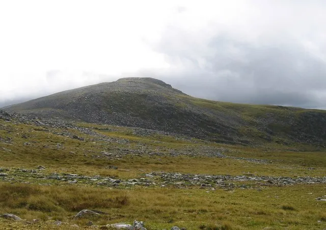
Eididh nan Clach Geala Stuart Meek · CC BY-SA 2.0 -
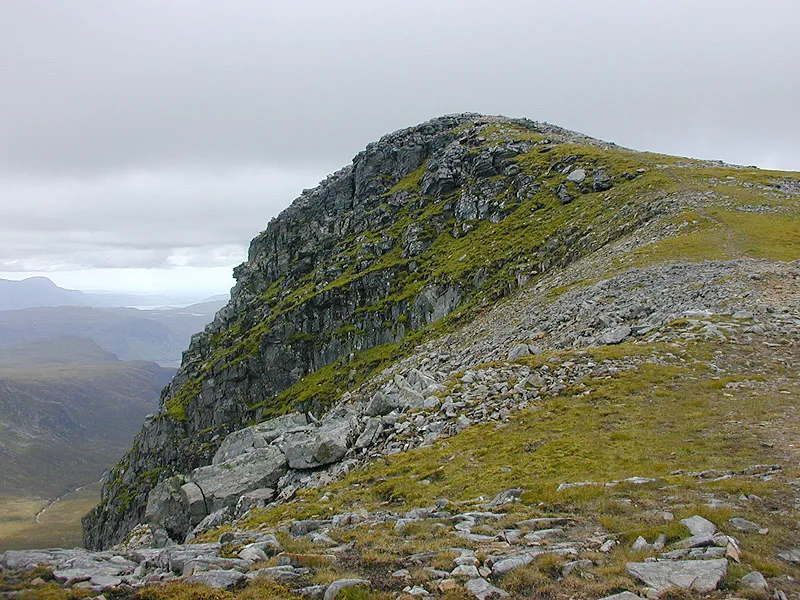
Meall nan Ceapraichean Nigel Brown · CC BY-SA 2.0


Climate of Inverlael
This month · November
A wet month
Day 9° · Night 3° · Rain 281 mm
- Hottest month
- July (day 17°)
- Coldest month
- December (night 0°)
- Wettest month
- November (281 mm)
- Driest month
- May (115 mm)
Bars: average monthly low and high temperature. Below: precipitation. Monthly averages for 1970–2000 at about 18 km resolution, adjusted for elevation. Highlighted months are mild and relatively dry. Source: WorldClim 2.1 (CC BY 4.0).
Show values as a table
| Month | Jan | Feb | Mar | Apr | May | Jun | Jul | Aug | Sep | Oct | Nov | Dec |
|---|---|---|---|---|---|---|---|---|---|---|---|---|
| Average high (°C) | 6° | 7° | 8° | 11° | 14° | 16° | 17° | 17° | 15° | 12° | 9° | 6° |
| Average low (°C) | 1° | 1° | 2° | 3° | 5° | 8° | 10° | 10° | 8° | 5° | 3° | 0° |
| Precipitation (mm) | 278 | 193 | 235 | 133 | 115 | 126 | 138 | 162 | 230 | 264 | 281 | 273 |
How to get to Inverlael
The nearest airport is Inverness Airport (INV), 67 km to the southeast as the crow flies. The nearest large city is Aberdeen, 192 km to the east.
Airports
- Inverness Airport (INV) Inverness, Highland 67 kmsoutheast
- Stornoway Airport (SYY) Stornoway, Western Isles 88 kmnorthwest
- Wick John O'Groats Airport (WIC) Wick 136 kmnortheast
Nearby large cities
- Aberdeen Population: 198.6K 192 kmeast
- Dundee Population: 148.2K 196 kmsoutheast
- Glasgow Population: 626.4K 223 kmsouth
- Edinburgh Population: 515K 236 kmsoutheast
- Belfast Population: 348K 363 kmsouth
Straight-line distances; road distances are longer. Airport data: OurAirports.
Day trips from Inverlael
Within 100 km: 47 historic and cultural sites, 3,755 natural sites, 943 lakes, rivers and coasts.
0–25 km415 places
- Isle Martin Island 18 kmNW
- Eilean a' Gharbh Uillt Island 25 kmW
- Eilean Dubh nan Con-easan Island 20 kmW
- Eileanan an Ruidh Mhaoil Island 25 kmW
25–60 km1,656 places
- Eilean a' Char Island 33 kmNW
- Eilean Dubh Island 55 kmN
- Moy Island Island 43 kmSE
- Tanera More Island 30 kmNW
60–100 km2,674 places
- Isle of Skye Island 92 kmSW
- Island of Raasay Island 78 kmSW
- Scalpay Island 96 kmW
- Scalpay Island 82 kmSW
Straight-line distances.
Nearby attractions & nature
Everything nearby-
Strone Nea Mountain, Highland0.7 km SE
-
River Lael River, Highland1 km W
-
River Broom River, Highland1 km W
-
Reidh Chreagan Mountain, Highland2.5 km N
-
Carn Dearg Mountain, Highland2.8 km W
-
Creag Loisgte Mountain, Highland2.9 km W
Sources & licences
Data last updated: · 2 independent sources