- Elevation
- 987 m
- above sea level
- Local time
- UTC+00:00
- Europe/London · UTC+00:00
- Airports
- INV Inverness Airport72 km
- SYY Stornoway Airport111 km
About Lurg Mhor
Lurg Mhor is a mountain. Location: Highland, Scotland. Elevation: 987 m.
Lurg Mhòr is a remote 986-metre (3,235 ft) mountain, a Munro, in the Northwest Highlands of Scotland at the high point of an east–west range of hills comprising Meall Mor (974 metres), Lurg Mhòr and Bidein a' Choire Sheasgaich (945 metres).
Source: Wikipedia · CC BY-SA 4.0
At a glance
- Topographic prominence
- 442 m
Source: Wikidata
Photos of Lurg Mhor
-

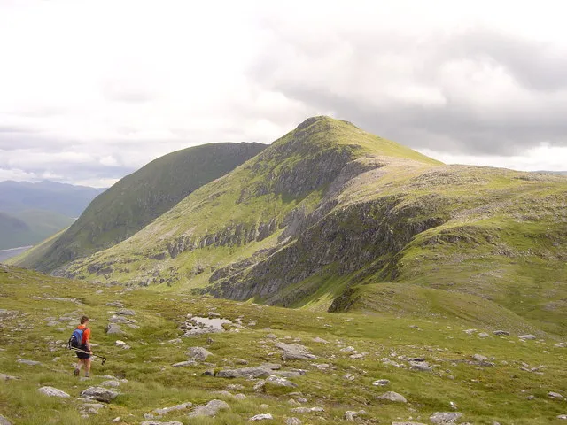
Alan Hodgson · CC BY-SA 2.0 -
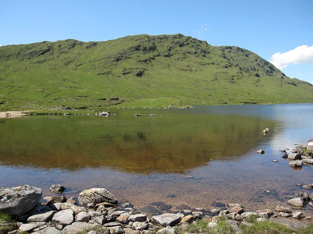
Beinn Dronaig Hugh Venables · CC BY-SA 2.0 -
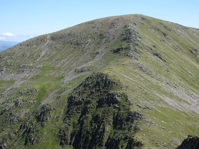
Sgurr a' Chaorachain Hugh Venables · CC BY-SA 2.0 -
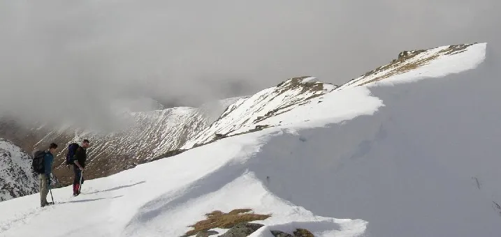
Sgurr Choinnich The original uploader was Grinner at English Wikipedia · Public domain -
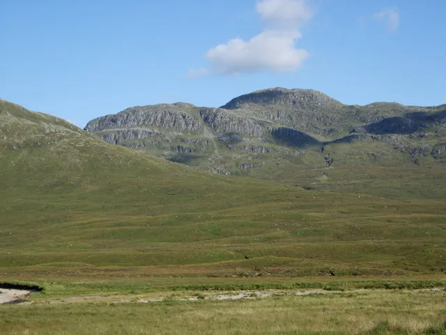
Bidein a' Choire Sheasgaich Tim Denvir · CC BY-SA 2.0


Climate of Lurg Mhor
This month · November
A wet month
Day 3° · Night -2° · Rain 302 mm
- Hottest month
- July (day 12°)
- Coldest month
- December (night -4°)
- Wettest month
- January (308 mm)
- Driest month
- May (121 mm)
Bars: average monthly low and high temperature. Below: precipitation. Monthly averages for 1970–2000 at about 18 km resolution, adjusted for elevation. Highlighted months are mild and relatively dry. Source: WorldClim 2.1 (CC BY 4.0).
Show values as a table
| Month | Jan | Feb | Mar | Apr | May | Jun | Jul | Aug | Sep | Oct | Nov | Dec |
|---|---|---|---|---|---|---|---|---|---|---|---|---|
| Average high (°C) | 1° | 1° | 3° | 5° | 9° | 11° | 12° | 12° | 10° | 6° | 3° | 1° |
| Average low (°C) | -4° | -4° | -4° | -2° | 0° | 3° | 5° | 5° | 3° | 1° | -2° | -4° |
| Precipitation (mm) | 308 | 208 | 258 | 139 | 121 | 130 | 144 | 168 | 247 | 281 | 302 | 302 |
How to get to Lurg Mhor
The nearest airport is Inverness Airport (INV), 72 km to the east as the crow flies. The nearest large city is Dundee, 173 km to the southeast.
Airports
- Inverness Airport (INV) Inverness, Highland 72 kmeast
- Stornoway Airport (SYY) Stornoway, Western Isles 111 kmnorthwest
- Benbecula Airport (BEB) Balivanich 129 kmwest
Nearby large cities
- Dundee Population: 148.2K 173 kmsoutheast
- Glasgow Population: 626.4K 182 kmsouth
- Aberdeen Population: 198.6K 191 kmeast
- Edinburgh Population: 515K 205 kmsoutheast
- Belfast Population: 348K 317 kmsouth
Straight-line distances; road distances are longer. Airport data: OurAirports.
Day trips from Lurg Mhor
Within 100 km: 38 historic and cultural sites, 4,229 natural sites, 1,034 lakes, rivers and coasts.
0–25 km471 places
- Eilean Donan Island 24 kmSW
- Eilean Mòr Island 22 kmNW
- Am Fraoch-eilean Island 24 kmSW
- Eilean an Fhraoich Island 21 kmW
25–60 km1,940 places
- Island of Raasay Island 51 kmW
- Scalpay Island 48 kmW
- Moy Island Island 45 kmE
- Eilean Tigh Island 48 kmW
60–100 km2,890 places
- Isle of Skye Island 63 kmW
- Eigg Island 81 kmSW
- The Coral Beaches Beach 85 kmW
- Scalpay Island 100 kmNW
Straight-line distances.
Nearest towns and villages
-
Craig Village, Highland8.2 km N
-
 Lochcarron Village, Highland17 km W
-
Balnacra Village, Highland10 km NW
-
Coulags Village, Highland11 km W
-
Blackwood Village, Highland11 km W
-
 Strathcarron Village, Highland12 km W
Nearby attractions & nature
Everything nearby-
Bidein a' Choire Sheasgaich Mountain, Highland1.7 km NW
-
Meall Mor Mountain, Highland0.7 km E
-
Bidein a' Choire Sheasgaich North Top Mountain, Highland2.1 km NW
-
Beinn Tharsuinn South Top Mountain, Highland2.3 km N
-
Beinn Dronaig Mountain, Highland3.6 km SW
-
Loch Calavie Lake, Highland2.2 km SW
-
Sgurr Choinnich Mountain, Highland4.4 km N
-
Beinn Tharsuinn Mountain, Highland3 km N
More nature in United Kingdom
-
Sgurr a' Chaorachain Mountain, Highland4.9 km NE
-
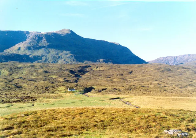 Aonach Buidhe Mountain, Highland8 km S
-
Sgurr na Conbhaire Mountain, Highland3.3 km NE
-
Beinn Tharsuinn West Top Mountain, Highland3.3 km NW
-
Cnoc a' Mhoraire Mountain, Highland3.4 km S
-
Beinn Tharsuinn North Top Mountain, Highland3.6 km N
Sources & licences
Data last updated: · 2 independent sources