- Elevation
- 277 m
- above sea level
- Local time
- UTC+00:00
- Europe/London · UTC+00:00
- Airports
- WIC Wick John O'Groats Airport62 km
- KOI Kirkwall Airport95 km
About Meall Bad na Cuaiche NW Top
Meall Bad na Cuaiche NW Top is a mountain. Location: Highland, Scotland. Elevation: 277 m. The nearest airport is Wick John O'Groats Airport (62 km). Nearby sights include Beinn Rifa-gil and Meall Bad na Cuaiche.
Climate of Meall Bad na Cuaiche NW Top
This month · November
A wet month
Day 7° · Night 2° · Rain 142 mm
- Hottest month
- July (day 15°)
- Coldest month
- February (night 0°)
- Wettest month
- November (142 mm)
- Driest month
- May (70 mm)
Bars: average monthly low and high temperature. Below: precipitation. Monthly averages for 1970–2000 at about 18 km resolution, adjusted for elevation. Highlighted months are mild and relatively dry. Source: WorldClim 2.1 (CC BY 4.0).
Show values as a table
| Month | Jan | Feb | Mar | Apr | May | Jun | Jul | Aug | Sep | Oct | Nov | Dec |
|---|---|---|---|---|---|---|---|---|---|---|---|---|
| Average high (°C) | 5° | 5° | 6° | 8° | 11° | 14° | 15° | 15° | 13° | 11° | 7° | 5° |
| Average low (°C) | 0° | 0° | 1° | 2° | 4° | 7° | 9° | 9° | 7° | 5° | 2° | 0° |
| Precipitation (mm) | 126 | 91 | 113 | 75 | 70 | 77 | 84 | 96 | 121 | 133 | 142 | 128 |
How to get to Meall Bad na Cuaiche NW Top
The nearest airport is Wick John O'Groats Airport (WIC), 62 km to the east as the crow flies. The nearest large city is Aberdeen, 185 km to the southeast.
Airports
- Wick John O'Groats Airport (WIC) Wick 62 kmeast
- Kirkwall Airport (KOI) Kirkwall, Orkney Islands 95 kmnortheast
- Inverness Airport (INV) Inverness, Highland 96 kmsouth
Nearby large cities
- Aberdeen Population: 198.6K 185 kmsoutheast
- Dundee Population: 148.2K 226 kmsouth
- Edinburgh Population: 515K 279 kmsouth
- Glasgow Population: 626.4K 282 kmsouth
Straight-line distances; road distances are longer. Airport data: OurAirports.
Day trips from Meall Bad na Cuaiche NW Top
Within 100 km: 55 historic and cultural sites, 1,827 natural sites, 565 lakes, rivers and coasts.
0–25 km279 places
- Eilean nan Ron Island 21 kmNW
- Rabbit Islands Island 20 kmNW
- Neave Island Island 19 kmNW
- Eilean Iosal Island 22 kmNW
25–60 km886 places
- Clett Island 43 kmNE
- Whale Islet Island 58 kmW
- Eilean Hoan Island 36 kmNW
- Eilean Dubh Island 34 kmW
60–100 km1,282 places
- Hoy Island 70 kmNE
- Flotta Island 77 kmNE
- Hesta Head Natural site 83 kmNE
- Lossiemouth East Beach Beach 91 kmSE
Straight-line distances.
Nearest towns and villages


Nearby attractions & nature
Everything nearby-
Beinn Rifa-gil Mountain, Highland1.4 km NW
-
Meall Bad na Cuaiche Mountain, Highland1.7 km SE
-
Ceann Garbh Mountain, Highland2.1 km SW
-
Meall Ceann Loch Strathy Mountain, Highland3 km SE
-
Loch Strathy Lake, Highland3.1 km SE
-
Eilean Garbh Island, Highland3.1 km W
-
Allt Rivigill River, Highland3.1 km NW
-
Creagan Dubha Reidhe Bhig Mountain, Highland3.7 km S
More nature in United Kingdom
-
Cnoc Bothan Uisge-beatha Mountain, Highland4.8 km S
-
Cnoc nan Tri-chlach Mountain, Highland5 km SE
-
Cnoc Maol Malpelly Mountain, Highland5.5 km W
-
Beinn Rosail Mountain, Highland8.7 km SW
-
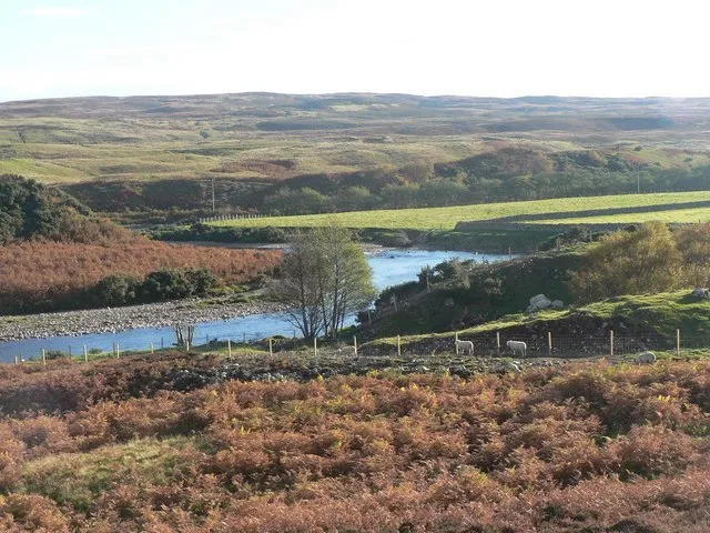 Strath Naver Natural site, Highland8.5 km SW
-
Cnoc Carnachadh Mountain, Highland6 km NW
Sources & licences
Data last updated: