- Elevation
- 553 m
- above sea level
- Local time
- UTC+00:00
- Europe/London · UTC+00:00
- Airports
- TRE Tiree Airport97 km
- INV Inverness Airport111 km
About Meall Coire na Saobhaidh
Meall Coire na Saobhaidh is a mountain. Location: Highland, Scotland. Elevation: 553 m. The nearest airport is Tiree Airport (97 km). Nearby sights include Sgurr an Utha and Sgurr an Fhuarain Duibh.
Photos of Meall Coire na Saobhaidh
-
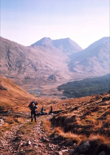
Streap Adam Ward · CC BY-SA 2.0 -
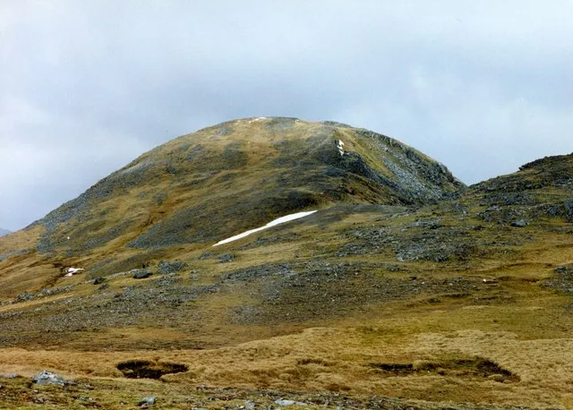
Sgurr Thuilm wfmillar · CC BY-SA 2.0


Climate of Meall Coire na Saobhaidh
This month · November
A wet month
Day 6° · Night 1° · Rain 290 mm
- Hottest month
- July (day 15°)
- Coldest month
- February (night -1°)
- Wettest month
- January (302 mm)
- Driest month
- May (112 mm)
Bars: average monthly low and high temperature. Below: precipitation. Monthly averages for 1970–2000 at about 18 km resolution, adjusted for elevation. Highlighted months are mild and relatively dry. Source: WorldClim 2.1 (CC BY 4.0).
Show values as a table
| Month | Jan | Feb | Mar | Apr | May | Jun | Jul | Aug | Sep | Oct | Nov | Dec |
|---|---|---|---|---|---|---|---|---|---|---|---|---|
| Average high (°C) | 3° | 4° | 5° | 8° | 11° | 13° | 15° | 14° | 12° | 9° | 6° | 4° |
| Average low (°C) | -1° | -1° | 0° | 1° | 3° | 6° | 8° | 8° | 6° | 4° | 1° | -1° |
| Precipitation (mm) | 302 | 197 | 250 | 132 | 112 | 122 | 142 | 166 | 243 | 270 | 290 | 294 |
How to get to Meall Coire na Saobhaidh
The nearest airport is Tiree Airport (TRE), 97 km to the southwest as the crow flies. The nearest large city is Glasgow, 139 km to the southeast.
Airports
- Tiree Airport (TRE) Balemartine, Argyll and Bute 97 kmsouthwest
- Inverness Airport (INV) Inverness, Highland 111 kmnortheast
- Barra Airport (BRR) Eoligarry 120 kmwest
Nearby large cities
- Glasgow Population: 626.4K 139 kmsoutheast
- Dundee Population: 148.2K 161 kmeast
- Edinburgh Population: 515K 176 kmsoutheast
- Aberdeen Population: 198.6K 207 kmeast
- Belfast Population: 348K 259 kmsouth
Straight-line distances; road distances are longer. Airport data: OurAirports.
Day trips from Meall Coire na Saobhaidh
Within 100 km: 35 historic and cultural sites, 4,415 natural sites, 1,316 lakes, rivers and coasts.
0–25 km530 places
- Samalaman Island Island 22 kmW
- Eilean nan Gobhar Island 20 kmW
- Eilean an Fheidh Island 25 kmSW
- An t-Eilean Meadhoin Island 19 kmW
25–60 km1,903 places
- Eigg Island 42 kmW
- Scalpay Island 52 kmNW
- Oronsay Island 39 kmSW
- Eriska Island 42 kmS
60–100 km3,333 places
- Hebrides Island 82 kmW
- Isle of Skye Island 64 kmNW
- Island of Raasay Island 64 kmNW
- The Coral Beaches Beach 96 kmNW
Straight-line distances.
Nearest towns and villages
-
 Glenfinnan Village, Highland4.6 km S
-
Gleann Fhionnainn Village, Highland4.7 km S
-
Sourlies Village, Highland10 km N
-
Kylesmorar Village, Highland11 km NW
-
Swordland Village, Highland11 km NW
-
Kinlocheil Village, Highland12 km SE
Nearby attractions & nature
Everything nearby-
Sgurr an Utha Mountain, Highland1.2 km S
-
Sgurr an Fhuarain Duibh Mountain, Highland1.7 km NE
-
Fraoch-bheinn Mountain, Highland1.7 km SE
-
Sgurr an Ursainn Mountain, Highland2 km NW
-
Sgurr a' Choire Riabhaich Mountain, Highland3 km NE
-
Sgurr an Ursainn Far West Top Mountain, Highland3 km NW
-
Sgùrr nan Coireachan Mountain, Highland3.3 km NE
-
Sgurr a' Mhuidhe Mountain, Highland3.8 km SW
More nature in United Kingdom
-
Sgurr Thuilm Mountain, Highland6.1 km NE
-
Streap Mountain, Highland6.3 km E
-
Sgurr na Plaide Mountain, Highland3.8 km W
-
Cnoc Gorm Mountain, Highland3.8 km N
-
Meall an Tarmachain Mountain, Highland4.1 km NE
-
Cruach Bhuidhe Mountain, Highland4.1 km NW
Sources & licences
Data last updated: