- Elevation
- 309 m
- above sea level
- Local time
- UTC+00:00
- Europe/London · UTC+00:00
- Airports
- INV Inverness Airport43 km
- SYY Stornoway Airport112 km
About Strath Rannoch
Strath Rannoch is a natural site. Location: Highland, Scotland. The nearest airport is Inverness Airport (43 km). Nearby sights include Druim Buidhe and Carn an t-Sneachda.
Photos of Strath Rannoch
-
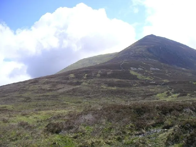
Ben Wyvis - Glas Leathad Mor Graham Scott · CC BY-SA 2.0

Climate of Strath Rannoch
This month · November
A wet month
Day 8° · Night 1° · Rain 267 mm
- Hottest month
- July (day 17°)
- Coldest month
- December (night -1°)
- Wettest month
- January (269 mm)
- Driest month
- May (114 mm)
Bars: average monthly low and high temperature. Below: precipitation. Monthly averages for 1970–2000 at about 18 km resolution, adjusted for elevation. Highlighted months are mild and relatively dry. Source: WorldClim 2.1 (CC BY 4.0).
Show values as a table
| Month | Jan | Feb | Mar | Apr | May | Jun | Jul | Aug | Sep | Oct | Nov | Dec |
|---|---|---|---|---|---|---|---|---|---|---|---|---|
| Average high (°C) | 6° | 6° | 7° | 10° | 13° | 15° | 17° | 16° | 15° | 11° | 8° | 5° |
| Average low (°C) | 0° | -1° | 0° | 2° | 4° | 7° | 9° | 9° | 7° | 4° | 1° | -1° |
| Precipitation (mm) | 269 | 190 | 228 | 130 | 114 | 124 | 134 | 158 | 219 | 252 | 267 | 260 |
How to get to Strath Rannoch
The nearest airport is Inverness Airport (INV), 43 km to the southeast as the crow flies. The nearest large city is Aberdeen, 168 km to the east.
Airports
- Inverness Airport (INV) Inverness, Highland 43 kmsoutheast
- Stornoway Airport (SYY) Stornoway, Western Isles 112 kmnorthwest
- Wick John O'Groats Airport (WIC) Wick 127 kmnortheast
Nearby large cities
- Aberdeen Population: 198.6K 168 kmeast
- Dundee Population: 148.2K 172 kmsoutheast
- Glasgow Population: 626.4K 206 kmsouth
- Edinburgh Population: 515K 215 kmsoutheast
- Belfast Population: 348K 354 kmsouth
Straight-line distances; road distances are longer. Airport data: OurAirports.
Day trips from Strath Rannoch
Within 100 km: 45 historic and cultural sites, 3,912 natural sites, 924 lakes, rivers and coasts.
0–25 km380 places
- Moy Island Island 19 kmSE
- Eilean na Faoileig Island 14 kmE
- Eilean nan Uan Island 15 kmS
- Eilean an Daraich Island 13 kmSE
25–60 km1,724 places
- Eilean a' Char Island 57 kmNW
- Tanera More Island 54 kmNW
- Summer Isles Island 55 kmNW
- Eilean Sùbhainn Island 47 kmW
60–100 km2,777 places
- Island of Raasay Island 89 kmSW
- Findlays Seat Mountain 91 kmE
- Lossiemouth East Beach Beach 85 kmE
- Scalpay Island 90 kmSW
Straight-line distances.
Nearest towns and villages
-
Inchbae Lodge Village, Highland2.1 km SE
-
Garbat Village, Highland4.8 km SE
-
 Garve Village, Highland9.4 km S
-
Gorstan Village, Highland9.3 km S
-
 Strathpeffer Village, Highland16 km SE
-
Lochluichart Village, Highland10 km SW
Nearby attractions & nature
Everything nearby-
Druim Buidhe Mountain, Highland0.3 km W
-
Carn an t-Sneachda Mountain, Highland2 km SW
-
Creag Bhreac Bheag Mountain, Highland2.7 km NW
-
Carn Gaineamhach Mountain, Highland3 km S
-
Carn Mor Mountain, Highland3 km E
-
Creag Bhreac Mhor Mountain, Highland3 km NW
-
Meall nan Sac Mountain, Highland3.2 km N
-
Carn na Dubh Choille Mountain, Highland3.7 km S
More nature in United Kingdom
-
Ben Wyvis - Glas Leathad Mor Mountain, Highland7.6 km E
-
Strath Vaich Natural site, Highland4.4 km NW
-
Carn nan Con Ruadha Mountain, Highland4 km NE
-
Gob a' Chairn Mountain, Highland4.2 km NE
-
Cnoc a' Chaisteil Mountain, Highland4.5 km NW
-
Carn Feur-lochan Mountain, Highland4.7 km E
Sources & licences
Data last updated: · 2 independent sources