- Elevation
- 12 m
- above sea level
- Local time
- UTC+00:00
- Europe/London · UTC+00:00
- Airports
- EOI Eday Airport28 km
- KOI Kirkwall Airport53 km
About Bustatoun
Bustatoun is a village. Location: Orkney Islands, Scotland. Elevation: 12 m. The nearest airport is Eday Airport (28 km). Nearby sights include North Ronaldsay Bird Observatory and North Ronaldsay.
Photos of Bustatoun
-
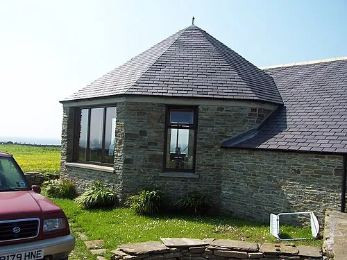
North Ronaldsay Bird Observatory John Tustin · CC BY-SA 2.0 -
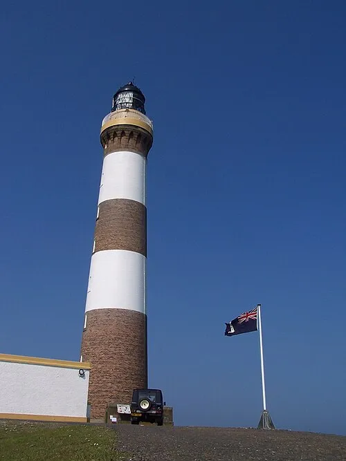
North Ronaldsay Lighthouse John Tustin · CC BY-SA 2.0


Climate of Bustatoun
This month · November
A wet month
Day 10° · Night 5° · Rain 130 mm
- Hottest month
- August (day 15°)
- Coldest month
- February (night 3°)
- Wettest month
- November (130 mm)
- Driest month
- May (48 mm)
Bars: average monthly low and high temperature. Below: precipitation. Monthly averages for 1970–2000 at about 18 km resolution, adjusted for elevation. Highlighted months are mild and relatively dry. Source: WorldClim 2.1 (CC BY 4.0).
Show values as a table
| Month | Jan | Feb | Mar | Apr | May | Jun | Jul | Aug | Sep | Oct | Nov | Dec |
|---|---|---|---|---|---|---|---|---|---|---|---|---|
| Average high (°C) | 8° | 7° | 7° | 9° | 11° | 13° | 14° | 15° | 14° | 12° | 10° | 8° |
| Average low (°C) | 3° | 3° | 3° | 4° | 6° | 8° | 9° | 10° | 9° | 7° | 5° | 4° |
| Precipitation (mm) | 113 | 88 | 97 | 65 | 48 | 53 | 58 | 71 | 101 | 118 | 130 | 120 |
How to get to Bustatoun
The nearest airport is Eday Airport (EOI), 28 km to the southwest as the crow flies. The nearest large city is Aberdeen, 248 km to the south.
Airports
- Eday Airport (EOI) Eday 28 kmsouthwest
- Kirkwall Airport (KOI) Kirkwall, Orkney Islands 53 kmsouthwest
- Sumburgh Airport (LSI) Lerwick, Shetland 86 kmnortheast
Nearby large cities
- Aberdeen Population: 198.6K 248 kmsouth
- Dundee Population: 148.2K 324 kmsouth
- Edinburgh Population: 515K 383 kmsouth
Straight-line distances; road distances are longer. Airport data: OurAirports.
Day trips from Bustatoun
Within 100 km: 26 historic and cultural sites, 515 natural sites, 169 lakes, rivers and coasts.
0–25 km71 places
- The Wart Island 20 kmSW
- Sanday Island Island 15 kmSW
- North Ronaldsay Island 1 kmN
- Holms of Ire Island 13 kmSW
25–60 km316 places
- Shapinsay Island 44 kmSW
- Rousay Island 41 kmSW
- Eday Island 29 kmSW
- Papa Westray Island Island 27 kmW
60–100 km323 places
- Hoy Island 76 kmSW
- Flotta Island 71 kmSW
- Hesta Head Natural site 70 kmSW
- Sweyn Holm Island 91 kmNE
Straight-line distances.
Nearby attractions & nature
Everything nearby-
North Ronaldsay Bird Observatory Attraction, Orkney Islands1.2 km SW
-
North Ronaldsay Island, Orkney Islands1.2 km N
-
Strom Ness Natural site, Orkney Islands1.4 km S
-
South Bay Natural site, Orkney Islands1.4 km S
-
Brides Ness Natural site, Orkney Islands1.9 km SE
-
Linklet Bay Natural site, Orkney Islands2.4 km E
Sources & licences
Data last updated: