- Elevation
- 33 m
- above sea level
- Local time
- UTC+00:00
- Europe/London · UTC+00:00
- Airports
- EOI Eday Airport3 km
- KOI Kirkwall Airport30 km
About Greenan Nev
Greenan Nev is a natural site. Location: Orkney Islands, Scotland. The nearest airport is Eday Airport (3 km). Nearby sights include Cusbay and Bay of Newark.
Photos of Greenan Nev
-
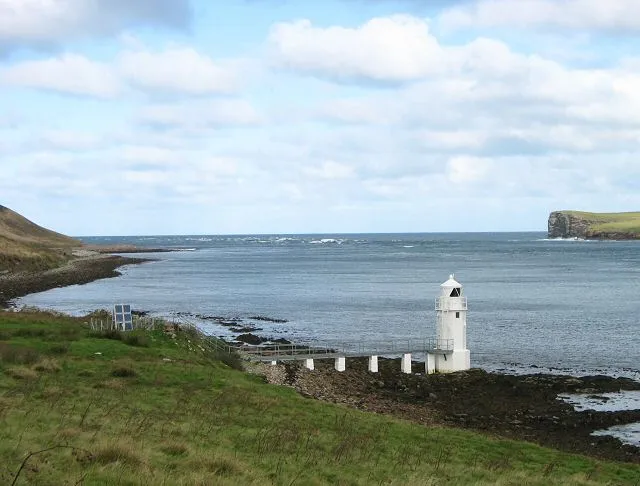
Eday Rob Burke · CC BY-SA 2.0 -
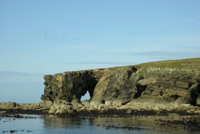
Holm of Faray George Brown · CC BY-SA 2.0 -
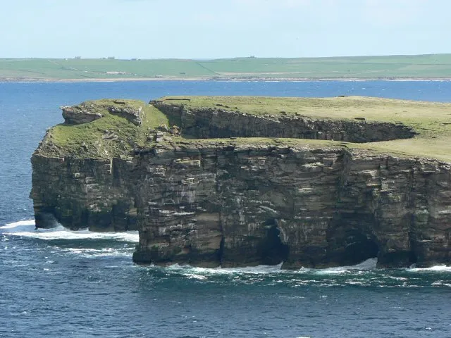
Calf of Eday See above · CC BY-SA 2.0


Climate of Greenan Nev
This month · November
A wet month
Day 9° · Night 5° · Rain 131 mm
- Hottest month
- August (day 15°)
- Coldest month
- February (night 2°)
- Wettest month
- November (131 mm)
- Driest month
- May (50 mm)
Bars: average monthly low and high temperature. Below: precipitation. Monthly averages for 1970–2000 at about 18 km resolution, adjusted for elevation. Highlighted months are mild and relatively dry. Source: WorldClim 2.1 (CC BY 4.0).
Show values as a table
| Month | Jan | Feb | Mar | Apr | May | Jun | Jul | Aug | Sep | Oct | Nov | Dec |
|---|---|---|---|---|---|---|---|---|---|---|---|---|
| Average high (°C) | 7° | 7° | 7° | 8° | 10° | 13° | 14° | 15° | 13° | 11° | 9° | 8° |
| Average low (°C) | 3° | 2° | 3° | 4° | 6° | 8° | 9° | 10° | 9° | 7° | 5° | 4° |
| Precipitation (mm) | 113 | 87 | 100 | 67 | 50 | 54 | 61 | 73 | 103 | 120 | 131 | 121 |
How to get to Greenan Nev
The nearest airport is Eday Airport (EOI), 3 km to the south as the crow flies. The nearest large city is Aberdeen, 234 km to the south.
Airports
- Eday Airport (EOI) Eday 3 kmsouth
- Kirkwall Airport (KOI) Kirkwall, Orkney Islands 30 kmsouth
- Wick John O'Groats Airport (WIC) Wick 86 kmsouth
Nearby large cities
- Aberdeen Population: 198.6K 234 kmsouth
- Dundee Population: 148.2K 306 kmsouth
- Edinburgh Population: 515K 364 kmsouth
- Glasgow Population: 626.4K 384 kmsouth
Straight-line distances; road distances are longer. Airport data: OurAirports.
Day trips from Greenan Nev
Within 100 km: 33 historic and cultural sites, 491 natural sites, 175 lakes, rivers and coasts.
0–25 km246 places
- Shapinsay Island 19 kmS
- Rousay Island 15 kmW
- Eday Island 4 kmS
- Papa Westray Island Island 16 kmNW
25–60 km297 places
- Hoy Island 50 kmSW
- Flotta Island 47 kmSW
- Hesta Head Natural site 49 kmS
- Ward Holm Island 36 kmS
60–100 km156 places
- Clett Island 79 kmSW
- Island of Stroma Island 63 kmS
- Garbh-eilean Island 99 kmSW
- Fair Isle Island 74 kmNE
Straight-line distances.
Nearest towns and villages
Nearby attractions & nature
Everything nearby-
Cusbay Natural site, United Kingdom0.9 km N
-
Bay of Newark Natural site, United Kingdom1 km S
-
Stennie Hill Mountain, Orkney Islands1.7 km SE
-
Vinquoy Hill Mountain, Orkney Islands1.8 km NE
-
Bay of Cusvie Natural site, Orkney Islands1.9 km N
-
Bay of London Natural site, Orkney Islands2.1 km SE
-
Bay of Carrick Natural site, Orkney Islands2.1 km NE
-
Calf of Eday Island, Orkney Islands3.4 km NE
Sources & licences
Data last updated: · 2 independent sources