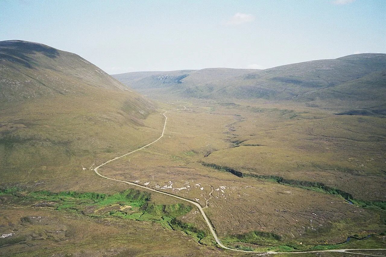
- Elevation
- 351 m
- above sea level
- Local time
- UTC+00:00
- Europe/London · UTC+00:00
- Population
- 419
- 419
- Airports
- KOI Kirkwall Airport26 km
- WIC Wick John O'Groats Airport45 km
About Hoy
Hoy is an island. Location: Orkney Islands, Scotland. Population: 419.
Hoy (from Old Norse Háey, meaning "high island") is an island in Orkney, Scotland, measuring 143 square kilometres (55 sq mi) – the second largest in the archipelago, after Mainland. A natural causeway, the Ayre, links the island to the smaller South Walls; the two islands are treated as one entity by the UK census. Hoy is also the name of a hamlet in the northwest of the island.
Source: Wikipedia · CC BY-SA 4.0
At a glance
- Heritage designation
- Site of Special Scientific Interest
- Length
- 20 km
- Area
- 143 km²
- Official website
- hoyorkney.com
Source: Wikidata
Photos of Hoy
-

United Kingdom Hydrographic Office · Public domain -

NornBoy · CC BY-SA 4.0 -

Ivan Ruggiero I'd appreciate if you could mail me · CC BY-SA 4.0 -

David Medcalf · CC BY-SA 2.0 -

David Medcalf · CC BY-SA 2.0


Travel notes for Hoy
From Wikivoyage
Hoy is the second largest of the Orkney Islands, extending 14 miles north-south by 6 miles east-west, but with a population of only 419 in 2011. The name means "high" and it's hilly and sparsely populated; its hills draw the clouds, drizzle and midges, and Hoy feels much more like the bleak Hebrides than the green, pastoral Orkneys. Its northern part is an important breeding ground for birds, and RSPB reserve. Together with nearby Mainland, Hoy encloses Scapa Flow, a wartime naval anchorage, so it has military heritage.
South Walls was a tidal island joined by a shingle strand. In the late 19th century a firm road causeway was built, passable at all tides, so Hoy and South Walls are now a single island.
Graemsay is a small farmland island a mile off Hoy. Flotta island is best known for its oil terminal, but beyond is farmland.
Hoy Orkney has online visitor information, including job vacancies.
Get in+
There is no air service to Hoy. There are two ferry routes from Mainland Orkney: until April 2025 the return fare for either is adult £6.10, child £3, car £19.40.
1 Lyness to the south has a ro-ro car ferry from Houton near Stromness via Flotta. It sails 5-6 times a day M-F, 2-3 times Sa Su, taking 45 min. The ferry passes by the uninhabited little islands of Holm of Houton, Cava and Fara. The first and last ferry of the day extends to Longhope on South Walls. Lyness pier has a waiting room with toilets.
2 Moaness in the north has a ferry from Stromness via Graemsay, for foot passengers and bicycles only. (Vehicles may be carried between Stromness and Graemsay, but there's no car ramp at Moaness.) May-Sep it sails 4 or 5 times M-F, twice Sa Su, taking 20 min. Moaness pier has a waiting room with toilets.
Kayakers should heed local advice on safe crossing times from Mainland. There are fierce rip tides as Scapa Flow floods then drains, and the ebb might carry you off to the Faeroes.
Source: Wikivoyage · CC BY-SA 4.0 · abridged
Climate of Hoy
This month · November
A wet month
Day 6° · Night 2° · Rain 136 mm
- Hottest month
- August (day 13°)
- Coldest month
- February (night 0°)
- Wettest month
- November (136 mm)
- Driest month
- May (57 mm)
Bars: average monthly low and high temperature. Below: precipitation. Monthly averages for 1970–2000 at about 18 km resolution, adjusted for elevation. Highlighted months are mild and relatively dry. Source: WorldClim 2.1 (CC BY 4.0).
Show values as a table
| Month | Jan | Feb | Mar | Apr | May | Jun | Jul | Aug | Sep | Oct | Nov | Dec |
|---|---|---|---|---|---|---|---|---|---|---|---|---|
| Average high (°C) | 4° | 4° | 5° | 7° | 9° | 11° | 13° | 13° | 12° | 9° | 6° | 5° |
| Average low (°C) | 0° | 0° | 0° | 1° | 4° | 6° | 8° | 8° | 7° | 5° | 2° | 1° |
| Precipitation (mm) | 118 | 90 | 105 | 69 | 57 | 59 | 66 | 79 | 108 | 126 | 136 | 124 |
How to get to Hoy
The nearest airport is Kirkwall Airport (KOI), 26 km to the northeast as the crow flies. The nearest large city is Aberdeen, 203 km to the south.
Airports
- Kirkwall Airport (KOI) Kirkwall, Orkney Islands 26 kmnortheast
- Wick John O'Groats Airport (WIC) Wick 45 kmsouth
- Eday Airport (EOI) Eday 49 kmnortheast
Nearby large cities
- Aberdeen Population: 198.6K 203 kmsouth
- Dundee Population: 148.2K 266 kmsouth
- Edinburgh Population: 515K 323 kmsouth
- Glasgow Population: 626.4K 337 kmsouth
Straight-line distances; road distances are longer. Airport data: OurAirports.
Day trips from Hoy
Within 100 km: 38 historic and cultural sites, 849 natural sites, 306 lakes, rivers and coasts.
0–25 km233 places
- Flotta Island 11 kmE
- Hesta Head Natural site 23 kmE
- Switha Island 13 kmSE
- Island of Stroma Island 22 kmSE
25–60 km439 places
- Shapinsay Island 33 kmNE
- Rousay Island 38 kmNE
- Eday Island 48 kmNE
- Wyre Island 35 kmNE
60–100 km521 places
- Papa Westray Island Island 60 kmN
- Sanday Island Island 61 kmNE
- Eilean nan Ron Island 69 kmSW
- Rabbit Islands Island 72 kmSW
Straight-line distances.
Nearest towns and villages


Nearby attractions & nature
Everything nearby-
Withi Gill Mountain, Orkney Islands0.2 km SW
-
Sky Fea Mountain, Orkney Islands1.7 km S
-
Knap of Trowieglen Mountain, Orkney Islands2.2 km NW
-
Lochs of Geniefea Lake, Orkney Islands2.1 km SW
-
Dwarfie Hamars Knap Mountain, Orkney Islands3.2 km N
-
Santoo Head Natural site, Orkney Islands3.8 km W
-
Lyrie Geo Natural site, Orkney Islands3.8 km W
-
Geo of the Lame Natural site, Orkney Islands3.8 km W
More lakes, rivers and coasts in United Kingdom
-
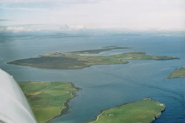 Flotta Island, Orkney Islands11 km E
-
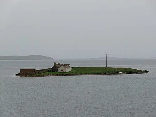 Inner Holm Island, Orkney Islands12 km N
-
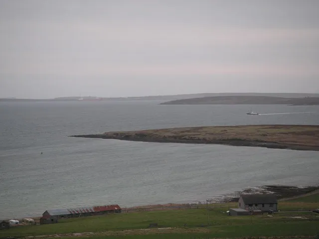 Holm of Houton Island, Orkney Islands10 km NE
-
Risa Island, Orkney Islands6 km E
-
Back Burn River, Orkney Islands7.3 km E
-
Fara Island, Orkney Islands7.7 km E
Sources & licences
Data last updated: · 2 independent sources