- Local time
- UTC+00:00
- Europe/London · UTC+00:00
- Airports
- EOI Eday Airport16 km
- KOI Kirkwall Airport35 km
About Inga Ness
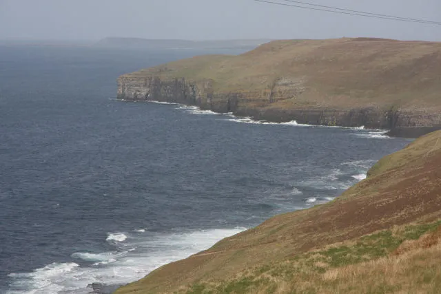
Inga Ness is a natural site. Location: Orkney Islands, Scotland. The nearest airport is Eday Airport (16 km). Nearby sights include Bay of Kirbist and Berst Ness.
Climate of Inga Ness
This month · November
A wet month
Day 9° · Night 5° · Rain 138 mm
- Hottest month
- August (day 15°)
- Coldest month
- February (night 2°)
- Wettest month
- November (138 mm)
- Driest month
- May (53 mm)
Bars: average monthly low and high temperature. Below: precipitation. Monthly averages for 1970–2000 at about 18 km resolution, adjusted for elevation. Highlighted months are mild and relatively dry. Source: WorldClim 2.1 (CC BY 4.0).
Show values as a table
| Month | Jan | Feb | Mar | Apr | May | Jun | Jul | Aug | Sep | Oct | Nov | Dec |
|---|---|---|---|---|---|---|---|---|---|---|---|---|
| Average high (°C) | 7° | 6° | 7° | 8° | 11° | 13° | 14° | 15° | 13° | 11° | 9° | 7° |
| Average low (°C) | 3° | 2° | 3° | 4° | 6° | 8° | 10° | 10° | 9° | 7° | 5° | 3° |
| Precipitation (mm) | 119 | 92 | 105 | 68 | 53 | 56 | 63 | 77 | 109 | 127 | 138 | 127 |
How to get to Inga Ness
The nearest airport is Eday Airport (EOI), 16 km to the southeast as the crow flies. The nearest large city is Aberdeen, 243 km to the south.
Airports
- Eday Airport (EOI) Eday 16 kmsoutheast
- Kirkwall Airport (KOI) Kirkwall, Orkney Islands 35 kmsouth
- Wick John O'Groats Airport (WIC) Wick 90 kmsouth
Nearby large cities
- Aberdeen Population: 198.6K 243 kmsouth
- Dundee Population: 148.2K 312 kmsouth
- Edinburgh Population: 515K 369 kmsouth
- Glasgow Population: 626.4K 386 kmsouth
Straight-line distances; road distances are longer. Airport data: OurAirports.
Day trips from Inga Ness
Within 100 km: 33 historic and cultural sites, 496 natural sites, 184 lakes, rivers and coasts.
0–25 km186 places
- Rousay Island 11 kmS
- Eday Island 16 kmSE
- Papa Westray Island Island 11 kmNE
- Wyre Island 17 kmS
25–60 km355 places
- Hoy Island 49 kmS
- Shapinsay Island 25 kmS
- Flotta Island 49 kmS
- Auskerry Island 37 kmSE
60–100 km172 places
- Clett Island 78 kmSW
- Island of Stroma Island 66 kmS
- Glass Islands Island 96 kmSW
- Garbh-eilean Island 94 kmSW
Straight-line distances.
Nearest towns and villages
Nearby attractions & nature
Everything nearby-
Bay of Kirbist Natural site, Orkney Islands<0.1 km N
-
Berst Ness Natural site, Orkney Islands1.9 km E
-
Cati Geo Natural site, Orkney Islands2.1 km SE
-
Fitty Hill Island, Orkney Islands2.3 km N
-
Ness of Tuquoy Natural site, Orkney Islands3.8 km E
-
Bis Geos Natural site, Orkney Islands5.1 km N
-
Westray Island, Orkney Islands4.9 km NE
-
Couters Hill Mountain, Orkney Islands5.8 km N
More nature in United Kingdom
-
Our Ness Natural site, Orkney Islands7.4 km N
-
Narr Ness Natural site, Orkney Islands7.5 km N
-
 Faraclett Head Natural site, Orkney Islands9.7 km S
-
North Hill Mountain, Orkney Islands6.4 km N
-
Bay of Cleat Natural site, Orkney Islands6 km NE
-
Langskaill Hill Mountain, Orkney Islands6.8 km E
Sources & licences
Data last updated: