Carn a' Chlamain
Located in Perth and Kinross, Scotland Coordinates: 56°51′39″ N 3°46′47″ W
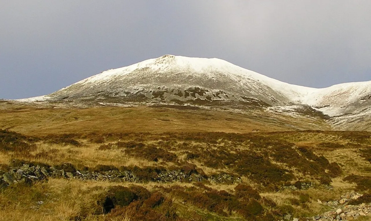
- Elevation
- 964 m
- above sea level
- Local time
- UTC+00:00
- Europe/London · UTC+00:00
- Airports
- DND Dundee Airport65 km
- INV Inverness Airport78 km
About Carn a' Chlamain
Carn a' Chlamain is a mountain. Location: Perth and Kinross, Scotland. Elevation: 964 m.
Càrn a' Chlamain (Gaelic: Càrn a' Chlamhain) is a Scottish mountain situated roughly 12 kilometres north of Blair Atholl in the Forest of Atholl. It is the highest point of an undulating plateau lying northeast of Glen Tilt. The River Tarf, a tributary of the Tilt, rises on the northwestern slopes before curving round the northern side of the plateau, whilst a further Tilt tributary marks the plateau's western boundary.
Source: Wikipedia · CC BY-SA 4.0
At a glance
- Topographic prominence
- 317 m
Source: Wikidata
Photos of Carn a' Chlamain
-

Euan Nelson · CC BY-SA 2.0 -

Graham Lewis · CC BY 2.0 -

Graham Lewis · CC BY 2.0


Climate of Carn a' Chlamain
This month · November
A wet month
Day 3° · Night -3° · Rain 167 mm
- Hottest month
- July (day 14°)
- Coldest month
- February (night -5°)
- Wettest month
- January (204 mm)
- Driest month
- June (88 mm)
Bars: average monthly low and high temperature. Below: precipitation. Monthly averages for 1970–2000 at about 18 km resolution, adjusted for elevation. Highlighted months are mild and relatively dry. Source: WorldClim 2.1 (CC BY 4.0).
Show values as a table
| Month | Jan | Feb | Mar | Apr | May | Jun | Jul | Aug | Sep | Oct | Nov | Dec |
|---|---|---|---|---|---|---|---|---|---|---|---|---|
| Average high (°C) | 1° | 0° | 2° | 5° | 9° | 12° | 14° | 13° | 10° | 6° | 3° | 1° |
| Average low (°C) | -5° | -5° | -4° | -2° | 0° | 3° | 5° | 5° | 3° | 1° | -3° | -4° |
| Precipitation (mm) | 204 | 132 | 149 | 90 | 93 | 88 | 90 | 105 | 141 | 172 | 167 | 170 |
How to get to Carn a' Chlamain
The nearest airport is Dundee Airport (DND), 65 km to the southeast as the crow flies. For international flights: Aberdeen International Airport (ABZ) (103 km). The nearest large city is Dundee, 66 km to the southeast.
Airports
- Dundee Airport (DND) Dundee 65 kmsoutheast
- Inverness Airport (INV) Inverness, Highland 78 kmnorth
- Aberdeen International Airport (ABZ) Aberdeen 103 kmeast
Nearby large cities
- Dundee Population: 148.2K 66 kmsoutheast
- Aberdeen Population: 198.6K 107 kmeast
- Edinburgh Population: 515K 107 kmsouth
- Glasgow Population: 626.4K 115 kmsouth
- Newcastle upon Tyne Population: 300.1K 250 kmsoutheast
Straight-line distances; road distances are longer. Airport data: OurAirports.
Day trips from Carn a' Chlamain
Within 100 km: 114 historic and cultural sites, 4,044 natural sites, 774 lakes, rivers and coasts.
0–25 km424 places
- West Mains Island Island 23 kmS
- Pitnacree Island Island 23 kmS
- Eilean Eas Chliabhan Island 25 kmSW
- Haugh Island Island 24 kmS
25–60 km1,745 places
- Moncreiffe Island Island 57 kmSE
- Bàn Eilean Island 60 kmNW
- Eilean an Tuilaich Island 58 kmW
- Eilean an Righ Island 43 kmW
60–100 km2,763 places
- Balbithan Island Island 97 kmNE
- Findlays Seat Mountain 86 kmNE
- Burntisland Beach Beach 95 kmS
- Moy Island Island 90 kmNW
Straight-line distances.
Nearest towns and villages
-
Fenderbridge Neighbourhood, Perth and Kinross9.7 km S
-
 Pitlochry Village, Perth and Kinross18 km S
-
Middlebridge Neighbourhood, Perth and Kinross9.9 km S
-
 Bridge of Tilt Village, Perth and Kinross11 km S
-
 Blair Atholl Village, Perth and Kinross11 km S
-
Sawmill Cottages Village, Perth and Kinross12 km S
Nearby attractions & nature
Everything nearby-
Carn a' Chlamain North Top Mountain, Perth and Kinross0.4 km NW
-
Aonach na Cloiche Moire Mountain, Perth and Kinross1.7 km NW
-
Creag Loisgte Mountain, Perth and Kinross1.7 km E
-
Conlach Mhor Mountain, Perth and Kinross1.8 km NE
-
Braigh nan Creagan Breac Mountain, Perth and Kinross1.8 km W
-
Braigh Clais Daimh Mountain, Perth and Kinross2.1 km SW
-
Braigh Sron Ghorm Mountain, Perth and Kinross2.8 km NW
-
Creag a' Chrochaidh Mountain, Perth and Kinross3 km E
Sources & licences
Data last updated: · 2 independent sources