- Elevation
- 346 m
- above sea level
- Local time
- UTC+00:00
- Europe/London · UTC+00:00
- Airports
- GLA Glasgow Airport88 km
- DND Dundee Airport96 km
About Druim Leacainn
Druim Leacainn is a mountain. Location: Perth and Kinross, Scotland. Elevation: 346 m. The nearest airport is Glasgow Airport (88 km). Nearby sights include Loch Eigheach and Allt Eigheach.
Photos of Druim Leacainn
-
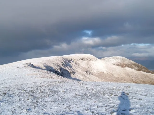
Meall Buidhe Patrick William McIvor · CC BY-SA 2.0

Climate of Druim Leacainn
This month · November
A wet month
Day 7° · Night 2° · Rain 251 mm
- Hottest month
- July (day 16°)
- Coldest month
- February (night 0°)
- Wettest month
- January (292 mm)
- Driest month
- June (112 mm)
Bars: average monthly low and high temperature. Below: precipitation. Monthly averages for 1970–2000 at about 18 km resolution, adjusted for elevation. Highlighted months are mild and relatively dry. Source: WorldClim 2.1 (CC BY 4.0).
Show values as a table
| Month | Jan | Feb | Mar | Apr | May | Jun | Jul | Aug | Sep | Oct | Nov | Dec |
|---|---|---|---|---|---|---|---|---|---|---|---|---|
| Average high (°C) | 4° | 4° | 6° | 9° | 12° | 14° | 16° | 16° | 13° | 10° | 7° | 5° |
| Average low (°C) | 0° | 0° | 1° | 2° | 5° | 7° | 9° | 9° | 8° | 5° | 2° | 0° |
| Precipitation (mm) | 292 | 188 | 210 | 117 | 120 | 112 | 125 | 150 | 210 | 247 | 251 | 260 |
How to get to Druim Leacainn
The nearest airport is Glasgow Airport (GLA), 88 km to the south as the crow flies. The nearest large city is Glasgow, 90 km to the south.
Airports
- Glasgow Airport (GLA) Glasgow 88 kmsouth
- Dundee Airport (DND) Dundee 96 kmeast
- Inverness Airport (INV) Inverness, Highland 103 kmnorth
Nearby large cities
- Glasgow Population: 626.4K 90 kmsouth
- Dundee Population: 148.2K 98 kmeast
- Edinburgh Population: 515K 114 kmsoutheast
- Aberdeen Population: 198.6K 158 kmeast
- Belfast Population: 348K 246 kmsouth
Straight-line distances; road distances are longer. Airport data: OurAirports.
Day trips from Druim Leacainn
Within 100 km: 124 historic and cultural sites, 4,969 natural sites, 1,212 lakes, rivers and coasts.
0–25 km349 places
- Eilean Molach Island 13 kmW
- Eilean nam Faoileag Island 9 kmE
- Eilean Beal na Gaoire Island 6 kmE
- Eilean na h-Iolaire Island 13 kmW
25–60 km1,995 places
- Eriska Island 56 kmW
- Shuna Island Island 53 kmW
- Inishail Island 47 kmSW
- Fraoch Eilean Island 44 kmSW
60–100 km3,961 places
- Scarba Island 90 kmSW
- Oronsay Island 85 kmW
- Cala Island 98 kmSW
- Moy Island Island 100 kmN
Straight-line distances.
Nearest towns and villages
-
Dunan Village, Perth and Kinross3.2 km E
-
Rannoch Village, Perth and Kinross3.7 km NW
-
Bridge of Gaur Village, Perth and Kinross5.7 km E
-
Finnart Village, Perth and Kinross7.3 km E
-
Camasericht Village, Perth and Kinross7.7 km E
-
Tigh na Cruaiche Village, Perth and Kinross8.2 km W
Nearby attractions & nature
Everything nearby-
Loch Eigheach Lake, Perth and Kinross1.3 km NE
-
Allt Eigheach River, Perth and Kinross1.3 km NE
-
Gleann Chomraidh Natural site, Perth and Kinross3.4 km E
-
Duibhe Bheag River, Perth and Kinross1.7 km SE
-
Meall Chomraidh Mountain, Perth and Kinross3.7 km E
-
Abhainn Duibhe River, Perth and Kinross2.2 km E
-
Meall nan Ruag Mountain, Perth and Kinross4.7 km SE
-
Meall Buidhe Mountain, Perth and Kinross7.2 km SE
Sources & licences
Data last updated: