Meall na Aighean
Located in Perth and Kinross, Scotland Coordinates: 56°37′14″ N 4°07′45″ W
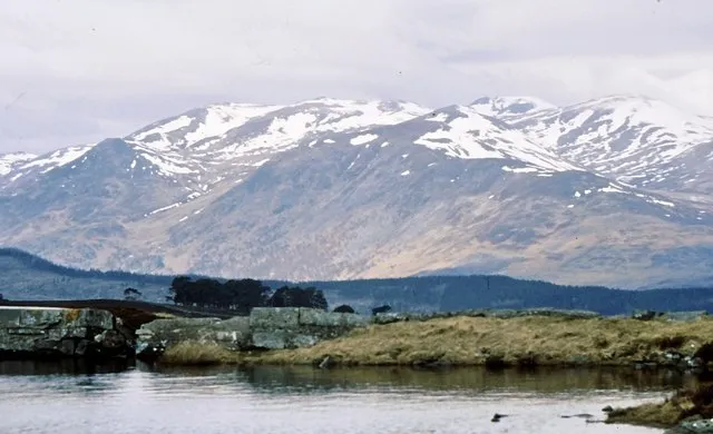
- Elevation
- 981 m
- above sea level
- Local time
- UTC+00:00
- Europe/London · UTC+00:00
- Airports
- DND Dundee Airport70 km
- GLA Glasgow Airport85 km
About Meall na Aighean
Meall na Aighean is a mountain. Location: Perth and Kinross, Scotland. Elevation: 981 m.
Meall nan Aighean is a Scottish mountain in the council area of Perth and Kinross. It stands in a group of four Munros known as the Càrn Mairg group or the Glen Lyon Horseshoe on the north side of Glen Lyon. It is often climbed as part of the circuit of the Càrn Mairg Munros, which stand in a curving arc around the Invervar Burn.
Source: Wikipedia · CC BY-SA 4.0
At a glance
- Topographic prominence
- 136 m
Source: Wikidata
Photos of Meall na Aighean
-

Mick Knapton at English Wikipedia · CC BY-SA 3.0 -
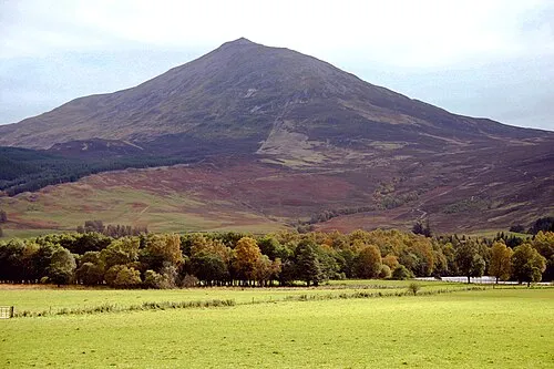
Schiehallion The original uploader was Andrew2606 at English Wikipedia · CC BY 3.0 -
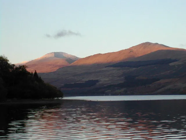
Meall Greigh Alan Mack · CC BY-SA 2.0 -
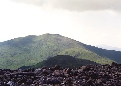
Carn Gorm Mick Knapton at English Wikipedia · CC BY-SA 3.0 -
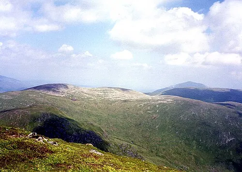
Meall Garbh East Top Mick Knapton at English Wikipedia · CC BY-SA 3.0


Climate of Meall na Aighean
This month · November
A wet month
Day 3° · Night -3° · Rain 182 mm
- Hottest month
- July (day 12°)
- Coldest month
- February (night -5°)
- Wettest month
- January (219 mm)
- Driest month
- April (87 mm)
Bars: average monthly low and high temperature. Below: precipitation. Monthly averages for 1970–2000 at about 18 km resolution, adjusted for elevation. Highlighted months are mild and relatively dry. Source: WorldClim 2.1 (CC BY 4.0).
Show values as a table
| Month | Jan | Feb | Mar | Apr | May | Jun | Jul | Aug | Sep | Oct | Nov | Dec |
|---|---|---|---|---|---|---|---|---|---|---|---|---|
| Average high (°C) | 0° | 0° | 2° | 5° | 8° | 11° | 12° | 12° | 9° | 6° | 3° | 1° |
| Average low (°C) | -5° | -5° | -4° | -2° | 0° | 3° | 5° | 5° | 3° | 1° | -3° | -4° |
| Precipitation (mm) | 219 | 141 | 154 | 87 | 96 | 88 | 97 | 112 | 152 | 183 | 182 | 187 |
How to get to Meall na Aighean
The nearest airport is Dundee Airport (DND), 70 km to the east as the crow flies. For international flights: Glasgow Airport (GLA) (85 km). The nearest large city is Dundee, 73 km to the east.
Airports
- Dundee Airport (DND) Dundee 70 kmeast
- Glasgow Airport (GLA) Glasgow 85 kmsouth
- Edinburgh Airport (EDI) Ingliston, Edinburgh 88 kmsoutheast
Nearby large cities
- Dundee Population: 148.2K 73 kmeast
- Glasgow Population: 626.4K 84 kmsouth
- Edinburgh Population: 515K 94 kmsoutheast
- Aberdeen Population: 198.6K 137 kmnortheast
- Newcastle upon Tyne Population: 300.1K 242 kmsoutheast
Straight-line distances; road distances are longer. Airport data: OurAirports.
Day trips from Meall na Aighean
Within 100 km: 170 historic and cultural sites, 4,480 natural sites, 1,030 lakes, rivers and coasts.
0–25 km374 places
- Isle of Spar Island 9 kmSE
- Eilean nam Faoileag Island 18 kmNW
- Eilean nan Ubh Island 10 kmE
- Eilean Beal na Gaoire Island 20 kmW
25–60 km1,816 places
- Ellens Isle Island 47 kmSW
- Island I Vow Island 52 kmSW
- Inveruglas Isle Island 55 kmSW
- Tarbet Isle Island 57 kmSW
60–100 km3,490 places
- Burntisland Beach Beach 84 kmSE
- Cramond beach Beach 88 kmSE
- Portobello Beach Beach 97 kmSE
- Eriska Island 79 kmW
Straight-line distances.
Nearest towns and villages
-
Invervar Village, Perth and Kinross3.2 km SW
-
Chesthill Village, Perth and Kinross4.2 km S
-
Fortingall Village, Perth and Kinross5.3 km SE
-
Tomnacroich Village, Perth and Kinross6.1 km SE
-
Roromore Village, Perth and Kinross6.8 km SW
-
Stron-fearnan Village, Perth and Kinross7.1 km SE
Nearby attractions & nature
Everything nearby-
Meall na Aighean West Top Mountain, Perth and Kinross0.4 km SW
-
Meall na Aighean East Top Mountain, Perth and Kinross1.2 km E
-
Meall Liath Mountain, Perth and Kinross1.6 km N
-
Meall nan Eun Mountain, Perth and Kinross1.8 km NE
-
Carn Mairg Mountain, Perth and Kinross1.9 km NW
-
Creag Mhor Mountain, Perth and Kinross1.9 km E
-
Meall Garbh East Top Mountain, Perth and Kinross4.8 km W
-
Aodann Mhor Mountain, Perth and Kinross3.2 km NE
More nature in United Kingdom
-
Schiehallion Mountain, Perth and Kinross5.4 km N
-
Carn Gorm Mountain, Perth and Kinross5.9 km W
-
Meall Greigh Mountain, Perth and Kinross6.2 km S
-
Meall a' Bharr Mountain, Perth and Kinross3.2 km NW
-
Meallanan Odhar Mountain, Perth and Kinross3.8 km NW
-
Meall Crumach Mountain, Perth and Kinross3.9 km E
Sources & licences
Data last updated: · 2 independent sources