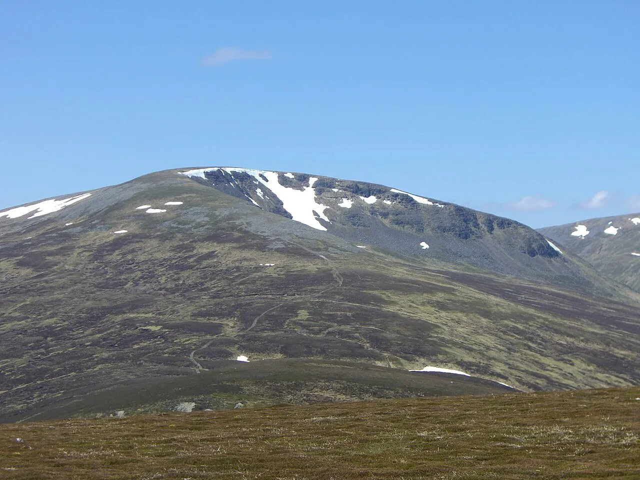
- Elevation
- 991 m
- above sea level
- Local time
- UTC+00:00
- Europe/London · UTC+00:00
- Airports
- INV Inverness Airport81 km
- DND Dundee Airport89 km
About Sgairneach Mhor
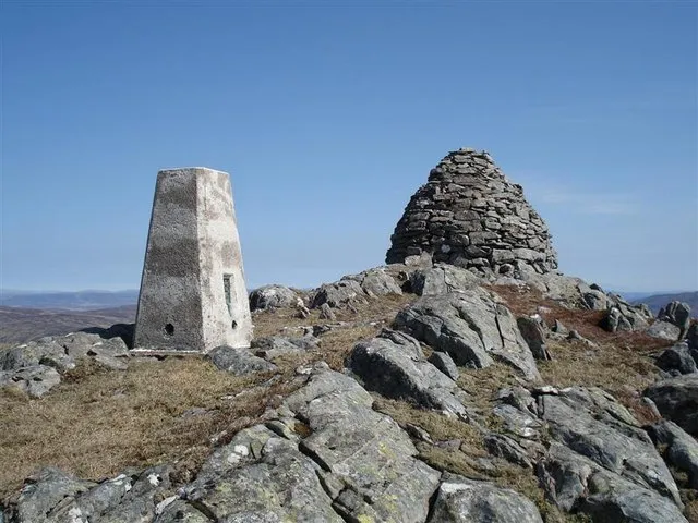
Sgairneach Mhor is a mountain. Location: Perth and Kinross, Scotland. Elevation: 991 m.
Sgairneach Mhòr is a Scottish mountain which lies in a group of seven Munros near the summit of the Pass of Drumochter and are known as the Drumochter mountains or informerly as the “A9 Munros”. The mountain is situated 13 km SSW of Dalwhinnie and four km east of the large Loch Ericht.
Source: Wikipedia · CC BY-SA 4.0
At a glance
- Topographic prominence
- 182 m
Source: Wikidata
Photos of Sgairneach Mhor
-

Adam Ward · CC BY-SA 2.0 -

Michael Graham · CC BY-SA 2.0 -

Michael Graham · CC BY-SA 2.0 -

Mick Knapton · CC BY-SA 3.0 -
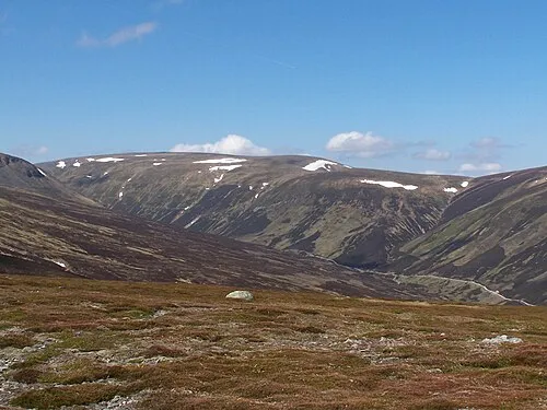
Beinn Udlamain Mick Knapton · CC BY-SA 3.0


Climate of Sgairneach Mhor
This month · November
A wet month
Day 2° · Night -3° · Rain 200 mm
- Hottest month
- July (day 12°)
- Coldest month
- February (night -5°)
- Wettest month
- January (238 mm)
- Driest month
- April (93 mm)
Bars: average monthly low and high temperature. Below: precipitation. Monthly averages for 1970–2000 at about 18 km resolution, adjusted for elevation. Highlighted months are mild and relatively dry. Source: WorldClim 2.1 (CC BY 4.0).
Show values as a table
| Month | Jan | Feb | Mar | Apr | May | Jun | Jul | Aug | Sep | Oct | Nov | Dec |
|---|---|---|---|---|---|---|---|---|---|---|---|---|
| Average high (°C) | 0° | 0° | 2° | 5° | 8° | 10° | 12° | 12° | 9° | 6° | 2° | 1° |
| Average low (°C) | -5° | -5° | -4° | -2° | 0° | 3° | 5° | 5° | 3° | 1° | -3° | -4° |
| Precipitation (mm) | 238 | 153 | 169 | 93 | 102 | 94 | 101 | 120 | 166 | 198 | 200 | 206 |
How to get to Sgairneach Mhor
The nearest airport is Inverness Airport (INV), 81 km to the north as the crow flies. For international flights: Glasgow Airport (GLA) (107 km). The nearest large city is Dundee, 91 km to the southeast.
Airports
- Inverness Airport (INV) Inverness, Highland 81 kmnorth
- Dundee Airport (DND) Dundee 89 kmsoutheast
- Glasgow Airport (GLA) Glasgow 107 kmsouth
Nearby large cities
- Dundee Population: 148.2K 91 kmsoutheast
- Glasgow Population: 626.4K 107 kmsouth
- Edinburgh Population: 515K 119 kmsoutheast
- Aberdeen Population: 198.6K 138 kmeast
- Newcastle upon Tyne Population: 300.1K 266 kmsoutheast
Straight-line distances; road distances are longer. Airport data: OurAirports.
Day trips from Sgairneach Mhor
Within 100 km: 83 historic and cultural sites, 4,886 natural sites, 1,129 lakes, rivers and coasts.
0–25 km361 places
- Eilean an Righ Island 18 kmNW
- Eilean nam Faoileag Island 17 kmS
- Eilean Beal na Gaoire Island 19 kmSW
- Eilean na Longairt Island 19 kmW
25–60 km1,976 places
- Eilean na h-Ealaidh Island 39 kmNW
- Eilean Molach Island 36 kmSW
- Bàn Eilean Island 41 kmNW
- Eilean nan Sasunnach Island 42 kmNW
60–100 km3,761 places
- Eriska Island 76 kmSW
- Moy Island Island 82 kmN
- Shuna Island Island 72 kmW
- Eilean Shona Island 96 kmW
Straight-line distances.
Nearest towns and villages
-
 Dalwhinnie Village, Highland12 km N
-
Trinafour Village, Perth and Kinross15 km SE
-
Kinloch Rannoch Village, Perth and Kinross16 km SE
-
Carie Village, Perth and Kinross16 km S
-
Killichonan Village, Perth and Kinross16 km S
-
Dall Village, Perth and Kinross17 km S
Nearby attractions & nature
Everything nearby-
Beinn Udlamain Mountain, Perth and Kinross2.1 km W
-
Sgairneach Mhor East Top Mountain, Perth and Kinross1.9 km E
-
Meallan Buidhe Mountain, Perth and Kinross2.1 km SE
-
Bruach nan Iomairean Mountain, Highland2.7 km N
-
Meall an Dobharchain Mountain, Perth and Kinross2.8 km E
-
An Sgulan Mountain, Perth and Kinross3 km W
-
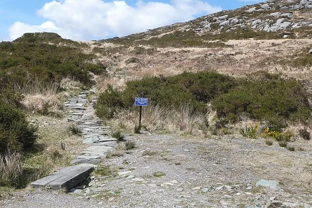 An Torc Mountain, Highland3.9 km NE
-
A' Mharconaich Mountain, Highland3.2 km N
More nature in United Kingdom
-
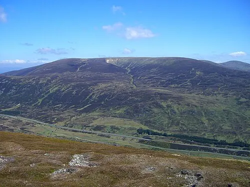 A' Bhuidheanach Bheag Mountain, Perth and Kinross7.6 km NE
-
 Beinn Mholach Mountain, Perth and Kinross7.7 km S
-
Meall Doire Mountain, Perth and Kinross4.1 km S
-
Stob Leathad a' Mhadaidh Mountain, Perth and Kinross4.3 km S
-
Glas Meall a' Chumhainn Mountain, Perth and Kinross4.3 km SW
-
Sron na h-Eiteich Mountain, Perth and Kinross5 km SE
Sources & licences
Data last updated: · 2 independent sources