- Elevation
- 46 m
- above sea level
- Local time
- UTC+00:00
- Europe/London · UTC+00:00
- Population
- 1,055
- 1.1K
- Airports
- LSI Sumburgh Airport100 km
- EOI Eday Airport203 km
About Unst
Unst is an island. Location: Shetland Islands, Scotland. Population: 1,055.
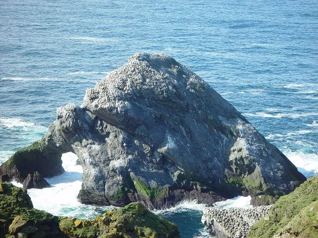
Unst (; Norn: Ønst) is one of the North Isles of the Shetland Islands, Scotland. It is the northernmost of the inhabited British Isles and is the third-largest island in Shetland after Mainland and Yell. It has an area of 46 sq mi (120 km2). Unst is largely grassland, with coastal cliffs. Its main village is Baltasound, formerly the second-largest herring fishing port after Lerwick and now the location of a leisure centre and the island's airport.
Source: Wikipedia · CC BY-SA 4.0
Photos of Unst
-

Andrew Tryon · CC BY-SA 2.0 -

Mike Pennington · CC BY-SA 2.0 -
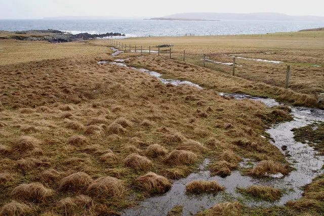
Ness of Ramnageo Mike Pennington · CC BY-SA 2.0 -
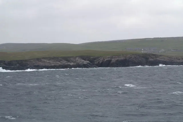
Papil Ness Mike Pennington · CC BY-SA 2.0 -
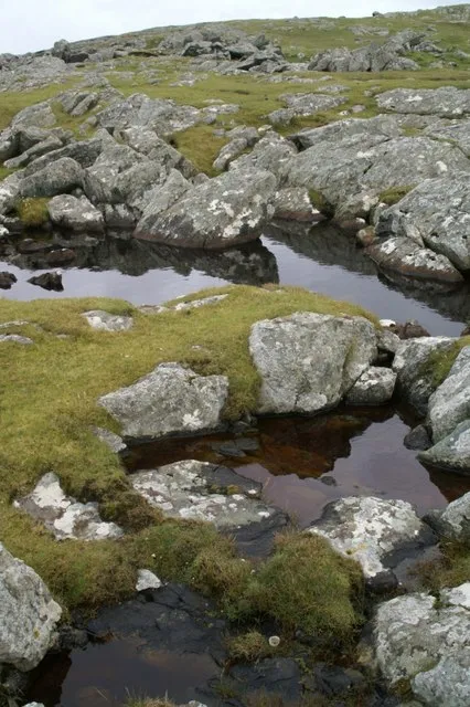
Ham Ness Mike Pennington · CC BY-SA 2.0


Travel notes for Unst
From Wikivoyage
Unst is the most northerly inhabited island of the Shetland Islands, north of mainland Scotland, with a population of 632 in 2011. Life here was traditionally based on herring fishing: the herring now are sparse but small-scale fishing continues, along with sheep farming. The oil boom on Mainland Shetland passed by Unst. There's a straggle of small settlements along the main road, notably Baltasound with probably the world's most sumptuous bus shelter, and Haroldswick with a museum and display of old boats. The star attraction is Hermaness, the nature reserve on the north-western tip of Unst, where thousands of seabirds nest and wheel and screech above the sea cliffs.
Tourism information. (updated Jan 2024)
Get in+
By boat is the only way, there's no air service. From Mainland Shetland you first take the ferry from Toft to Ulsta on Yell, then cross that island to Gutcher, as described for Yell#Get in. A day trip is simple by car but not possible by bus; join an organised tour from Lerwick if you lack your own transport.
1 Gutcher has ferries to Unst and Fetlar: queue in Lanes 1 / 2 for Unst. The Bluemull ferry takes 10 min to cross from Gutcher to 2 Belmont on Unst, M-Sa sailing every 30-60 min, Su every 90 min to 2 hours, from 6:15AM to 10:15PM. However five or six ferries per day follow a triangle: from Gutcher to Hamar's Ness on the island of Fetlar (20 min) then onward to Belmont, or the reverse pattern. Assuming you started from Mainland Shetland that day, your ticket is already paid; if you started from Yell it's the same as the Mainland-Yell fare.
The ferry terminals at Gutcher and Belmont are basic, just small waiting rooms with toilets and a timetable.
By bus the timetable is designed for day trips from Unst and Yell to Lerwick, so that residents can do what they need to in town and get back, but a day-trip out from Lerwick is not possible. Bus 24 leaves Lerwick M-F at 2:30PM to reach Yell at 3:45PM and Unst at 4:40PM. Bus 28 then takes you up Unst as far as Baltasound, Haroldswick and Saxa Vord. The southbound bus sets off from Baltasound to Lerwick at 7:30AM. Bus 28 makes three other runs the length of Unst, so you can reach the ferry to Yell or Fetlar but with no connection to Lerwick.
Source: Wikivoyage · CC BY-SA 4.0 · abridged
Climate of Unst
This month · November
A wet month
Day 8° · Night 5° · Rain 156 mm
- Hottest month
- August (day 15°)
- Coldest month
- February (night 2°)
- Wettest month
- November (156 mm)
- Driest month
- May (50 mm)
Bars: average monthly low and high temperature. Below: precipitation. Monthly averages for 1970–2000 at about 18 km resolution, adjusted for elevation. Highlighted months are mild and relatively dry. Source: WorldClim 2.1 (CC BY 4.0).
Show values as a table
| Month | Jan | Feb | Mar | Apr | May | Jun | Jul | Aug | Sep | Oct | Nov | Dec |
|---|---|---|---|---|---|---|---|---|---|---|---|---|
| Average high (°C) | 6° | 6° | 7° | 8° | 10° | 12° | 14° | 15° | 13° | 10° | 8° | 7° |
| Average low (°C) | 3° | 2° | 3° | 4° | 6° | 8° | 10° | 11° | 9° | 7° | 5° | 3° |
| Precipitation (mm) | 144 | 98 | 128 | 75 | 50 | 57 | 59 | 81 | 119 | 135 | 156 | 147 |
How to get to Unst
The nearest airport is Sumburgh Airport (LSI), 100 km to the south as the crow flies. The nearest large city is Bergen, 343 km to the east.
Airports
- Sumburgh Airport (LSI) Lerwick, Shetland 100 kmsouth
- Eday Airport (EOI) Eday 203 kmsouthwest
- Kirkwall Airport (KOI) Kirkwall, Orkney Islands 230 kmsouthwest
Nearby large cities
- Bergen Population: 294K 343 kmeast
Straight-line distances; road distances are longer. Airport data: OurAirports.
Day trips from Unst
Within 100 km: 9 historic and cultural sites, 578 natural sites, 256 lakes, rivers and coasts.
0–25 km160 places
- Fetlar Island Island 15 kmS
- Yell Island 20 kmSW
- Kay Holm Island 19 kmSW
- Furra Stacs Island 20 kmS
25–60 km366 places
- Shetland Islands Island 51 kmSW
- Whalsay Island 47 kmS
- Brother Isle Island 32 kmSW
- Mainland Island 58 kmS
60–100 km317 places
- Trondra Island 74 kmS
- Green Holm Island 73 kmS
- Hoove Holm Island 66 kmS
- Flotta Island Island 66 kmS
Straight-line distances.
Nearest towns and villages
Nearby attractions & nature
Everything nearby-
Knowe of Gue Mountain, Shetland Islands2.3 km NW
-
Valla Field Mountain, Shetland Islands2.5 km W
-
Hill of Colvadale Mountain, Shetland Islands2.5 km S
-
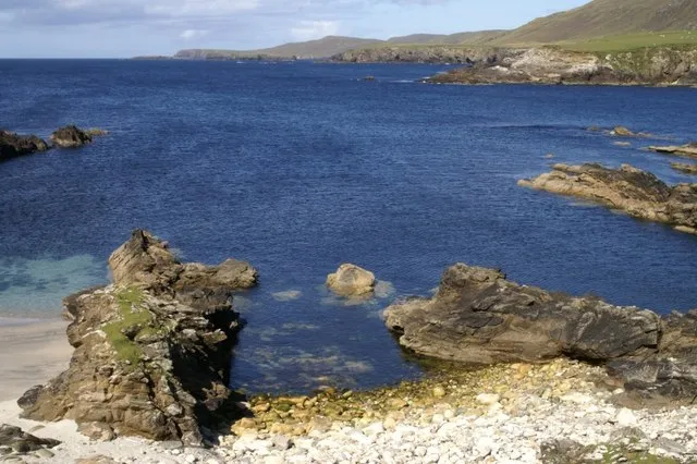 Ness of Collaster Natural site, Shetland Islands3.6 km W
-
Crussa Field Mountain, Shetland Islands3.1 km N
-
Spoo Ness Natural site, Shetland Islands3.6 km W
-
Little Holm Island, Shetland Islands2.9 km SW
-
Houllna Gruna Mountain, Shetland Islands3.8 km NW
More lakes, rivers and coasts in United Kingdom
-
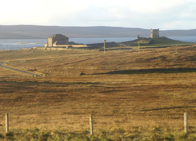 Fetlar Island Island, Shetland Islands15 km S
-
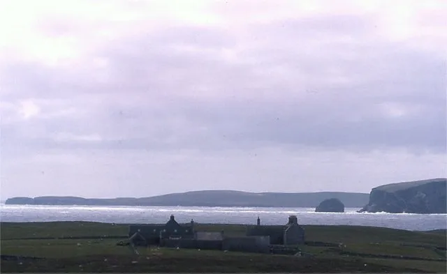 Uyea Island, Shetland Islands9.3 km S
-
Loch of Cliff Lake, Shetland Islands4.3 km N
-
Brough Holm Island, Shetland Islands4.8 km SW
-
South Holms Island, Shetland Islands4.1 km NW
-
Huney Island Island, Shetland Islands4.1 km SE
Sources & licences
Data last updated: · 2 independent sources