- Elevation
- 483 m
- above sea level
- Local time
- UTC+00:00
- Europe/London · UTC+00:00
- Airports
- GLA Glasgow Airport48 km
- EDI Edinburgh Airport81 km
About Cnoc na Nathrach
Cnoc na Nathrach is a mountain. Location: Stirling, Scotland. Elevation: 483 m. The nearest airport is Glasgow Airport (48 km). Nearby sights include Creag Chaorannach and An Stuchd.
Photos of Cnoc na Nathrach
-
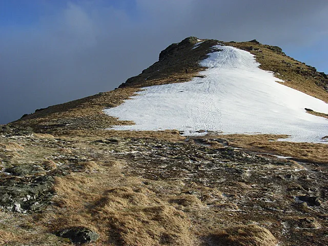
Beinn Tulaichean Andrew Smith · CC BY-SA 2.0 -
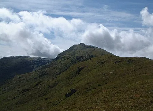
An Caisteal Mick Knapton at English Wikipedia · CC BY-SA 3.0


Climate of Cnoc na Nathrach
This month · November
A wet month
Day 6° · Night 1° · Rain 235 mm
- Hottest month
- July (day 15°)
- Coldest month
- January (night -1°)
- Wettest month
- January (272 mm)
- Driest month
- June (107 mm)
Bars: average monthly low and high temperature. Below: precipitation. Monthly averages for 1970–2000 at about 18 km resolution, adjusted for elevation. Highlighted months are mild and relatively dry. Source: WorldClim 2.1 (CC BY 4.0).
Show values as a table
| Month | Jan | Feb | Mar | Apr | May | Jun | Jul | Aug | Sep | Oct | Nov | Dec |
|---|---|---|---|---|---|---|---|---|---|---|---|---|
| Average high (°C) | 4° | 4° | 5° | 8° | 11° | 13° | 15° | 15° | 12° | 9° | 6° | 4° |
| Average low (°C) | -1° | -1° | 0° | 1° | 4° | 6° | 8° | 8° | 7° | 4° | 1° | -1° |
| Precipitation (mm) | 272 | 177 | 188 | 111 | 120 | 107 | 121 | 147 | 203 | 240 | 235 | 239 |
How to get to Cnoc na Nathrach
The nearest airport is Glasgow Airport (GLA), 48 km to the south as the crow flies. The nearest large city is Glasgow, 51 km to the south.
Airports
- Glasgow Airport (GLA) Glasgow 48 kmsouth
- Edinburgh Airport (EDI) Ingliston, Edinburgh 81 kmsoutheast
- Glasgow Prestwick Airport (PIK) Prestwick, South Ayrshire 89 kmsouth
Nearby large cities
- Glasgow Population: 626.4K 51 kmsouth
- Edinburgh Population: 515K 91 kmsoutheast
- Dundee Population: 148.2K 98 kmeast
- Aberdeen Population: 198.6K 176 kmnortheast
- Belfast Population: 348K 209 kmsouthwest
Straight-line distances; road distances are longer. Airport data: OurAirports.
Day trips from Cnoc na Nathrach
Within 100 km: 167 historic and cultural sites, 4,104 natural sites, 1,203 lakes, rivers and coasts.
0–25 km448 places
- Inchlonaig Island 22 kmS
- Inchcailloch Island 24 kmS
- Ellens Isle Island 9 kmSE
- Bucinch Island 23 kmS
25–60 km1,693 places
- Inishail Island 36 kmW
- Fraoch Eilean Island 34 kmW
- Aber Isle Island 26 kmS
- Creinch Island 26 kmS
60–100 km3,333 places
- Isle of Arran Island 90 kmSW
- Great Cumbrae Island Island 64 kmSW
- Ayr Beach Beach 93 kmS
- Troon Beach Beach 85 kmS
Straight-line distances.
Nearest towns and villages
-
Glengyle Village, Stirling5 km W
-
Stronachlachar Village, Stirling5.6 km SW
-
Aberfoyle Village, Stirling16 km SE
-
 Kinlochard Village, Stirling12 km S
-
Balquhidder Village, Stirling11 km NE
-
 Callander Village, Stirling20 km E
Nearby attractions & nature
Everything nearby-
Creag Chaorannach Mountain, Stirling0.7 km W
-
An Stuchd Mountain, Stirling0.8 km NE
-
Beinn Mheadhonach Mountain, Stirling1 km SE
-
Creag na h-Iolaire Mountain, Stirling1.6 km NW
-
Meall Reamhar Mountain, Stirling1.9 km NW
-
Meall Gaothach Mountain, Stirling2 km E
-
Cruinn Bheinn Mountain, Stirling2.3 km S
-
Stob Breac Mountain, Stirling2.4 km N
More nature in United Kingdom
-
Beinn Tulaichean Mountain, Stirling5.7 km NW
-
Strath Gartney Natural site, Stirling3.6 km SE
-
Stob a' Choin Mountain, Stirling2.7 km NW
-
Taobh na Coille Mountain, Stirling2.8 km E
-
An Garadh Mountain, Stirling3.4 km W
-
Stob an Duibhe Mountain, Stirling4.4 km W
Sources & licences
Data last updated: