Windlestraw Law
Located in The Scottish Borders, Scotland Coordinates: 55°40′38″ N 3°00′05″ W
- Elevation
- 659 m
- above sea level
- Local time
- UTC+00:00
- Europe/London · UTC+00:00
About Windlestraw Law
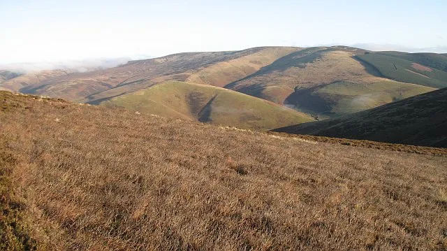
Windlestraw Law is a mountain. Location: The Scottish Borders, Scotland. Elevation: 659 m.
Windlestraw Law is a hill in the Moorfoot Hills range, part of the Southern Uplands of Scotland. It is the highest peak of the range, and lies north of the town of Innerleithen in the Scottish Borders. A large and boggy peak, it is usually climbed from either its western slopes or the longer route from Tweeddale to the south.
Read more on Wikipedia Text: Wikipedia contributors · CC BY-SA 4.0 · shortened
In comparison
- No. 2516 of 18223 mountains in United Kingdom by elevation
- 66 sights and natural places within 10 km Bareback Knowe, Mossy Rig
Nearest towns and villages
-
Walkerburn Village, The Scottish Borders6.1 km S
-
Innerleithen Village, The Scottish Borders7.5 km SW
-
Cardrona Mains Village, The Scottish Borders7.9 km SW
-
Stow Village, The Scottish Borders8.8 km E
-
 Peebles Town, The Scottish Borders12 km W
-
Clovenfords Village, The Scottish Borders10 km SE
Nearby attractions & nature
Everything nearby-
Bareback Knowe Mountain, The Scottish Borders1.4 km SW
-
Mossy Rig Mountain, The Scottish Borders1.6 km NE
-
Scawd Law Mountain, The Scottish Borders2.6 km S
-
Maiden Law Mountain, The Scottish Borders2.7 km SE
-
Seathope Law Mountain, The Scottish Borders3.1 km SE
-
Eastside Heights Mountain, The Scottish Borders3.2 km NW
-
Scroof Hill Mountain, The Scottish Borders3.5 km E
-
Dod Hill Mountain, The Scottish Borders3.6 km W
Sources & licences
Data last updated: · 2 independent sources