- Elevation
- 52 m
- above sea level
- Local time
- UTC+00:00
- Europe/London · UTC+00:00
- Airports
- BRR Barra Airport16 km
- TRE Tiree Airport58 km
About Aird Phabach
Aird Phabach is a mountain. Location: Western Isles, Scotland. Elevation: 52 m. The nearest airport is Barra Airport (16 km). Nearby sights include Cnoc a' Ghlinne Mhoir and Loch na Cuilce.
Climate of Aird Phabach
This month · November
A wet month
Day 10° · Night 5° · Rain 152 mm
- Hottest month
- August (day 15°)
- Coldest month
- February (night 3°)
- Wettest month
- October (159 mm)
- Driest month
- May (63 mm)
Bars: average monthly low and high temperature. Below: precipitation. Monthly averages for 1970–2000 at about 18 km resolution, adjusted for elevation. Highlighted months are mild and relatively dry. Source: WorldClim 2.1 (CC BY 4.0).
Show values as a table
| Month | Jan | Feb | Mar | Apr | May | Jun | Jul | Aug | Sep | Oct | Nov | Dec |
|---|---|---|---|---|---|---|---|---|---|---|---|---|
| Average high (°C) | 8° | 8° | 8° | 9° | 12° | 14° | 15° | 15° | 14° | 12° | 10° | 8° |
| Average low (°C) | 4° | 3° | 4° | 4° | 6° | 9° | 11° | 11° | 10° | 8° | 5° | 4° |
| Precipitation (mm) | 150 | 109 | 117 | 73 | 63 | 71 | 88 | 104 | 131 | 159 | 152 | 148 |
How to get to Aird Phabach
The nearest airport is Barra Airport (BRR), 16 km to the north as the crow flies. The nearest large city is Glasgow, 231 km to the southeast.
Airports
- Barra Airport (BRR) Eoligarry 16 kmnorth
- Tiree Airport (TRE) Balemartine, Argyll and Bute 58 kmsoutheast
- Benbecula Airport (BEB) Balivanich 67 kmnorth
Nearby large cities
- Glasgow Population: 626.4K 231 kmsoutheast
- Belfast Population: 348K 273 kmsouth
- Dundee Population: 148.2K 282 kmeast
- Edinburgh Population: 515K 286 kmeast
- Aberdeen Population: 198.6K 330 kmeast
Straight-line distances; road distances are longer. Airport data: OurAirports.
Day trips from Aird Phabach
Within 100 km: 15 historic and cultural sites, 665 natural sites, 724 lakes, rivers and coasts.
0–25 km122 places
- Isle of Barra Beach Beach 10 kmN
- Garbh-Lingeigh Island 17 kmNE
- Vatersay Island Island 4 kmN
- Sandray Island 2 kmN
25–60 km207 places
- Hebrides Island 44 kmE
- Stulaigh Island 38 kmNE
- Siolaigh Mor Island 52 kmN
- Dùn Mòr Island 53 kmN
60–100 km1,075 places
- Isle of Skye Island 90 kmNE
- Eigg Island 82 kmE
- The Coral Beaches Beach 87 kmNE
- Lingay Island 91 kmN
Straight-line distances.
Nearest towns and villages
-
Uidh Village, Western Isles6 km N
-
Isle of Barra Village, Western Isles12 km N
-
Leideag Village, Western Isles8.2 km N
-
Ledaig Village, Western Isles8.2 km N
-
Castlebay Village, Western Isles8.4 km N
-
Kentangaval Village, Western Isles8.7 km N
Nearby attractions & nature
Everything nearby-
Cnoc a' Ghlinne Mhoir Mountain, Western Isles0.7 km E
-
Loch na Cuilce Lake, Western Isles0.7 km NW
-
Carnach Mountain, Western Isles1.3 km NE
-
Cairn Galtar Mountain, Western Isles1.3 km N
-
Sgeir Noddimull Island, Western Isles1.2 km NW
-
Sandray Island, Western Isles1.5 km N
-
Grianamul Island, Western Isles2.1 km W
-
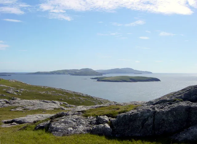 Lingeigh Island Island, Western Isles3.9 km W
Sources & licences
Data last updated: