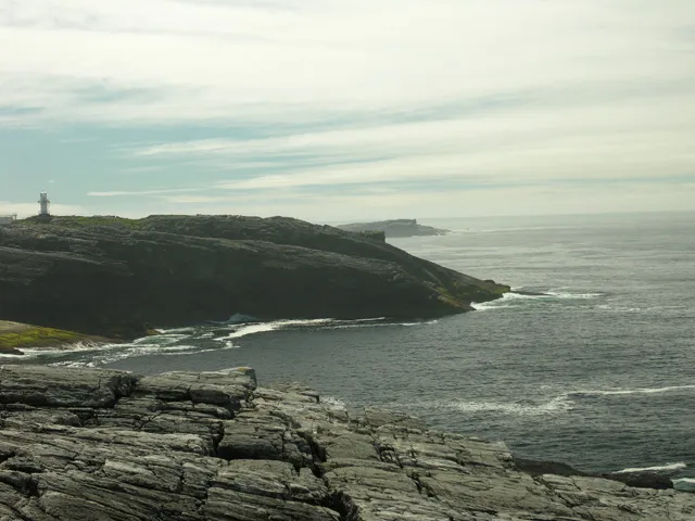
- Elevation
- 5 m
- above sea level
- Local time
- UTC+00:00
- Europe/London · UTC+00:00
- Airports
- BEB Benbecula Airport31 km
- BRR Barra Airport77 km
About Haskeir
Haskeir is an island. Location: Western Isles, Scotland.
Haskeir (Scottish Gaelic: Eilean Hasgeir), also known as Great Haskeir (Scottish Gaelic: Hasgeir Mhòr) is a remote, exposed and uninhabited island in the Outer Hebrides of Scotland. It lies 13 kilometres (7 nautical miles) west-northwest of North Uist. One kilometre (1⁄2 nautical mile) southwest lie the skerries of Haskeir Eagach, made up of a colonnade of five rock stacks, and 40 km (22 nmi) northwest is St Kilda.
Source: Wikipedia · CC BY-SA 4.0
At a glance
- Area
- 15 ha
Source: Wikidata
Photos of Haskeir
-

Director General of the Ordnance Survey, Southampton, UK · Public domain -

United Kingdom Hydrographic Office · Public domain -

Gordon Hatton · CC BY-SA 2.0 -

David Purchase · CC BY-SA 2.0 -

Rob Farrow · CC BY-SA 2.0


Climate of Haskeir
This month · November
A wet month
Day 11° · Night 7° · Rain 166 mm
- Hottest month
- August (day 15°)
- Coldest month
- March (night 5°)
- Wettest month
- October (173 mm)
- Driest month
- May (71 mm)
Bars: average monthly low and high temperature. Below: precipitation. Monthly averages for 1970–2000 at about 18 km resolution, adjusted for elevation. Highlighted months are mild and relatively dry. Source: WorldClim 2.1 (CC BY 4.0).
Show values as a table
| Month | Jan | Feb | Mar | Apr | May | Jun | Jul | Aug | Sep | Oct | Nov | Dec |
|---|---|---|---|---|---|---|---|---|---|---|---|---|
| Average high (°C) | 9° | 9° | 8° | 9° | 12° | 13° | 15° | 15° | 14° | 12° | 11° | 10° |
| Average low (°C) | 5° | 5° | 5° | 5° | 7° | 9° | 11° | 12° | 11° | 9° | 7° | 6° |
| Precipitation (mm) | 154 | 119 | 132 | 87 | 71 | 75 | 90 | 106 | 143 | 173 | 166 | 153 |
How to get to Haskeir
The nearest airport is Benbecula Airport (BEB), 31 km to the southeast as the crow flies. The nearest large city is Glasgow, 293 km to the southeast.
Airports
- Benbecula Airport (BEB) Balivanich 31 kmsoutheast
- Barra Airport (BRR) Eoligarry 77 kmsouth
- Stornoway Airport (SYY) Stornoway, Western Isles 99 kmnortheast
Nearby large cities
- Glasgow Population: 626.4K 293 kmsoutheast
- Dundee Population: 148.2K 317 kmsoutheast
- Edinburgh Population: 515K 336 kmsoutheast
- Aberdeen Population: 198.6K 341 kmeast
- Belfast Population: 348K 362 kmsouth
Straight-line distances; road distances are longer. Airport data: OurAirports.
Day trips from Haskeir
Within 100 km: 18 historic and cultural sites, 918 natural sites, 907 lakes, rivers and coasts.
0–25 km55 places
- Bhorogaigh Island 24 kmSE
- Vallay Island Island 17 kmE
- Shillay Island 19 kmS
- Oronsay Island 24 kmE
25–60 km725 places
- Isle of Harris Natural site 57 kmNE
- Lingay Island 26 kmE
- Siolaigh Mor Island 49 kmSE
- Flodaigh Beag Island 39 kmSE
60–100 km1,063 places
- Hebrides Island 97 kmSE
- Isle of Skye Island 97 kmSE
- The Coral Beaches Beach 66 kmE
- Isle of Barra Beach Beach 81 kmS
Straight-line distances.
Nearest towns and villages
-
Scolpaig Village, Western Isles13 km SE
-
Baile Mhartainn Village, Western Isles14 km SE
-
Tigh A' Gearraidh Village, Western Isles14 km SE
-
Balelone Village, Western Isles14 km SE
-
Baleloch Village, Western Isles14 km SE
-
Balranald Village, Western Isles14 km SE
Nearby attractions & nature
Everything nearby-
Haskeir Island NE Top Mountain, Western Isles0.3 km N
-
Heisgeir Eagach Island, Western Isles2.1 km SW
-
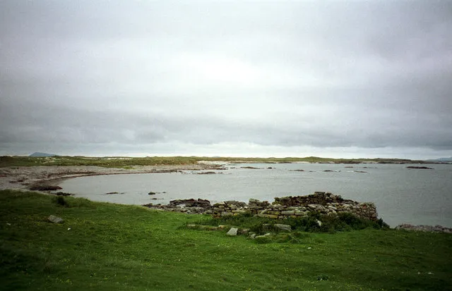 Ceann Ear Island, Western Isles20 km S
-
Causamul Island, Western Isles12 km SE
-
Beinn Scolpaig Mountain, Western Isles14 km E
-
Carra-crom Mountain, Western Isles14 km SE
-
Beinn Riabhach Mountain, Western Isles15 km SE
-
Eilean a' Mhurain Island, Western Isles13 km SE
Sources & licences
Data last updated: · 2 independent sources