Telecommunication Tower of Remote Radar Head Benbecula
Located in Western Isles, Scotland Coordinates: 57°37′03″ N 7°26′40″ W
- Local time
- UTC+00:00
- Europe/London · UTC+00:00
- Elevation
- 81 m
- above sea level
- Airports
- BEB Benbecula Airport16 km
- BRR Barra Airport66 km
About Telecommunication Tower of Remote Radar Head Benbecula
Telecommunication Tower of Remote Radar Head Benbecula is a landmark. Location: Western Isles, Scotland. The nearest airport is Benbecula Airport (16 km). Nearby sights include Cleitreabhal a Deas and Carra-crom.
Climate of Telecommunication Tower of Remote Radar Head Benbecula
This month · November
A wet month
Day 9° · Night 5° · Rain 162 mm
- Hottest month
- August (day 16°)
- Coldest month
- February (night 2°)
- Wettest month
- October (166 mm)
- Driest month
- May (65 mm)
Bars: average monthly low and high temperature. Below: precipitation. Monthly averages for 1970–2000 at about 18 km resolution, adjusted for elevation. Highlighted months are mild and relatively dry. Source: WorldClim 2.1 (CC BY 4.0).
Show values as a table
| Month | Jan | Feb | Mar | Apr | May | Jun | Jul | Aug | Sep | Oct | Nov | Dec |
|---|---|---|---|---|---|---|---|---|---|---|---|---|
| Average high (°C) | 7° | 7° | 8° | 10° | 12° | 14° | 15° | 16° | 14° | 12° | 9° | 7° |
| Average low (°C) | 3° | 2° | 3° | 4° | 6° | 9° | 11° | 11° | 9° | 7° | 5° | 3° |
| Precipitation (mm) | 154 | 113 | 123 | 77 | 65 | 75 | 89 | 103 | 138 | 166 | 162 | 155 |
How to get to Telecommunication Tower of Remote Radar Head Benbecula
The nearest airport is Benbecula Airport (BEB), 16 km to the south as the crow flies. The nearest large city is Glasgow, 276 km to the southeast.
Airports
- Benbecula Airport (BEB) Balivanich 16 kmsouth
- Barra Airport (BRR) Eoligarry 66 kmsouth
- Stornoway Airport (SYY) Stornoway, Western Isles 94 kmnortheast
Nearby large cities
- Glasgow Population: 626.4K 276 kmsoutheast
- Dundee Population: 148.2K 300 kmsoutheast
- Edinburgh Population: 515K 319 kmsoutheast
- Aberdeen Population: 198.6K 326 kmeast
- Belfast Population: 348K 349 kmsouth
Straight-line distances; road distances are longer. Airport data: OurAirports.
Day trips from Telecommunication Tower of Remote Radar Head Benbecula
Within 100 km: 19 historic and cultural sites, 1,096 natural sites, 962 lakes, rivers and coasts.
0–25 km338 places
- Lingay Island 14 kmNE
- Flodaigh Beag Island 22 kmSE
- Beinn Shleibhe Island 21 kmNE
- Taghaigh Island 21 kmE
25–60 km581 places
- Isle of Harris Natural site 49 kmNE
- The Coral Beaches Beach 50 kmE
- Scalpay Island 54 kmNE
- Clett Island 49 kmE
60–100 km1,158 places
- Hebrides Island 82 kmSE
- Isle of Skye Island 80 kmSE
- Island of Raasay Island 87 kmE
- Isle of Barra Beach Beach 72 kmS
Straight-line distances.
Nearby attractions & nature
Everything nearby-
Cleitreabhal a Deas Mountain, Western Isles0.2 km SW
-
Carra-crom Mountain, Western Isles2.5 km NW
-
Beinn Riabhach Mountain, Western Isles2.8 km NW
-
Dùn Mhic Raouill Island, Western Isles2.5 km W
-
Beinn Ernaigeitir Mountain, Western Isles3 km E
-
Dùn Scarie Island, Western Isles3.5 km SW
-
Eilean Dubh Mòr Island, Western Isles3.8 km NE
-
Beinn Scolpaig Mountain, Western Isles4.5 km N
Nearest towns and villages
-
Paible Village, Western Isles2.3 km SW
-
Hosta Village, Western Isles2.8 km W
-
Isle of North Uist Village, Western Isles6.4 km E
-
Balelone Village, Western Isles3.2 km NW
More sights in Western Isles
-
Monach Islands Light Landmark, Western Isles18 km SW
-
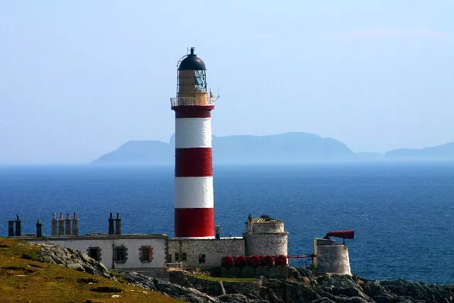 Eilean Glas Lighthouse Landmark, Western Isles55 km NE
-
Ushenish Lighthouse (historical) Landmark, Western Isles39 km SE
-
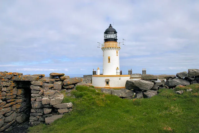 Barra Head Lighthouse Landmark, Western Isles94 km S
-
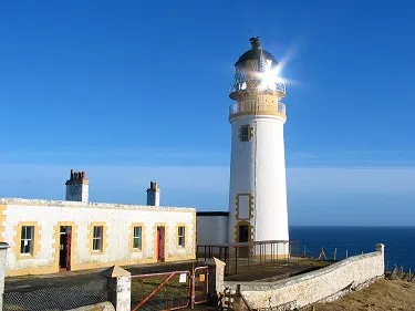 Tiumpan Head Lighthouse Landmark, Western Isles105 km NE
-
Kildonan Museum Museum, Western Isles44 km S
Sources & licences
Data last updated: