- Elevation
- 358 m
- above sea level
- Local time
- UTC+00:00
- Europe/London · UTC+00:00
- Airports
- SYY Stornoway Airport49 km
- BEB Benbecula Airport53 km
About Uabhal Mor
Uabhal Mor is a mountain. Location: Western Isles, Scotland. Elevation: 358 m. The nearest airport is Stornoway Airport (49 km). Nearby sights include Langracleit and Ceann Reamhar.
Climate of Uabhal Mor
This month · November
A wet month
Day 7° · Night 2° · Rain 185 mm
- Hottest month
- July (day 14°)
- Coldest month
- February (night 0°)
- Wettest month
- October (185 mm)
- Driest month
- May (76 mm)
Bars: average monthly low and high temperature. Below: precipitation. Monthly averages for 1970–2000 at about 18 km resolution, adjusted for elevation. Highlighted months are mild and relatively dry. Source: WorldClim 2.1 (CC BY 4.0).
Show values as a table
| Month | Jan | Feb | Mar | Apr | May | Jun | Jul | Aug | Sep | Oct | Nov | Dec |
|---|---|---|---|---|---|---|---|---|---|---|---|---|
| Average high (°C) | 5° | 5° | 6° | 7° | 10° | 12° | 14° | 14° | 12° | 10° | 7° | 5° |
| Average low (°C) | 1° | 0° | 1° | 2° | 5° | 7° | 9° | 9° | 7° | 5° | 2° | 1° |
| Precipitation (mm) | 174 | 130 | 149 | 92 | 76 | 86 | 100 | 113 | 157 | 185 | 185 | 176 |
How to get to Uabhal Mor
The nearest airport is Stornoway Airport (SYY), 49 km to the northeast as the crow flies. The nearest large city is Glasgow, 273 km to the southeast.
Airports
- Stornoway Airport (SYY) Stornoway, Western Isles 49 kmnortheast
- Benbecula Airport (BEB) Balivanich 53 kmsouthwest
- Barra Airport (BRR) Eoligarry 101 kmsouth
Nearby large cities
- Glasgow Population: 626.4K 273 kmsoutheast
- Dundee Population: 148.2K 281 kmsoutheast
- Aberdeen Population: 198.6K 296 kmeast
- Edinburgh Population: 515K 308 kmsoutheast
- Belfast Population: 348K 369 kmsouth
Straight-line distances; road distances are longer. Airport data: OurAirports.
Nearest towns and villages
-
Tarbert Village, Western Isles4 km NE
-
Àird Mhìghe Village, Western Isles4.1 km S
-
West Tarbert Village, Western Isles4.4 km NE
-
Greosabhagh Village, Western Isles4.6 km SE
-
Isle of Scalpay Village, Western Isles8.5 km E
-
Ceann-na-Cleithe Village, Western Isles5.7 km SE
Nearby attractions & nature
Everything nearby-
Langracleit Mountain, Western Isles2.1 km NE
-
Ceann Reamhar Mountain, Western Isles2.4 km NW
-
Stoicleit an Ear SE Top Mountain, Western Isles2.5 km S
-
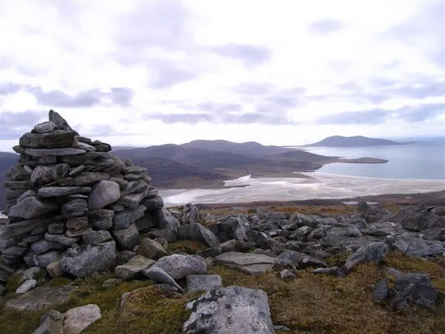 Ben Luskentyre Mountain, Western Isles3.6 km NW
-
Uamascleit Mountain, Western Isles3 km N
-
Stocleit an Iar Mountain, Western Isles3.1 km SW
-
Grosa Cleit Mountain, Western Isles3.2 km SE
-
Cnoc Biorach Mountain, Western Isles3.8 km S
Sources & licences
Data last updated: